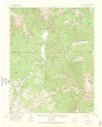
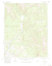
1957 Map of Wolf Creek Pass
USGS Topo · Published 1966About this map
The high-altitude drainage of the West Fork San Juan River and its surrounding peaks define this mid-century survey of the southern Colorado Rockies. Located along the Continental Divide, the area was a center for high-country ranching and timber activity, evidenced by established homesteads like West Fork Ranch and Three Meadows Ranch. The landscape is dominated by the massive relief of Treasure Mountain and Blackhead Peak, with the road network reflecting the challenges of the terrain. The Wolf Creek Highway Maintenance Camp and Silver Falls Guard Station mark the essential infrastructure needed to manage this portion of the San Juan National Forest. Near the southern edge, the Red Ryder Rodeo Grounds and a Sawmill point to the local cultural and economic life on the outskirts of the mountains during the 1950s.
Find a feature on this map
63 named features on this map. Tap any name to fly to it.
Don’t see what you’re looking for? This feature index may not catch every label — zoom into the map to look around manually.
Map Details
Editions of this 1957 Wolf Creek Pass Map
6 editions found

Other maps of this area

1905 · San Cristobal
USGS Topo · 1:125,000

1907 · San Cristobal
USGS Topo · 1:125,000

1913 · Summitville
USGS Topo · 1:125,000

1914 · Creede
USGS Topo · 1:125,000

1915 · Summitville
USGS Topo · 1:125,000

1916 · Creede
USGS Topo · 1:125,000

1924 · Pagosa Springs
USGS Topo · 1:125,000

1927 · Pagosa Springs
USGS Topo · 1:125,000

1945 · Durango
USGS Topo · 1:250,000

1953 · Durango
USGS Topo · 1:250,000