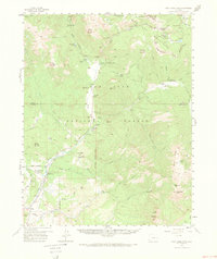
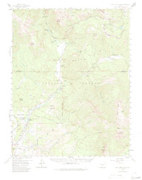
1957 Map of Wolf Creek Pass
USGS Topo · Published 1973About this map
The Continental Divide snake-like path through the high peaks of the San Juan National Forest defines the hydrology of this mid-century topographic study. The drainage systems of the West Fork and East Fork San Juan Rivers dominate the valley floors, where a distinct pattern of private ranching is established. Named properties such as At Last Ranch, Three Meadows Ranch, and Saddleback Ranch are situated along the river corridors, indicating the agricultural and residential footprint before later-century development.
Find a feature on this map
52 named features on this map. Tap any name to fly to it.
Don’t see what you’re looking for? This feature index may not catch every label — zoom into the map to look around manually.
Map Details
Editions of this 1957 Wolf Creek Pass Map
6 editions found

Other maps of this area

1905 · San Cristobal
USGS Topo · 1:125,000

1907 · San Cristobal
USGS Topo · 1:125,000

1913 · Summitville
USGS Topo · 1:125,000

1914 · Creede
USGS Topo · 1:125,000

1915 · Summitville
USGS Topo · 1:125,000

1916 · Creede
USGS Topo · 1:125,000

1924 · Pagosa Springs
USGS Topo · 1:125,000

1927 · Pagosa Springs
USGS Topo · 1:125,000

1945 · Durango
USGS Topo · 1:250,000

1953 · Durango
USGS Topo · 1:250,000