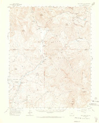
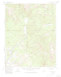
1957 Map of Wolf Creek Pass
USGS Topo · Published 1973About this map
The Continental Divide serpentines across this high-country survey of the San Juan Mountains, marking the separation between the Rio Grande National Forest and San Juan National Forest. At the center of the sheet, the passage of Wolf Creek Pass serves as a critical artery through the alpine landscape, supported by a Highway Maintenance Camp and the nearby Wolf Creek Campground. The drainage of the San Juan River and its numerous tributaries, including the West Fork and East Fork, dictates the placement of early mountain agriculture and industry.
Find a feature on this map
55 named features on this map. Tap any name to fly to it.
Don’t see what you’re looking for? This feature index may not catch every label — zoom into the map to look around manually.
Map Details
Editions of this 1957 Wolf Creek Pass Map
6 editions found

Other maps of this area

1905 · San Cristobal
USGS Topo · 1:125,000

1907 · San Cristobal
USGS Topo · 1:125,000

1913 · Summitville
USGS Topo · 1:125,000

1914 · Creede
USGS Topo · 1:125,000

1915 · Summitville
USGS Topo · 1:125,000

1916 · Creede
USGS Topo · 1:125,000

1924 · Pagosa Springs
USGS Topo · 1:125,000

1927 · Pagosa Springs
USGS Topo · 1:125,000

1945 · Durango
USGS Topo · 1:250,000

1953 · Durango
USGS Topo · 1:250,000