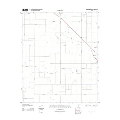
2012 Map of Wolfforth NE
USGS Topo · Published 2012About this map
Shallowater stands as the primary hub of this Llano Estacado landscape, where a rigid grid of agricultural roads defines the South Plains geography. The settlement's infrastructure is supported by the nearby Shallowater Water Field, reflecting the critical importance of water management in this semi-arid region. Transportation is dominated by the diagonal corridor of Ranch Road 179, which cuts across the cardinal grid of local routes like Louisiana Rd, Kansas Rd, and Iowa Rd. Aviation history in the area is marked by Biggin Hill Airport, located just north of the central town site. This map captures a moment in the early 21st century when rural life in Lubbock County remained deeply tied to the land, while maintaining a clear, organized network of farm-to-market roads like Fm-1294 and Fm-2378 to serve the surrounding fields.
Find a feature on this map
45 named features on this map. Tap any name to fly to it.
Don’t see what you’re looking for? This feature index may not catch every label — zoom into the map to look around manually.
Map Details
Editions of this 2012 Wolfforth NE Map
This is the sole edition of this map. No revisions or reprints were ever made.
Other maps of this area

1954 · Lubbock
USGS Topo · 1:250,000

1954 · Brownfield
USGS Topo · 1:250,000

1956 · Shallowater
USGS Topo · 1:24,000

1957 · Lubbock West
USGS Topo · 1:24,000

1957 · Lubbock
USGS Topo · 1:62,500

1957 · Anton
USGS Topo · 1:62,500

1957 · Abernathy
USGS Topo · 1:62,500

1957 · Wolfforth
USGS Topo · 1:62,500

1958 · Brownfield
USGS Topo · 1:250,000

1962 · Brownfield
USGS Topo · 1:250,000