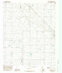
1985 Map of Wolfforth NE
USGS Topo · Published 1985About this map
Yellow House Draw meanders across this High Plains landscape, defining the local topography as it passes through the ranching and agricultural lands of the South Plains. In the early 1980s, the small community of Shallowater appears as the primary population center, situated near the intersection of the regional road network and the Hockley Co and Lubbock Co line. The map captures an era of infrastructure development and resource extraction, indicated by the presence of a Gravel Pit and a local Airport. These features, alongside a Radio Tower (K-ING) and a Roadside Park, reflect the utilitarian character of this West Texas region during the late twentieth century.
Find a feature on this map
7 named features on this map. Tap any name to fly to it.
Don’t see what you’re looking for? This feature index may not catch every label — zoom into the map to look around manually.
Map Details
Editions of this 1985 Wolfforth NE Map
This is the sole edition of this map. No revisions or reprints were ever made.
Other maps of this area

1954 · Lubbock
USGS Topo · 1:250,000

1954 · Brownfield
USGS Topo · 1:250,000

1956 · Shallowater
USGS Topo · 1:24,000

1957 · Lubbock West
USGS Topo · 1:24,000

1957 · Lubbock
USGS Topo · 1:62,500

1957 · Anton
USGS Topo · 1:62,500

1957 · Abernathy
USGS Topo · 1:62,500

1957 · Wolfforth
USGS Topo · 1:62,500

1958 · Brownfield
USGS Topo · 1:250,000

1962 · Brownfield
USGS Topo · 1:250,000