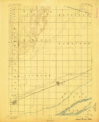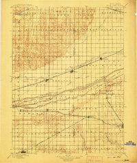
1896 Map of Wood River
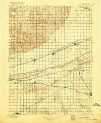
USGS Topo · Published 1908About this map
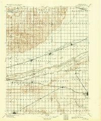
The North Channel Platte River and its complex network of seasonal channels define the central landscape of this central Nebraska survey. At the turn of the century, the region was a bustling corridor for westward expansion, anchored by the Union Pacific R. R. and the Burlington and Missouri River R. R. which run parallel to the river. The map reveals an intricate system of islands including Grand Island, Clark Island, and Fort Farm Island, illustrating how the Platte's braided nature dictated settlement patterns. Towns like Wood River, Shelton, and Gibbon grew as vital rail stops on the northern banks, while further south, the Kearney Branch connects smaller outposts like Lowell and Kenesaw. Landmark heights such as Sugar Bowl and Topeka Peak provide rare vertical relief in the broad river valley.
Find a feature on this map
86 named features on this map. Tap any name to fly to it.
Don’t see what you’re looking for? This feature index may not catch every label — zoom into the map to look around manually.
Map Details
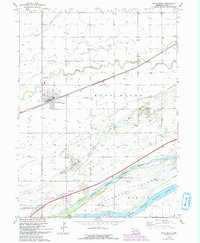
Editions of this 1896 Wood River Map
4 editions found

Historical Maps of Minden Through Time
7 maps found