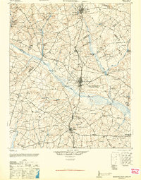
1946 Map of Woodford
USGS Topo · Published 1946About this map
The North Fork Edisto River winds through the heart of this mid-century landscape, defining the boundary between Aiken and Orangeburg counties. This 1944 Army Map Service compilation, later released for civil use, reveals a region heavily shaped by water and rail. Small settlements like Woodford, North, and Neeses are connected by the Seaboard Air Line railroad and an intricate network of historical routes including the Ninety-Six Road and Ferry Road.
Find a feature on this map
96 named features on this map. Tap any name to fly to it.
Don’t see what you’re looking for? This feature index may not catch every label — zoom into the map to look around manually.
Map Details
Editions of this 1946 Woodford Map
3 editions found

Other maps of this area

1919 · Bamberg
USGS Topo · 1:48,000

1920 · Bamberg
USGS Topo · 1:62,500

1920 · Orangeburg
USGS Topo · 1:48,000

1921 · Orangeburg
USGS Topo · 1:62,500

1923 · Williston
USGS Topo · 1:48,000

1927 · Williston
USGS Topo · 1:62,500

1943 · Bamberg
USGS Topo · 1:62,500

1943 · Orangeburg
USGS Topo · 1:125,000

1943 · Williston
USGS Topo · 1:62,500

1943 · Orangeburg
USGS Topo · 1:62,500