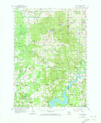
1958 Map of Woodville
USGS Topo · Published 1973About this map
Manistee National Forest dominates much of this mid-century landscape in western Michigan, where the rugged terrain is defined by a complex network of wetlands and small lakes. In the southeast, the Muskegon River flows into the expansive Hardy Dam Pond, which is flanked by Big Bend Park and Oxbow Park. This area illustrates the balance between conservation land and utility infrastructure, specifically the Basin Storage Field which points to the region's underground natural gas storage capacity.
Find a feature on this map
79 named features on this map. Tap any name to fly to it.
Don’t see what you’re looking for? This feature index may not catch every label — zoom into the map to look around manually.
Map Details
Editions of this 1958 Woodville Map
3 editions found
Other maps of this area

1954 · Midland
USGS Topo · 1:250,000

1958 · Midland
USGS Topo · 1:250,000

1958 · Sand Lake
USGS Topo · 1:62,500

1958 · Fremont
USGS Topo · 1:62,500

1958 · Woodville
USGS Topo · 1:62,500

1958 · Big Rapids
USGS Topo · 1:62,500

1959 · Midland
USGS Topo · 1:250,000

1959 · Howard City
USGS Topo · 1:62,500

1959 · Evart
USGS Topo · 1:62,500

1959 · Reed City
USGS Topo · 1:62,500