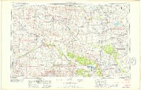
1958 Map of Woodward
USGS Topo · Published 1958About this map
The Cheyenne-Arapaho Indian Reservation and the sprawling Salt Plains Wildlife Refuge anchor the southern and eastern reaches of this mid-century Oklahoma landscape. Settled agricultural hubs such as Woodward, Alva, and Cherokee are connected by a heavy network of railroads, including the Atchison Topeka and Santa Fe and the Chicago Rock Island and Pacific. The region's hydrology is defined by the braided courses of the Cimarron River, North Canadian River, and the Canadian River, with significant flood control and recreation infrastructure at Great Salt Plains Reservoir and Canton Reservoir. This survey captures the rural character of the Northwest Oklahoma plains just as modern highways like U.S. 270 were becoming primary arteries, while landmarks like the Western Oklahoma State Hospital highlight the regional importance of the larger towns.
Find a feature on this map
90 named features on this map. Tap any name to fly to it.
Don’t see what you’re looking for? This feature index may not catch every label — zoom into the map to look around manually.
Map Details
Editions of this 1958 Woodward Map
2 editions found

Other maps of this area

1889 · Anthony
USGS Topo · 1:125,000

1889 · Caldwell
USGS Topo · 1:125,000

1891 · Medicine Lodge
USGS Topo · 1:125,000

1891 · Anthony
USGS Topo · 1:125,000

1892 · Meade
USGS Topo · 1:125,000

1892 · Coldwater
USGS Topo · 1:125,000

1892 · Kingfisher
USGS Topo · 1:125,000

1893 · Hennessey
USGS Topo · 1:62,500

1893 · Caldwell
USGS Topo · 1:125,000

1893 · Medicine Lodge
USGS Topo · 1:125,000