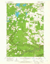
1954 Map of Wrenshall
USGS Topo · Published 1966About this map
The Northern Pacific and Soo Line railroads intersect near Wrenshall, a hub of transit and industry defined by its brick-making history and proximity to Jay Cooke State Park. This mid-century survey reveals a landscape of transition where the industrial corridors of the Minneapolis St Paul and Sault Ste Marie meet the natural expanses of the Nemadji State Forest. Small settlements and rural points like Scotts Corner, Blackhoof, and Pleasant Valley are linked by a network of gravel pits and timberlands. Water defines the northern reaches, with named bodies such as Lac La Belle, Venoah Lake, and Chub Lake dotting the terrain. For the genealogist or historian, the map preserves specific local landmarks including the Maccabee Cem and the Town Hall, alongside an Old Railroad Grade that speaks to the shifting transport patterns of Carlton County.
Find a feature on this map
32 named features on this map. Tap any name to fly to it.
Don’t see what you’re looking for? This feature index may not catch every label — zoom into the map to look around manually.
Map Details
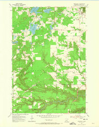
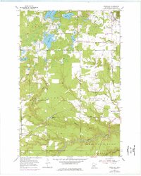
Editions of this 1954 Wrenshall Map
4 editions found
Other maps of this area

1949 · Holyoke
USGS Topo · 1:48,000

1953 · Duluth
USGS Topo · 1:250,000

1954 · Cloquet
USGS Topo · 1:24,000

1954 · Foxboro
USGS Topo · 1:24,000

1954 · Wrenshall
USGS Topo · 1:24,000

1954 · Frogner
USGS Topo · 1:24,000

1954 · Atkinson
USGS Topo · 1:24,000

1954 · Esko
USGS Topo · 1:24,000

1954 · Iverson
USGS Topo · 1:24,000

1956 · Barnum
USGS Topo · 1:62,500