1959 Map of Wylie
USGS Topo · Published 1968About this map
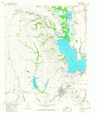
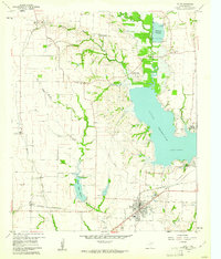
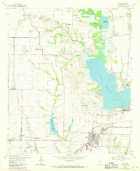
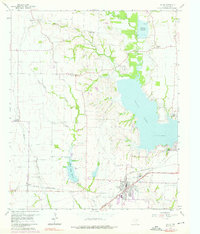
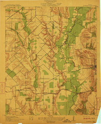
Lavon Reservoir dominates the eastern half of this landscape, its shoreline reaching toward Branch and Winningkoff during the late 1950s. The rising waters of the reservoir and the smaller Muddy Creek Reservoir signify a period of significant hydraulic engineering and land-use change in this part of Collin County. To the west, the rural character remains intact near Lucas and Parker, where a network of gravel pits and local family landmarks like Fitzhugh Cem and Moulden Cem are preserved.
Find a feature on this map
39 named features on this map. Tap any name to fly to it.
Don’t see what you’re looking for? This feature index may not catch every label — zoom into the map to look around manually.
Map Details
Editions of this 1959 Wylie Map
4 editions found
Other maps of this area

1891 · Dallas
USGS Topo · 1:125,000

1893 · Dallas
USGS Topo · 1:125,000
1912 · Rockwall
USGS Topo · 1:31,680

1919 · Royse City
USGS Topo · 1:62,500

1924 · Farmersville 3-c
USGS Topo · 1:48,000

1924 · Mc Kinney 4-d
USGS Topo · 1:48,000

1929 · McKinney
USGS Topo · 1:62,500

1930 · Farmersville
USGS Topo · 1:62,500

1954 · Dallas
USGS Topo · 1:250,000

1954 · Sherman
USGS Topo · 1:250,000