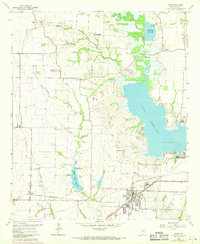
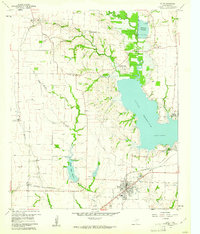
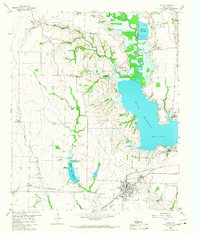
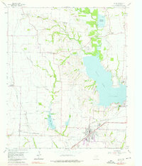
1959 Map of Wylie
USGS Topo · Published 1969About this map
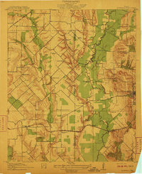
The Lavon Reservoir dominates the eastern portion of this landscape, its shoreline defining the local geography as it appeared in the late 1950s. Surrounding the water, the terrain is marked by a transition from agricultural fields to expanding lakeside developments like the Lavon Lake Baptist Encampment and East Fork Park. The southern portion of the sheet features the growing town of Wylie, where the industrial and transport infrastructure is concentrated, including a Filtration Plant and Substation at the junction of several rail lines.
Find a feature on this map
38 named features on this map. Tap any name to fly to it.
Don’t see what you’re looking for? This feature index may not catch every label — zoom into the map to look around manually.
Map Details
Editions of this 1959 Wylie Map
4 editions found
Other maps of this area

1891 · Dallas
USGS Topo · 1:125,000

1893 · Dallas
USGS Topo · 1:125,000
1912 · Rockwall
USGS Topo · 1:31,680

1919 · Royse City
USGS Topo · 1:62,500

1924 · Farmersville 3-c
USGS Topo · 1:48,000

1924 · Mc Kinney 4-d
USGS Topo · 1:48,000

1929 · McKinney
USGS Topo · 1:62,500

1930 · Farmersville
USGS Topo · 1:62,500

1954 · Dallas
USGS Topo · 1:250,000

1954 · Sherman
USGS Topo · 1:250,000