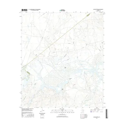
2016 Map of Wyser Bottom
USGS Topo · Published 2016About this map
Wyser Bottom is a distinctive riverfront landscape defined by the low-lying wetlands and dramatic rises of the Trinity River valley. This 2016 survey highlights the relationship between the shifting river morphology and the historic settlements that once anchored this region. Local terrain is punctuated by significant elevations like Cincinnati Bluff and Wyser Bluff, overlooking the expansive Lake Livingston shoreline. The presence of numerous family-named burial grounds, including Mason Cem, Spivey Cem, and Dunlap Cem, provides essential points for genealogical research in this rural portion of East Texas. The map also reveals a complex network of waterways and oxbow features such as Big Tucker Lake, Mason Slough, and Horseshoe Lake, illustrating the hydrological character of the bottomlands before and after the regional dam projects that shaped the modern landscape.
Find a feature on this map
48 named features on this map. Tap any name to fly to it.
Don’t see what you’re looking for? This feature index may not catch every label — zoom into the map to look around manually.
Map Details
Editions of this 2016 Wyser Bottom Map
This is the sole edition of this map. No revisions or reprints were ever made.
Other maps of this area

1953 · Palestine
USGS Topo · 1:250,000

1954 · Beaumont
USGS Topo · 1:250,000

1957 · Beaumont
USGS Topo · 1:250,000

1957 · Palestine
USGS Topo · 1:250,000

1960 · Trinity West
USGS Topo · 1:24,000

1961 · Riverside
USGS Topo · 1:24,000

1962 · Pine Prairie
USGS Topo · 1:24,000

1962 · Lovelady South
USGS Topo · 1:24,000

1962 · Wyser Bottom
USGS Topo · 1:24,000

1962 · Baker Lake
USGS Topo · 1:24,000