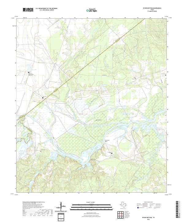
2022 Map of Wyser Bottom
USGS Topo · Published 2022About this map
The Trinity River winds through this landscape, defining a complex network of wetlands and riverbottom land. This 2022 survey documents the lowlands of Wyser Bottom and the elevated overlooks at Cincinnati Bluff and Wyser Bluff. The map is particularly rich for genealogical research, identifying numerous family and historical burial sites including Hutchings Alston Haden Family Cem, Cincinnati Cem, and Mason Cem. These names often signify the enduring presence of families who settled the fertile plains near the river long before modern infrastructure like FM 230 crossed the region. To the south and west, the terrain transitions into a dense concentration of named water bodies and oxbow features such as Big Tucker Lake, Moten Lake, and Lost Indian Lake, illustrating the fluid history of the river's path over time.
Find a feature on this map
48 named features on this map. Tap any name to fly to it.
Don’t see what you’re looking for? This feature index may not catch every label — zoom into the map to look around manually.
Map Details
Editions of this 2022 Wyser Bottom Map
This is the sole edition of this map. No revisions or reprints were ever made.
Other maps of this area

1953 · Palestine
USGS Topo · 1:250,000

1954 · Beaumont
USGS Topo · 1:250,000

1957 · Beaumont
USGS Topo · 1:250,000

1957 · Palestine
USGS Topo · 1:250,000

1960 · Trinity West
USGS Topo · 1:24,000

1961 · Riverside
USGS Topo · 1:24,000

1962 · Pine Prairie
USGS Topo · 1:24,000

1962 · Lovelady South
USGS Topo · 1:24,000

1962 · Wyser Bottom
USGS Topo · 1:24,000

1962 · Baker Lake
USGS Topo · 1:24,000