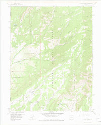
1957 Map of X LAZY F RANCH
USGS Topo · Published 1975About this map
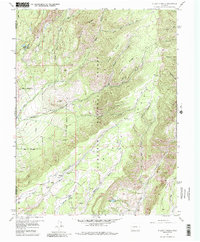
X Lazy F Ranch sits at the heart of this high-country survey, representing a remote outpost within the Gunnison National Forest. The landscape is defined by its complex drainage systems, where Crystal Creek and Curecanti Creek carve through the high elevations of Soap Mesa. A network of pack trails and jeep trails crisscrosses the terrain, linking remote points like Blue Lake with the various ridges and gulches that characterize the western Colorado wilderness.
Find a feature on this map
36 named features on this map. Tap any name to fly to it.
Don’t see what you’re looking for? This feature index may not catch every label — zoom into the map to look around manually.
Map Details
Editions of this 1957 X LAZY F RANCH Map
6 editions found

Other maps of this area

1908 · Uncompahgre
USGS Topo · 1:125,000

1909 · Montrose
USGS Topo · 1:125,000

1911 · Uncompahgre
USGS Topo · 1:125,000

1911 · Montrose
USGS Topo · 1:125,000

1954 · Little Soap Park
USGS Topo · 1:24,000

1954 · Sapinero
USGS Topo · 1:24,000

1956 · Curecanti Needle
USGS Topo · 1:24,000

1956 · Cimarron
USGS Topo · 1:24,000

1956 · Montrose
USGS Topo · 1:250,000

1957 · Cathedral Peak
USGS Topo · 1:24,000