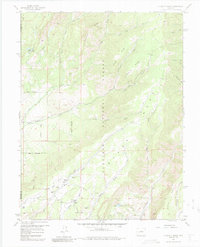
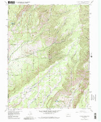
1957 Map of X Lazy F Ranch
USGS Topo · Published 1987About this map
Gunnison National Forest dominates this mid-century terrain, where the high-altitude topography of Black Mesa and Soap Mesa is defined by an intricate network of drainages and early water management. The namesake X Lazy F Ranch sits near the confluence of Corral Gulch and Myers Gulch, serving as a central landmark in a landscape of isolated springs and seasonal creeks.
Find a feature on this map
46 named features on this map. Tap any name to fly to it.
Don’t see what you’re looking for? This feature index may not catch every label — zoom into the map to look around manually.
Map Details
Editions of this 1957 X Lazy F Ranch Map
6 editions found

Other maps of this area

1908 · Uncompahgre
USGS Topo · 1:125,000

1909 · Montrose
USGS Topo · 1:125,000

1911 · Uncompahgre
USGS Topo · 1:125,000

1911 · Montrose
USGS Topo · 1:125,000

1954 · Little Soap Park
USGS Topo · 1:24,000

1954 · Sapinero
USGS Topo · 1:24,000

1956 · Curecanti Needle
USGS Topo · 1:24,000

1956 · Cimarron
USGS Topo · 1:24,000

1956 · Montrose
USGS Topo · 1:250,000

1957 · Cathedral Peak
USGS Topo · 1:24,000