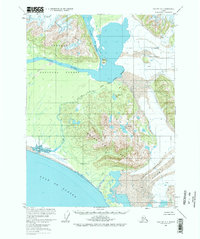
1959 Map of Yakutat A-1
USGS Topo · Published 1977About this map
The Alsek River dominates this coastal landscape as it flows through the Brabazon Range toward the Gulf of Alaska. Surveyed in the late 1940s and 1950s, the map illustrates the complex glacial and fluvial geography of the Tongass National Forest before significant modern environmental changes. The presence of Cabins along the northern banks suggests seasonal reliance on the river system for travel and subsistence in an otherwise unpopulated wilderness. Massive ice fields, including the Alsek Glacier and the Grand Plateau Glacier, press against the inland mountains, while the Doame River drains through Lower Doame Lake and Upper Doame Lake. The map specifically notes an indefinite National Forest Boundary, reflecting the ongoing efforts of the International Boundary Commission to delineate these remote northern reaches.
Find a feature on this map
16 named features on this map. Tap any name to fly to it.
Don’t see what you’re looking for? This feature index may not catch every label — zoom into the map to look around manually.
Map Details
Editions of this 1959 Yakutat A-1 Map
3 editions found
Other maps of this area

1951 · Yakutat
USGS Topo · 1:250,000

1951 · Mt Fairweather
USGS Topo · 1:250,000

1952 · Skagway
USGS Topo · 1:250,000

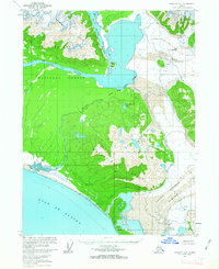
1959 · Yakutat A-1
USGS Topo · 1:63,360

1959 · Yakutat A-2
USGS Topo · 1:63,360

1959 · Yakutat B-2
USGS Topo · 1:63,360

1959 · Yakutat B-1
USGS Topo · 1:63,360

1959 · Yakutat
USGS Topo · 1:250,000
1961 · Mount Fairweather D-7
USGS Topo · 1:63,360

1961 · Mount Fairweather D-6
USGS Topo · 1:63,360