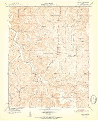
1951 Map of Yancy Mills
USGS Topo · Published 1951About this map
Little Piney Creek winds through the heart of this mid-century Missouri landscape, where the rural post office at Yancy Mills PO served as a vital community anchor. The map reveals a high concentration of country schools and churches that defined local life in the early 1950s, including Ben Fore Sch, Grayson Sch, and the Pilot Knob Ch. The terrain is marked by numerous hollows and springs, such as Lane Spring and Piney Spring, illustrating a landscape deeply tied to its water sources.
Find a feature on this map
45 named features on this map. Tap any name to fly to it.
Don’t see what you’re looking for? This feature index may not catch every label — zoom into the map to look around manually.
Map Details
Editions of this 1951 Yancy Mills Map
2 editions found
Other maps of this area

1912 · Rolla
USGS Topo · 1:62,500

1928 · Meramec Spring
USGS Topo · 1:62,500

1937 · Edgar Springs
USGS Topo · 1:48,000

1941 · Salem
USGS Topo · 1:62,500

1945 · Salem
USGS Topo · 1:62,500

1945 · Edgar Springs
USGS Topo · 1:62,500

1949 · Rolla
USGS Topo · 1:250,000

1949 · Meramec Spring
USGS Topo · 1:62,500

1950 · Newburg
USGS Topo · 1:24,000
1950 · Kaintuck Hollow
USGS Topo · 1:24,000