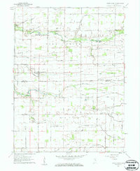
1959 Map of Young America
USGS Topo · Published 1961About this map
Young America serves as the central hub of this agricultural landscape in central Indiana, where the boundary between Cass and Howard counties meets. The settlement patterns of the late 1950s are defined by an extensive network of drainage features like Brown Ditch and Munson Ditch, which converted the natural wetlands into productive farmland. Local genealogy is well-documented through numerous rural institutions, including Center Ch, Poplar Grove Ch, and the Ervin Sch. These community anchors, along with family-named burial sites such as the Hoover-Snider Cem and Pickett Cem, reflect a deeply rooted rural society. The presence of the Galveston Airport (Abandoned) in the east provides a tangible marker of changing local infrastructure during this era, while watercourses like Deer Creek and Little Deer Creek continue to shape the terrain.
Find a feature on this map
48 named features on this map. Tap any name to fly to it.
Don’t see what you’re looking for? This feature index may not catch every label — zoom into the map to look around manually.
Map Details
Editions of this 1959 Young America Map
2 editions found
Other maps of this area

1951 · Onward
USGS Topo · 1:24,000

1953 · Danville
USGS Topo · 1:250,000

1955 · Danville
USGS Topo · 1:250,000

1955 · Anoka
USGS Topo · 1:24,000

1956 · Danville
USGS Topo · 1:250,000

1959 · Galveston
USGS Topo · 1:24,000

1959 · Young America
USGS Topo · 1:24,000

1960 · Kokomo West
USGS Topo · 1:24,000

1961 · Russiaville
USGS Topo · 1:24,000

1961 · Burlington
USGS Topo · 1:24,000