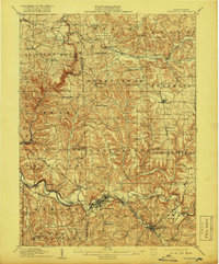
1910 Map of Zelienople
USGS Topo · Published 1917About this map
Slippery Rock Creek and Connoquenessing Creek define this rural landscape as it appeared in the early twentieth century, showing a network of valleys carved through Butler, Lawrence, and Beaver Counties. This era was characterized by a dense grid of rural education and industry, evidenced by the numerous schoolhouses like Snyder School and Teets School, alongside historical industrial landmarks such as Kennedy Mill and the Old Furnace near Zelienople.
Find a feature on this map
93 named features on this map. Tap any name to fly to it.
Don’t see what you’re looking for? This feature index may not catch every label — zoom into the map to look around manually.
Map Details
Editions of this 1910 Zelienople Map
5 editions found

Other maps of this area

1901 · Beaver
USGS Topo · 1:62,500

1902 · New Castle
USGS Topo · 1:62,500

1904 · Newcastle
USGS Topo · 1:62,500

1904 · Beaver
USGS Topo · 1:62,500

1905 · Neshannock
USGS Topo · 1:62,500

1906 · Sewickley
USGS Topo · 1:62,500

1907 · Neshannock
USGS Topo · 1:62,500

1908 · Sewickley
USGS Topo · 1:62,500

1908 · New Kensington
USGS Topo · 1:62,500

1908 · Zelienople
USGS Topo · 1:62,500