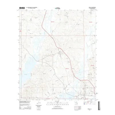
2015 Map of Zwolle
USGS Topo · Published 2015About this map
Toledo Bend Reservoir dominates the western and southern reaches of this Sabine Parish landscape, where the inundated valleys of Derby Br and Choctaw Br meet the expansive shoreline. The town of Zwolle serves as a primary hub in the southeast, situated near the headwaters of Bayou Scie. To the north, the smaller settlement of Noble sits along a major transportation corridor, flanked by local landmarks such as Noble Cem.
Find a feature on this map
94 named features on this map. Tap any name to fly to it.
Don’t see what you’re looking for? This feature index may not catch every label — zoom into the map to look around manually.
Map Details
Editions of this 2015 Zwolle Map
This is the sole edition of this map. No revisions or reprints were ever made.
Other maps of this area

1941 · Zwolle
USGS Topo · 1:62,500

1941 · Pelican
USGS Topo · 1:62,500

1943 · Pleasant Hill
USGS Topo · 1:62,500

1944 · Logansport
USGS Topo · 1:62,500

1944 · Patroon
USGS Topo · 1:62,500

1944 · Zwolle
USGS Topo · 1:62,500

1944 · Pleasant Hill
USGS Topo · 1:62,500

1953 · Alexandria
USGS Topo · 1:250,000

1955 · Alexandria
USGS Topo · 1:250,000

1956 · Logansport
USGS Topo · 1:62,500