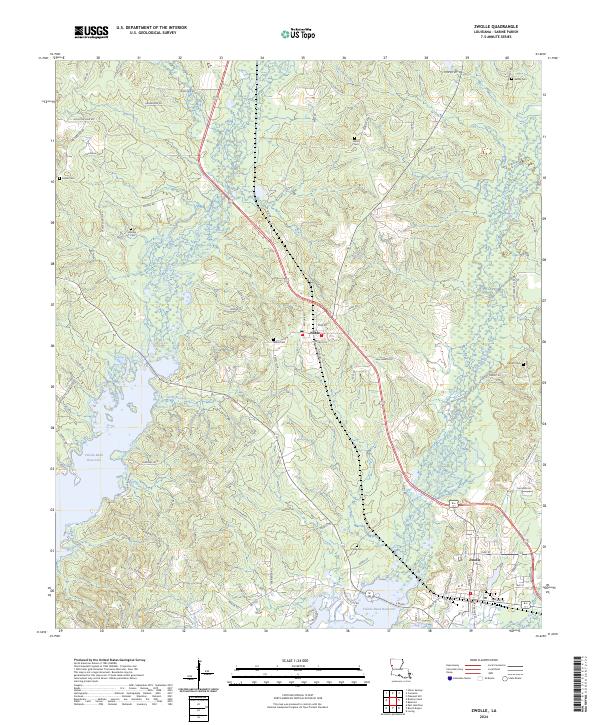
2024 Map of Zwolle
USGS Topo · Published 2024About this map
Zwolle and Noble anchor this Sabine Parish landscape, where the rising waters of the Toledo Bend Reservoir meet the wooded uplands of western Louisiana. The map reveals a high concentration of family and community burial grounds, including Sardis Cem, Noble Cem, Shiloh Cem, and Parrott Cem, documenting the long-standing settlement patterns of the region. The terrain is defined by a dense network of waterways like Bayou San Patricio, Bayou San Miguel, and Bayou Scie that drain into the reservoir. Transportation is dominated by the corridor between these two towns, with numerous rural roads like Sam Webb Loop and Old Pleasant Hill Rd providing access to the small homesteads and timberlands that characterize the area's modern topography.
Find a feature on this map
87 named features on this map. Tap any name to fly to it.
Don’t see what you’re looking for? This feature index may not catch every label — zoom into the map to look around manually.
Map Details
Editions of this 2024 Zwolle Map
This is the sole edition of this map. No revisions or reprints were ever made.
Other maps of this area

1941 · Zwolle
USGS Topo · 1:62,500

1941 · Pelican
USGS Topo · 1:62,500

1943 · Pleasant Hill
USGS Topo · 1:62,500

1944 · Logansport
USGS Topo · 1:62,500

1944 · Patroon
USGS Topo · 1:62,500

1944 · Zwolle
USGS Topo · 1:62,500

1944 · Pleasant Hill
USGS Topo · 1:62,500

1953 · Alexandria
USGS Topo · 1:250,000

1955 · Alexandria
USGS Topo · 1:250,000

1956 · Logansport
USGS Topo · 1:62,500