1940s Maps of Cochise County, Arizona
Explore 23 historic maps of Cochise County from the 1940s. These maps offer a rare glimpse into what life looked like during the 1940s — showing old roads, neighborhoods, homes, and landmarks that have changed or disappeared over time.
Whether you're researching your family's past, planning a metal detecting trip, or studying how Cochise County's landscape evolved across the 1940s, these high-resolution maps are a powerful tool for exploring the history of this region.
- Focus on a specific era: All maps on this page are from the 1940s, giving you a focused view of this time period.
- See what’s changed: Compare century-old streets, trails, and buildings to today's modern landscape using overlays and satellite layers.
- Research with precision: Use these maps for genealogy, historical research, land use analysis, or educational projects.
- View, download, or print: Maps are fully viewable online in high resolution, and can be downloaded or printed for your own records.
Start exploring Cochise County's history through authentic maps from the 1940s. This is your window into the past.
Cochise County, AZ maps
(23)- 1940 Map of Apache
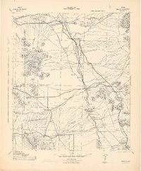
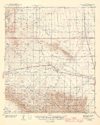
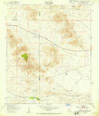
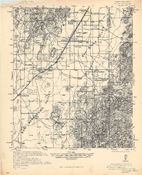 1940 Apache1940 Print · USGSArizona and New Mexico ranching culture is captured here during the early twentieth century, showing the rugged borderlands before modern development. Genealogists can trace family homesteads like Darnell Ranch and find rural landmarks like Texizona School and Moores Spur.
 - 1940 Map of College Peaks
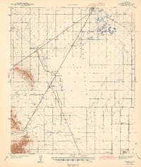
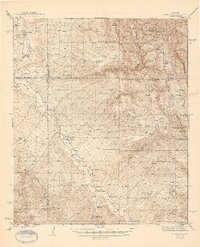
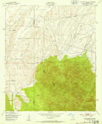
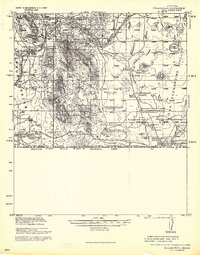 1940 College Peaks1940 Print · USGSThe Arizona-Mexico border comes alive in this pre-war survey of the high desert and cattle country. Genealogists and historians can trace the vast San Bernardino Grant and family outposts like Slaughters Ranch San Bernardino or the Ed Howard Ranch.
 - 1943 Map of Dos Cabezas
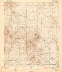
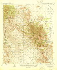
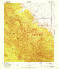
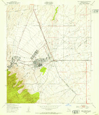
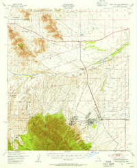
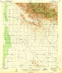 1943 Dos Cabezas1943 Print · USGSCochise County mining and ranching are documented here in the early 1940s, showing the peaks and valley floor before modern development. Genealogists and historians can locate the Elma Mine, Dos Cabezas, and family outposts like Arrowhead Ranch.3 unique versions available
 - 1943 Map of Willcox
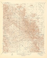
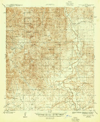
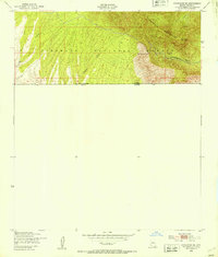
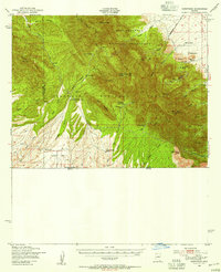
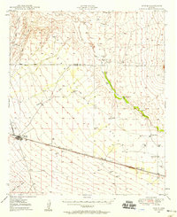
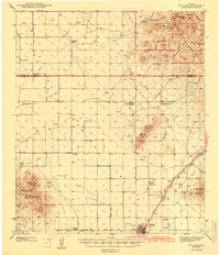 1943 Willcox1943 Print · USGSIn the early 1940s, the cattle ranches and rail lines of southeastern Arizona defined the high desert landscape. Genealogists and researchers can locate family sites like the Brookerson Ranch, follow the Southern Pacific tracks through Raso, or find the Stewart Sch.3 unique versions available
 - 1943 Map of Benson
 1943 Benson1943 Print · USGSCochise County during the wartime 1940s reveals a landscape defined by the San Pedro River and the legendary town of Tombstone. Genealogists and historians can trace the foundations of Fort Huachuca and locate rural landmarks like St David, Fairbank, and Huachuca Turner PO.
 - 1943 Map of Cochise
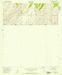
 1943 Cochise1943 Print · USGSSoutheast Arizona's high-desert ranching and mining country is captured here during the early years of the war. Genealogists and researchers can trace the rail-side life of Willcox and Cochise, or locate landmarks like the Sulphur Spring School and Red Bird Mine.3 unique versions available
 - 1943 Map of Dragoon
 1943 Dragoon1943 Print · USGSCochise County during the early 1940s shows a landscape of active copper and tungsten mining alongside established ranching operations. You can trace the railroad economy through Dragoon or locate remote sites like the Republic Mine and Texas Canyon Sch.3 unique versions available
 - 1943 Map of Winchester Mts. , 1945 Print
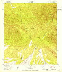
 1943 Winchester Mts.1945 Print · USGSSoutheastern Arizona's high desert cattle country is captured here during the early 1940s. Genealogists and historians can trace numerous remote homesteads and water sources, including Muleshoe Ranch, Antelope Ranch, and Hooker Hot Springs.2 unique versions available
 - 1944 Map of Fisher Hills
 1944 Fisher Hills1944 Print · USGSSoutheast Arizona in the early 1940s is defined here by the Southern Pacific rail line and the sprawling cattle ranches of Cochise County. Genealogists and historians can trace old homesteads and stations like Luzena, the Flying W Ranch, and the inactive CCC Camp near the mountains.3 unique versions available
 - 1945 Map of Redington
 1945 Redington1945 Print · USGSThe San Pedro River valley in the 1940s was a landscape of remote cattle ranches and mining claims. Genealogists and historians can trace family properties like Bingham Ranch, locate the Pool Sch, and find the historic Jackson Mine.2 unique versions available
 - 1945 Map of Winchester Mts.
 1945 Winchester Mts.1945 Print · USGSCochise and Graham Counties in the 1940s were a landscape of remote cattle operations and high-desert peaks. Researchers can trace the heritage of family-named outposts like the Muleshoe Ranch and Lee Ranch, or locate water sources like Hookers Hot Springs.
 - 1945 Map of Happy Valley
 1945 Happy Valley1945 Print · USGSThe San Pedro River valley and the eastern slopes of the Rincon Mountains are documented here during the mid-1940s. Genealogists and historians can locate numerous family homesteads like Russell Ranch and Gunter Ranch, or trace the Willcox-Cascabel Road past the Apodaca Sch.2 unique versions available
 - 1948 Map of Huachuca Peak, 1953 Print
 1948 Huachuca Peak1953 Print · USGSThe high Arizona mountains and the military frontier meet in the late 1940s just north of the border. Researchers can trace remote ranching outposts like Hathaway Ranch, the operations at Eureka Mine, and the early footprint of the Fort Huachuca Military Reservation.
 - 1948 Map of Fort Huachuca NE, 1953 Print
 1948 Fort Huachuca NE1953 Print · USGSCochise County is captured here in the late 1940s, showing a landscape defined by military training grounds and heritage cattle ranches. Researchers can locate family landmarks like Pyeatt Ranch and Hunt Ranch or trace the Southern Pacific rail line as it nears Campstone.
 - 1948 Map of Miller Peak, 1953 Print
 1948 Miller Peak1953 Print · USGSCochise County in the late 1940s reveals a rugged landscape of military reservations and forest land defined by its mining and ranching roots. Genealogists and historians can trace family locations at Carr Canyon Ranch and Wakefield Camp or locate the Pomona Mine high in the mountains.
 - 1948 Map of Sunnyside SE, 1953 Print
 1948 Sunnyside SE1953 Print · USGSThe high ridges of the Arizona-Mexico border are captured here just after the war. Mineral seekers and local historians can trace the paths to the Morgan Mine, Texas Mine, and a secluded Cem near Montezuma Pass.
 - 1948 Map of Sunnyside SW, 1953 Print
 1948 Sunnyside SW1953 Print · USGSSouthern Cochise County at the close of the 1940s reveals a sparse landscape of cattle ranching and international boundary markers. Genealogists and local historians can trace family holdings at McNab Ranch or locate early survey points like Mon 106 5211 along the Mexico border.
 - 1948 Map of Mustang Mountains, 1953 Print
 1948 Mustang Mountains1953 Print · USGSThe high desert range of Cochise County is captured here in the years following World War II, when large cattle ranches dominated the valley floor. Genealogists and historians can trace old homesteads like Sands Ranch and the rail line of the Southern Pacific as it follows the Babocomari River.
 - 1948 Map of Fort Huachuca SW, 1953 Print
 1948 Fort Huachuca SW1953 Print · USGSCochise County ranching and military life intersect here just after the war, where the high desert meets the national forest. Researchers can trace historic property lines and family operations like Pyeatt Ranch, Diamond C Ranch, and the Anderson Mine.
 - 1948 Map of Fort Huachuca, 1953 Print
 1948 Fort Huachuca1953 Print · USGSCochise County is captured during the late 1940s, centered on the active operations of the Fort Huachuca installation and its surrounding high-desert terrain. Genealogists and historians can trace the early layout of the Fry Post Office, Apache Flats, and the Buena Sch along the Southern Pacific rail line.
 - 1948 Map of Sunnyside, 1956 Print
 1948 Sunnyside1956 Print · USGSArizona's high border country is captured here in the late Forties, showing the intersection of military lands and remote mountain ranching. Genealogists and historians can locate family holdings like Hathaway Ranch and McNab Ranch or trace old mining sites such as the Wakefield Mine.
 - 1948 Map of Fort Huachuca, 1956 Print
 1948 Fort Huachuca1956 Print · USGSSoutheast Arizona in the late 1940s is defined here by the intersection of military operations and high-desert ranching. Genealogists and historians can trace family properties like Sands Ranch alongside the installations at Fort Huachuca and the Buena Sch.
 - 1949 Map of Bowie, 1958 Print
 1949 Bowie1958 Print · USGSThe Southern Pacific railroad and the cattle ranches of Cochise County define this desert landscape in the late 1940s. Genealogists and historians can trace family-named sites like Garrett Ranch and the station at Bowie.2 unique versions available
End of results
Showing maps 1-23 of 23
Top cities of Cochise County
- Sierra Vista historical maps
- Douglas historical maps
- Bisbee historical maps
- Benson historical maps
- Willcox historical maps
- Whetstone historical maps
See more
Frequently asked questions
- What are the different types of historical maps available for Cochise County?
- What is the oldest map of Cochise County?
- Where can I purchase historical maps of Cochise County for my home or office?
- Where can I download high-res historical maps of Cochise County?
- Are there historical topographic maps available for Cochise County?
- Is there historical aerial imagery available for Cochise County?
- Where are historical maps of Cochise County sourced from?