1990s Maps of Cochise County, Arizona
Explore 107 historic maps of Cochise County from the 1990s. These maps offer a rare glimpse into what life looked like during the 1990s — showing old roads, neighborhoods, homes, and landmarks that have changed or disappeared over time.
Whether you're researching your family's past, planning a metal detecting trip, or studying how Cochise County's landscape evolved across the 1990s, these high-resolution maps are a powerful tool for exploring the history of this region.
- Focus on a specific era: All maps on this page are from the 1990s, giving you a focused view of this time period.
- See what’s changed: Compare century-old streets, trails, and buildings to today's modern landscape using overlays and satellite layers.
- Research with precision: Use these maps for genealogy, historical research, land use analysis, or educational projects.
- View, download, or print: Maps are fully viewable online in high resolution, and can be downloaded or printed for your own records.
Start exploring Cochise County's history through authentic maps from the 1990s. This is your window into the past.
Cochise County, AZ maps
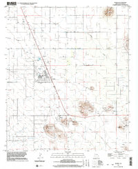
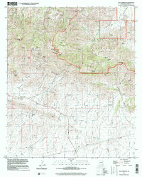
(107)- 1994 Map of Douglas
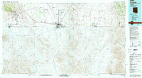 1994 Douglas1994 Print · USGSThe copper mining heart of Cochise County and the international border are captured here in the mid-nineties. Researchers can trace the massive Lavender Pit at Bisbee or locate rural landmarks like Paul Spur and the San Bernardino National Wildlife Refuge.2 unique versions available
 - 1994 Map of Willcox
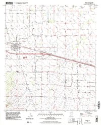
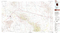 1994 Willcox1994 Print · USGSSoutheast Arizona in the mid-nineties shows a landscape defined by expansive desert basins and rugged sky islands. Genealogists and historians can trace the rail corridor of the Southern Pacific through Willcox, Bowie, and the Kansas Settlement.2 unique versions available
 - 1994 Map of Fort Huachuca
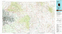
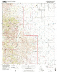
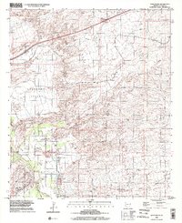
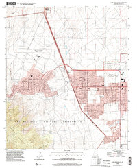
 1994 Fort Huachuca1994 Print · USGSSouthern Arizona in the mid-nineties shows a landscape of expansive military reservations, historic land grants, and storied mining districts. Researchers can trace the S P RR through the San Pedro River valley or locate dozens of remote mountain workings like the Montezuma Mine and Eureka Mine.3 unique versions available
 - 1994 Map of Tucson
 1994 Tucson1994 Print · USGSTucson and the Santa Cruz Valley appear here in the mid-1990s, caught between rapid urban growth and protected wilderness. Researchers can trace the development of Casas Adobes, the operations at Davis Monthan Air Force Base, and the rail lines of the Southern Pacific RR.2 unique versions available
 - 1994 Map of Chiricahua Peak
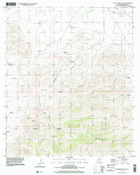
 1994 Chiricahua Peak1994 Print · USGSSoutheast Arizona in the mid-nineties shows a land of high sky islands and broad cattle valleys transitioning into New Mexico. Trace the legacy of old mining camps and railroad stops from Pearce and Gleeson to the canyons of the Chiricahua Mountains.2 unique versions available
 - 1994 Map of Nogales
 1994 Nogales1994 Print · USGSThe Arizona-Sonora borderlands come into focus in the mid-1990s, showcasing the intricate Spanish land grants and mining districts that shaped the region. Genealogists and historians can trace old mining camps like Washington Camp and Duquesne or locate the historic Mowry Mine.2 unique versions available
 - 1996 Map of Deepwell Ranch, 2001 Print
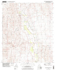
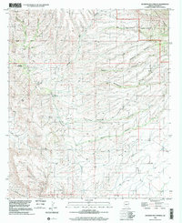
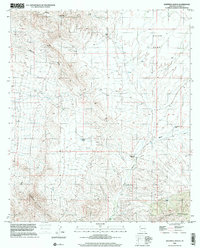 1996 Deepwell Ranch2001 Print · USGSThe high desert of Cochise County is captured here in the late twentieth century, showing a landscape of cattle ranching and rugged hills. Researchers can trace the water infrastructure and terrain around Deepwell Ranch, the Johnny Lyon Hills, and Allen Flat.
 - 1996 Map of Wildhorse Mountain, 2001 Print
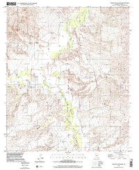
 1996 Wildhorse Mountain2001 Print · USGSCochise County during the late nineties is a landscape of desert canyons and river valleys framed by the Rincon Mountains. Genealogists and researchers can locate the Appodaca Cem or trace hydrology at the Gaging Station and Diamond B Spring.
 - 1996 Map of Galleta Flat East, 2002 Print
 1996 Galleta Flat East2002 Print · USGSCochise County ranching and desert waterways are captured in the 1990s as modern imagery updated the valley landscape. Researchers can trace land use at Singing Wind Ranch or follow drainage patterns along Ash Creek and Tres Alamos Wash.
 - 1996 Map of Cochise Stronghold, 2002 Print
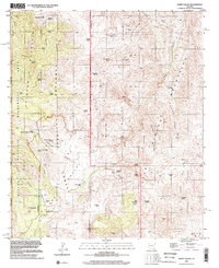
 1996 Cochise Stronghold2002 Print · USGSThe Dragoon Mountains are shown in detail during the late nineties, showcasing the complex terrain of the Coronado National Forest. Researchers can trace historical mining sites and trails through Cochise Stronghold, Middlemarch Trail, and China Peak.
 - 1996 Map of Black Diamond Peak, 2002 Print
 1996 Black Diamond Peak2002 Print · USGSThe Dragoon Mountains in the mid-nineties remain a landscape defined by its mining heritage and scattered desert water sources. Local history researchers can trace old mining operations through numerous Mine Shafts and Adits near Black Diamond Peak and Middlemarch Pass.
 - 1996 Map of Potter Mountain, 2002 Print
 1996 Potter Mountain2002 Print · USGSThe Mule Mountains of Cochise County are shown here in the late nineties, defined by high-desert ranching and mineral prospecting. Researchers can trace remote water sources like Owl Hoot Windmill and Sandy Bob Springs Windmill or locate a mountain Shaft and Adit.
 - 1996 Map of Red Bird Hills, 2002 Print
 1996 Red Bird Hills2002 Print · USGSCochise County at the close of the twentieth century shows a landscape defined by desert industry and military activity. Local historians can trace the mining footprint in the Red Bird Hills or locate the sprawling Bombing Range near Willcox Dry Lake Playa.
 - 1996 Map of Pat Hills North, 2002 Print
 1996 Pat Hills North2002 Print · USGSCochise County ranching and utility corridors come into focus in the late nineties as this survey documents the arid basin near the Pat Hills. Researchers can locate historic water infrastructure and rural land use at Creasey Ranch and Shaw Well.
 - 1996 Map of Saint David, 2002 Print
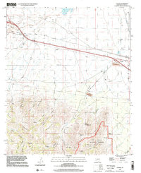
 1996 Saint David2002 Print · USGSThe San Pedro Valley and Lonesome Valley appear in the mid-nineties as the region balanced its agricultural roots with modern infrastructure. Genealogists can trace the rural layout of Saint David and locate family landmarks near Fenner or the Stronghold.
 - 1996 Map of Fort Huachuca, 2002 Print
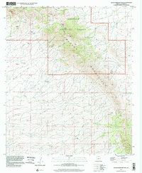
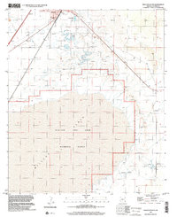
 1996 Fort Huachuca2002 Print · USGSThe High Desert of Cochise County comes into focus in the mid-1990s as military and civilian sectors converge. Genealogists can locate General Myer Sch or Fry, while researchers can trace the Old Railroad Grade and base boundaries.
 - 1996 Map of Willcox South, 2002 Print
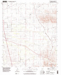
 1996 Willcox South2002 Print · USGSThe desert south of Willcox appears here in the mid-nineties, where town life meets a sprawling military training ground. Researchers can trace the borders of the Willcox Bombing Range and locate landmarks like the Mobile Home Park and the Alkali Flats.
 - 1996 Map of Tombstone SE, 2002 Print
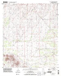
 1996 Tombstone SE2002 Print · USGSCochise County’s high desert landscape is shown here in the mid-1990s, where traditional ranching meets federal conservation efforts. You can trace the Old Railroad Grade and locate legacy family holdings like Keller Ranch and Johnson Ranch.
 - 1996 Map of Bowie, 2002 Print
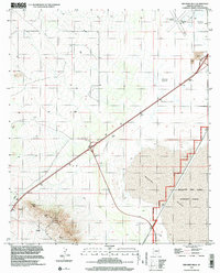
 1996 Bowie2002 Print · USGSBowie sits at the intersection of desert rail and road networks in the mid-1990s, serving as a vital hub in Cochise County. Researchers can trace the town's layout from the High Sch to the Desert Rest (Cem), alongside the vital Southern Pacific railroad.
 - 1996 Map of Pearce, 2002 Print
 1996 Pearce2002 Print · USGSThe desert basin of Cochise County reveals a mix of historic mining roots and modern community planning in the late nineties. Genealogists and researchers can trace the Old Railroad Grade and explore old mining sites like Pearce Hill and Three Sisters Buttes.
 - 1996 Map of Hookers Hot Springs, 2002 Print
 1996 Hookers Hot Springs2002 Print · USGSCochise County’s high-desert landscape comes to life in the mid-1990s as the Winchester Mountains meet the valley floor. Researchers can trace the springs and remote canyon networks that sustained local life, from Hookers Hot Springs to the rural Riggs Serp and the broad Allen Flat.
 - 1996 Map of Luzena, 2002 Print
 1996 Luzena2002 Print · USGSCochise County high desert and mountain terrain are captured here in the late nineties, showcasing the intersection of wilderness and modern transit. Genealogists and historians can locate the Buckeye Mill (Site) and cultural landmarks like the Cowboy Swimming Hole.
 - 1996 Map of Happy Valley, 2002 Print
 1996 Happy Valley2002 Print · USGSHappy Valley and the high desert canyons of the Cochise-Pima border are documented here in the mid-1990s. Researchers can trace the layout of remote ranching outposts like Last Chance Ranch and Barney Ranch alongside natural landmarks like Hells Gate.
 - 1996 Map of Dos Cabezas, 2002 Print
 1996 Dos Cabezas2002 Print · USGSThe high desert of Cochise County is captured here in the mid-1990s, centered on the mining and ranching history of Dos Cabezas. Genealogists and historians can trace old operations like the Mascot Mine or locate the local Cem and Rancho Sacatal.
 - 1996 Map of Fairbank, 2002 Print
 1996 Fairbank2002 Print · USGSCochise County during the late twentieth century reflects a landscape shaped by river corridors and former mining hubs. Genealogists and historians can locate Fairbank, the Charleston Lead Mine, and ruins near the Babocomari River.
Showing maps 1-25 of 107
Top cities of Cochise County
- Sierra Vista historical maps
- Douglas historical maps
- Bisbee historical maps
- Benson historical maps
- Willcox historical maps
- Whetstone historical maps
See more
Frequently asked questions
- What are the different types of historical maps available for Cochise County?
- What is the oldest map of Cochise County?
- Where can I purchase historical maps of Cochise County for my home or office?
- Where can I download high-res historical maps of Cochise County?
- Are there historical topographic maps available for Cochise County?
- Is there historical aerial imagery available for Cochise County?
- Where are historical maps of Cochise County sourced from?