1950s Maps of Cochise County, Arizona
Explore 70 historic maps of Cochise County from the 1950s. These maps offer a rare glimpse into what life looked like during the 1950s — showing old roads, neighborhoods, homes, and landmarks that have changed or disappeared over time.
Whether you're researching your family's past, planning a metal detecting trip, or studying how Cochise County's landscape evolved across the 1950s, these high-resolution maps are a powerful tool for exploring the history of this region.
- Focus on a specific era: All maps on this page are from the 1950s, giving you a focused view of this time period.
- See what’s changed: Compare century-old streets, trails, and buildings to today's modern landscape using overlays and satellite layers.
- Research with precision: Use these maps for genealogy, historical research, land use analysis, or educational projects.
- View, download, or print: Maps are fully viewable online in high resolution, and can be downloaded or printed for your own records.
Start exploring Cochise County's history through authentic maps from the 1950s. This is your window into the past.
Cochise County, AZ maps
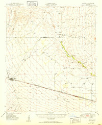
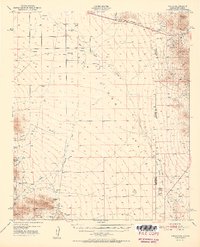
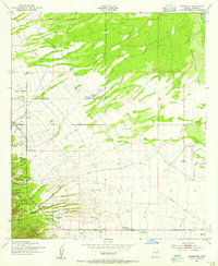
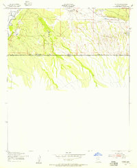
(70)- 1950 Map of San Simon
 1950 San Simon1950 Print · USGSThe high desert borderlands of Arizona and New Mexico are captured here at mid-century, following the line of the Southern Pacific railroad. Researchers can locate remote cattle operations and early landmarks like the Braidfoot Ranch, the Old Stage Station (Ruins), and the lonely Giddings Grave.2 unique versions available
 - 1950 Map of Bowie
 1950 Bowie1950 Print · USGSSoutheast Arizona ranching and rail life at mid-century are centered here on the town of Bowie and the Southern Pacific line. Researchers can trace historic property sites like Posey Ranch and Garrett Ranch or locate the Yellow Hammer Mill.
 - 1950 Map of Cochise Head, 1952 Print
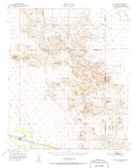
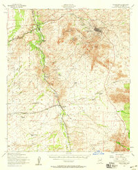
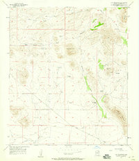
 1950 Cochise Head1952 Print · USGSThe Chiricahua foothills in the early fifties show a rugged landscape of military ruins and cattle ranching. Trace family homesteads and early landmarks like Old Fort Bowie (Ruins), Riggs Home Ranch, and the El Dorado School.3 unique versions available
 - 1950 Map of Vanar, 1958 Print
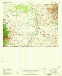
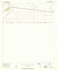
 1950 Vanar1958 Print · USGSThe high desert borderlands near the Arizona and New Mexico line come to life in this mid-century survey of the San Simon Valley. Genealogists and historians can trace the remote Southern Pacific rail stops, old mining sites like Mineral Mtn Mine, and ranching landmarks such as Cienega Ranch.3 unique versions available
 - 1951 Map of Vanar
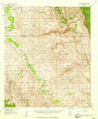
 1951 Vanar1951 Print · USGSThe Arizona-New Mexico borderlands in the early fifties reveal a landscape of remote ranching and early mining at the edge of the Coronado National Forest. Genealogists and historians can trace the Southern Pacific rail line through Vanar or locate the Cienega Ranch and its associated cemetery.2 unique versions available
 - 1951 Map of San Simon
 1951 San Simon1951 Print · USGSCrossing the Arizona-New Mexico border in the 1950s, this survey shows a high-desert landscape defined by the railroad and mountain passes. Trace the legacy of early travel and mining at the Old Stage Station (Ruins), Giddings Grave, and the Volcano Mine.
 - 1952 Map of Tombstone SE, 1955 Print
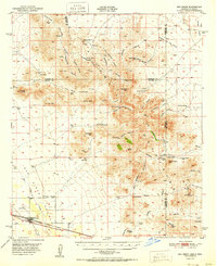
 1952 Tombstone SE1955 Print · USGSCochise County in the early fifties shows a landscape defined by cattle ranching and early transit corridors south of Tombstone. Researchers can trace historic homesteads like Keller Ranch and the path of the Southern Pacific near the Mule Mountains.3 unique versions available
 - 1952 Map of Lewis Springs, 1955 Print
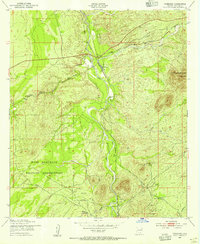
 1952 Lewis Springs1955 Print · USGSCochise County ranchlands and military grounds are captured here during the early fifties, centering on the San Pedro River. Researchers can trace historic family holdings like the Donnet-Fry Ranch and Schrader Ranch or the rail stop at Lewis Springs.4 unique versions available
 - 1952 Map of Hereford, 1955 Print
 1952 Hereford1955 Print · USGSThe ranching country of southern Cochise County comes into focus in this early 1950s survey of the San Pedro River valley. Researchers can trace historic family holdings like the Ullrich Ranch and Stagg Ranch alongside the Southern Pacific Railroad.4 unique versions available
 - 1952 Map of Fairbank, 1955 Print
 1952 Fairbank1955 Print · USGSCochise County during the early 1950s was a landscape of remote rail junctions and desert ranching along the San Pedro River. Genealogists and historians can trace the foundations of Fairbank, the operations at Boquillas Ranch, and the Charleston Lead Mine.3 unique versions available
 - 1952 Map of Nicksville, 1955 Print
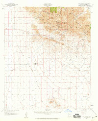
 1952 Nicksville1955 Print · USGSNicksville and the surrounding Cochise County ranchlands are captured here in the early fifties, showing a landscape of specialized agriculture and aviation. Researchers can locate named family spreads like Wintergreen Mink Ranch and the Bauer-Kircher Mine.4 unique versions available
 - 1952 Map of Tombstone, 1955 Print
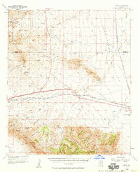
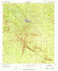 1952 Tombstone1955 Print · USGSTombstone and the surrounding high desert are captured here in the early fifties, showing the legendary town's layout alongside its historic mining and ranching legacy. Researchers can locate the Boothill Cem, the Schieffelin Monument, and family sites like Fox Ranch.3 unique versions available
 - 1952 Map of Hereford SW, 1955 Print
 1952 Hereford SW1955 Print · USGSThe Arizona-Mexico borderlands in the early fifties reveal a landscape of isolated cattle operations and mountain canyons. Genealogists and historians can trace family properties like Smith Ranch and Montezuma Ranch along the San Pedro River.3 unique versions available
 - 1952 Map of Stark, 1955 Print
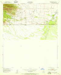
 1952 Stark1955 Print · USGSCochise County sits at the international border in the early fifties, where the San Pedro River supports isolated desert outposts. Trace the Southern Pacific rail line through Stark and locate early water infrastructure like the Diversion Dams.3 unique versions available
 - 1952 Map of Tombstone, 1959 Print
 1952 Tombstone1959 Print · USGSCochise County during the early 1950s reveals a landscape defined by ranching, mining, and frontier legacy. Genealogists and historians can trace old homesteads like Bakarich-McCool Ranch or locate the famed Boothill Cem and Fairbank rail junction.2 unique versions available
 - 1952 Map of Hereford, 1959 Print
 1952 Hereford1959 Print · USGSCochise County ranching and rail life are on full display in the early fifties, from the valley floor to the national forest peaks. Genealogists can trace family holdings like Smiling Tiger Ranch and Rancho Del Rio or locate the Cem near Palominas.2 unique versions available
 - 1954 Map of Silver City, 1967 Print
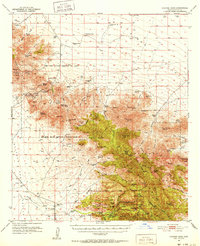
 1954 Silver City1967 Print · USGSSoutheast Arizona and southwest New Mexico meet in this mid-century survey of the high desert and mountain mining districts. Local researchers can trace the rail lines through Lordsburg, the silver operations at Ash Peak Mines, and the limits of Fort Bayard Military Reservation.4 unique versions available
 - 1955 Map of Douglas
 1955 Douglas1955 Print · USGSThe Arizona and New Mexico borderlands come into focus in the mid-1950s, highlighting the mining and ranching hubs of the Desert Southwest. Genealogists and historians can trace the foundations of Bisbee, the operations at Hachita Mine, and rural landmarks like the Double Adobe School.2 unique versions available
 - 1956 Map of Nogales, 1963 Print
 1956 Nogales1963 Print · USGSSouthern Arizona in the mid-fifties is captured here from the Papago tribal lands to the San Pedro valley. Genealogists and historians can trace border settlements like Sasabe, the legacy of Tombstone, and old mining sites including the Mary G Mine.4 unique versions available
 - 1956 Map of Tucson, 1967 Print
 1956 Tucson1967 Print · USGSPost-war Southern Arizona comes into focus as the copper and aviation industries expand around Tucson. Trace family roots in South Tucson or locate early mining sites like the San Manuel Mine and Silver Bell Mine near the Santa Cruz River.3 unique versions available
 - 1957 Map of Redington, 1958 Print
 1957 Redington1958 Print · USGSThe San Pedro River valley in the late fifties shows a landscape shaped by remote ranching and desert homesteads. Genealogists and historians can trace family-named sites like Bingham Ranch, the Cascabel School, and Soza Ranch.3 unique versions available
 - 1957 Map of Hay Mountain, 1959 Print
 1957 Hay Mountain1959 Print · USGSCochise County ranching and mining efforts are captured here in the late fifties, showing the high-desert terrain near the Dragoon Mts. Researchers can locate historic outposts like Gold Camp and the Reeves Ranch, or trace water sources like Antelope Spring.3 unique versions available
 - 1957 Map of Paul Spur, 1959 Print
 1957 Paul Spur1959 Print · USGSSouthern Cochise County sits at a crossroads of rail and air transit during the late fifties along the international border. Genealogists and historians can trace the foundations of Paul Spur, the industrial Quarry, and the Forrest Airport.3 unique versions available
 - 1957 Map of Dos Cabezas, 1959 Print
 1957 Dos Cabezas1959 Print · USGSThe Dos Cabezas Mountains and the Sulphur Springs Valley are shown here in the late fifties as ranching and mining shaped the Arizona landscape. Genealogists and historians can trace local landmarks like Dos Cabezas, the Mascot Mine, and Rancho Sacatal.2 unique versions available
 - 1957 Map of Luzena, 1959 Print
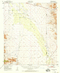
 1957 Luzena1959 Print · USGSSoutheast Arizona in the late fifties is defined by the vital transit corridor through Railroad Pass. Genealogists and historians can locate remote desert outposts and ranches such as Luzena, Raso, and the Monk Ranch along the rail line.2 unique versions available
Showing maps 1-25 of 70
Top cities of Cochise County
- Sierra Vista historical maps
- Douglas historical maps
- Bisbee historical maps
- Benson historical maps
- Willcox historical maps
- Whetstone historical maps
See more
Frequently asked questions
- What are the different types of historical maps available for Cochise County?
- What is the oldest map of Cochise County?
- Where can I purchase historical maps of Cochise County for my home or office?
- Where can I download high-res historical maps of Cochise County?
- Are there historical topographic maps available for Cochise County?
- Is there historical aerial imagery available for Cochise County?
- Where are historical maps of Cochise County sourced from?