Old Maps of Cochise County, Arizona for Hiking & Exploration
Hike through history with 838 historic maps of Cochise County. Explore old trails, ghost towns, and forgotten backroads — perfect for outdoor adventurers and local explorers.
- Rediscover forgotten places: Map out old mining camps, roads, and footpaths that no longer exist on modern maps.
- Layer with modern tools: Combine with LiDAR or satellite views to plan hikes through historical terrain.
- Made for exploration: Popular among hikers, overlanders, and local history lovers.
Use these maps to find adventure and explore the hidden past of Cochise County.
Cochise County, AZ maps
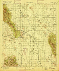
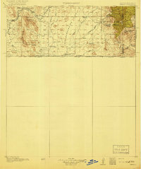
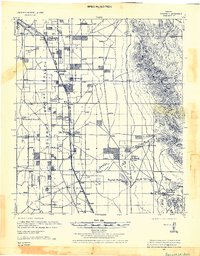
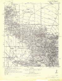
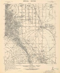
(838)- 1902 Map of Bisbee
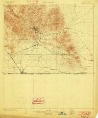 1902 Bisbee1902 Print · USGSCochise County mining and ranching culture are shown here at the turn of the century as the local economy centered on copper and the border trade. You can trace the early footprints of Bisbee and Don Luis or locate old homesteads like Fike's Ranch and the Glance Mine.2 unique versions available
 - 1910 Map of Bisbee
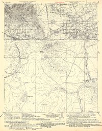
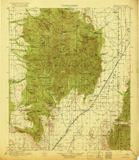
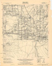
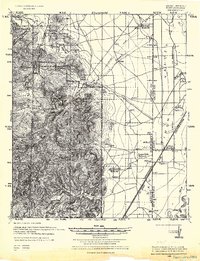
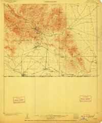 1910 Bisbee1910 Print · USGSMining and ranching define this Cochise County landscape in the early 1900s as Bisbee booms in the Mule Mountains. Researchers can trace the El Paso and Southwestern RR past Don Luis to the border at Naco, identifying family ranch sites like Browns Ranch and Forrests Ranch along the way.2 unique versions available
 - 1914 Map of Hereford
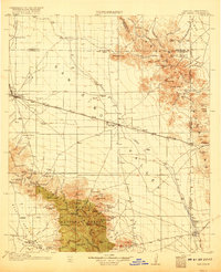
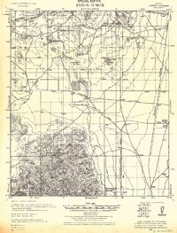
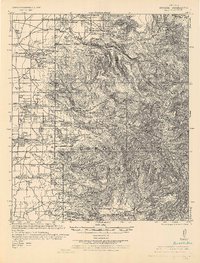
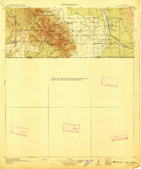 1914 Hereford1914 Print · USGSUpper Cochise County reveals its early ranching and mining character just before the Great War. Genealogists and historians can trace remote mountain settlements like Sunnyside and Hamburg or the railway path of the El Paso and Southwestern.3 unique versions available
 - 1914 Map of Douglas
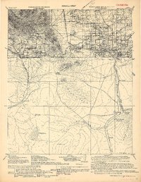
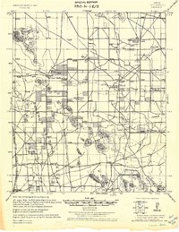
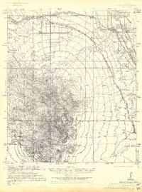
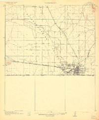 1914 Douglas1914 Print · USGSThe copper-smelting industry dominates the landscape near the international border just before the Great War. Genealogists and historians can trace the early foundations of Douglas, the grid of Pirtleville, and rural landmarks like Carey Ranch and Valley School.3 unique versions available
 - 1915 Map of Benson
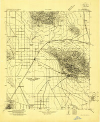
 1915 Benson1915 Print · USGSSouthern Arizona was a landscape of rail junctions and mining claims just before the Great War. Genealogists and historians can trace the reach of Tombstone, find the Panama Mine, and locate vanished rail stops like Fairbank and Boquillas.4 unique versions available
 - 1916 Map of Pearce
 1916 Pearce1916 Print · USGSCochise County mining camps and ranch lands are documented here during the peak of the copper boom. Researchers can trace family-named outposts like Kirkpatrick Ranch or locate early rural education sites such as Stronghold School and Brophy School.3 unique versions available
 - 1916 Map of Douglas
 1916 Douglas1916 Print · USGSThe Arizona-Mexico border comes alive in the mid-1910s, showcasing the height of the copper mining era around Bisbee and Douglas. Genealogists and historians can trace family land like Forrests Ranch and local institutions like the Double Adobe Valley School.
 - 1917 Map of San Simon
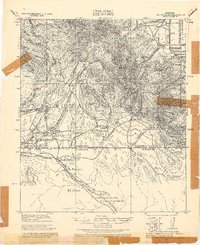
 1917 San Simon1917 Print · USGSArizona and New Mexico ranching and rail history meet here during the years following the border surveys. Genealogists and historians can locate remote family sites like Posey Ranch, the historical Old Fort Bowie, and early copper or granite works at Willie Rose Mine.3 unique versions available
 - 1917 Map of Chiricahua, 1954 Print
 1917 Chiricahua1954 Print · USGSSoutheastern Arizona and the New Mexico borderlands are shown here during a period of mining expansion and cattle ranching. Genealogists can locate family homesteads like Staffords Ranch or trace remote outposts like Paradise and the Hilltop Mine.
 - 1919 Map of Douglas
 1919 Douglas1919 Print · USGSThe Arizona-Mexico borderlands come alive in the decade following the turn of the century, showing the dense mining and rail networks around the Mule Mountains. Trace early ranching footprints at Forrest's Ranch, the industrial layout of Tin Town, and cross-border landmarks like Mina de Oro.
 - 1919 Map of Perilla
 1919 Perilla1919 Print · USGSThe Arizona-Mexico borderlands come alive in this survey of the high desert ranching country. Genealogists and historians can trace family operations like the McDonald Ranch and Ed Howard Ranch, or locate the Cottonwood Creek School and Cazador Siding along the old rail line.4 unique versions available
 - 1919 Map of Chiricahua
 1919 Chiricahua1919 Print · USGSSoutheastern Arizona ranching and mining operations are captured here during the late nineteen-teens. Genealogists can trace family homesteads like Staffords Ranch and Hampe Ranch alongside the Hilltop Mine and several rural schoolhouses.3 unique versions available
 - 1922 Map of Willcox
 1922 Willcox1922 Print · USGSCochise County’s high-desert ranching and mining heartland is captured in the early 1920s as a thriving railroad hub. Genealogists can trace family holdings and rail stops across the basin, from Willcox and Servoss to the Mascot Mine and Circle I Ranch.
 - 1922 Map of Sunnyside, 1926 Print
 1922 Sunnyside1926 Print · USGSThe Arizona-Mexico border comes alive in the 1920s, showing the high country of the Huachucas before modern development. Genealogists and researchers can locate remote outposts like Sunnyside, trace the Southern Pacific Railroad, and find the Carr Canyon School.
 - 1922 Map of Swisshelm, 1927 Print
 1922 Swisshelm1927 Print · USGSSulphur Spring Valley and the Swisshelm Mountains are captured here in the early 1920s as a thriving rail-and-ranching corridor. Genealogists and historians can trace the foundations of local life at Caliente Webb P O, the Leslie School, and the El Paso Southwestern line.
 - 1922 Map of St. David, 1928 Print
 1922 St. David1928 Print · USGSCochise County's river-and-rail economy is captured here in the 1920s, showing the settlement at St David and the industrial works of the Apache Powder Co. Researchers can trace the Southern Pacific line and family landmarks like Fourr Ranch or the landing at Boquillas.
 - 1922 Map of McDonald, 1928 Print
 1922 McDonald1928 Print · USGSThe Arizona and New Mexico borderlands meet the international boundary in the 1920s, showing a landscape defined by cattle ranching and desert springs. Researchers can trace historic family holdings like Hazelwood Ranch and remote landmarks such as the Cottonwood Creek School and Spring of Contention.
 - 1925 Map of Douglas
 1925 Douglas1925 Print · USGSThe Arizona-Mexico borderlands in the mid-twenties were a mosaic of family-named ranches and early motor routes. Genealogists can trace individual homesteads like the Cross U Bar R. (Stephenson) or the Lakes Ranch alongside the historic Nacozari Railroad.
 - 1925 Map of Gleeson
 1925 Gleeson1925 Print · USGSThe mining town of Gleeson and its surrounding ranchlands appear here during the mid-1920s. Genealogists and researchers can trace family holdings like the 3-O Ranch and Potter Ranch alongside the Arizona Eastern rail line.
 - 1926 Map of Light
 1926 Light1926 Print · USGSCochise County ranching and rail transport are captured here during the mid-twenties, as the high desert landscape began to transition. Researchers can trace family ranch lands such as Moore Ranch and the site of Light, alongside the route of the Eastern Arizona Railroad.
 - 1926 Map of Cochise Head
 1926 Cochise Head1926 Print · USGSSoutheastern Arizona in the mid-twenties shows a landscape of isolated cattle ranches and historic military sites transitioning into managed forest lands. Genealogists and historians can trace family landholdings at Riggs Home Ranch and Faraway Ranch or locate the site of Old Fort Bowie.
 - 1926 Map of Rodeo
 1926 Rodeo1926 Print · USGSThe high desert borderlands near the Arizona state line thrived with cattle ranching and mining during the mid-twenties. Genealogists and historians can locate family landmarks like Hall Ranch, the Lone Oak School, and the Washburn Mining Co.
 - 1926 Map of Rucker
 1926 Rucker1926 Print · USGSSoutheast Arizona's high desert and mountain ranges are captured here in the 1920s, showing a land of remote ranches and early national forest management. Genealogists and historians can trace family-named sites like McCutcheons Ranch, the Hilltop Mine, and the Rucker School.
 - 1926 Map of Whetstone
 1926 Whetstone1926 Print · USGSThe San Pedro River valley and the railroad hub of Benson are captured here in the mid-1920s. Genealogists and historians can trace the early footprints of Wakefield Ranch, locate the Taylor School, and follow the junction of the Southern Pacific and El Paso and Southwestern lines.
 - 1926 Map of Courtland
 1926 Courtland1926 Print · USGSMining and ranching infrastructure dominated this corner of Cochise County in the mid-twenties as the Dragoon Mountains hummed with industrial activity. Researchers can trace the legacy of the Commonwealth Mine & Stamp Mill and the specific operations at Courtland and Pearce.
Showing maps 1-25 of 838
Top cities of Cochise County
- Sierra Vista historical maps
- Douglas historical maps
- Bisbee historical maps
- Benson historical maps
- Willcox historical maps
- Whetstone historical maps
See more
Frequently asked questions
- What are the different types of historical maps available for Cochise County?
- What is the oldest map of Cochise County?
- Where can I purchase historical maps of Cochise County for my home or office?
- Where can I download high-res historical maps of Cochise County?
- Are there historical topographic maps available for Cochise County?
- Is there historical aerial imagery available for Cochise County?
- Where are historical maps of Cochise County sourced from?