Old Maps of Clark County, Kansas for Genealogy
Trace your family roots with 145 historic maps of Clark County. These high-res maps reveal old neighborhoods, homesites, landmarks, and streets — helping you uncover where your ancestors lived and how the area evolved over time.
- Explore historic neighborhoods: Identify where your relatives may have lived in the 1800s or 1900s.
- Compare maps over time: Trace the changes in streets, buildings, and landmarks for multi-generational research.
- Perfect for genealogy & ancestry research: Used by family historians and researchers to map out lineage and migration.
These maps are an incredible resource for exploring your personal connection to Clark County's past.
Clark County, KS maps
(145)- 1892 Map of Meade
 1892 Meade1892 Print · USGSSouthwestern Kansas at the end of the nineteenth century centers on the growing rail hub of Meade. Genealogists and historians can trace early prairie settlements and rail stops like Fowler, Minneola, and the riverside site of Odee.5 unique versions available
 - 1894 Map of Sitka
 1894 Sitka1894 Print · USGSSouthwest Kansas in the late nineteenth century was a landscape of deep river draws and new rail connections. Trace the path of the Atchison Topeka and Santa Fé R.R. through Sitka or follow the early surveyed courses of the Cimarron River and Bluff Creek.2 unique versions available
 - 1896 Map of Ashland
 1896 Ashland1896 Print · USGSClark County at the close of the nineteenth century was a landscape of expanding railroads and emerging cattle-towns. Genealogists and researchers can trace the early footprints of Ashland, locate the remote Jacobs Well, and follow the original routes of the Atchison Topeka and Santa Fe R. R.3 unique versions available
 - 1955 Map of Woodward, 1967 Print
 1955 Woodward1967 Print · USGSNorthwest Oklahoma and the bordering plains are captured during the mid-sixties, showing a landscape defined by river valleys and massive water projects. Researchers can trace family roots in towns like Woodward and Alva or locate landmarks such as the Western Oklahoma State Hospital and Kegelman AF.3 unique versions available
 - 1955 Map of Pratt, 1968 Print
 1955 Pratt1968 Print · USGSSouth-central Kansas during the mid-fifties presents a landscape of sprawling oil fields and critical rail junctions. Researchers can trace the paths of the Atchison Topeka and Santa Fe railroad or locate local landmarks like the Blue Ridge Community House and Camp Carlisle.3 unique versions available
 - 1955 Map of Dodge City, 1968 Print
 1955 Dodge City1968 Print · USGSSouthwest Kansas in the mid-fifties reveals an expansive landscape of cattle towns, early gas fields, and prairie outposts. Researchers can trace rural school districts like Moundview and Good Luck or locate the Kansas State Game Farm near Lakin.3 unique versions available
 - 1958 Map of Woodward
 1958 Woodward1958 Print · USGSNorthwest Oklahoma and the neighboring panhandle borders are shown here during a period of steady mid-century growth. Researchers can trace the rail networks of the Atchison Topeka and Santa Fe and locate landmarks like the Western Oklahoma State Hospital and Port Supply Reservoir.2 unique versions available
 - 1958 Map of Dodge City
 1958 Dodge City1958 Print · USGSSouthwest Kansas in the late fifties shows a landscape of river-valley agriculture and burgeoning energy infrastructure. Genealogists can trace rural life through numerous landmarks like Fairview Cemetery, the Goodwell School, and Concord Church.
 - 1959 Map of Pratt
 1959 Pratt1959 Print · USGSSouth-central Kansas thrived as a rail and agricultural hub in the late fifties, where the Arkansas River meets a vast grid of section roads. Researchers can trace the path of the Missouri Pacific railroad through settlements like Turon and Stafford, or locate family landmarks like the Prairie Oak School.2 unique versions available
 - 1959 Map of Dodge City
 1959 Dodge City1959 Print · USGSSouthwest Kansas in the mid-fifties is captured at its agricultural height, centered on the vital rail and river hubs of Dodge City and Garden City. Genealogists and local historians can trace rural school districts like Shockey School and Hickok School or locate the Fairview Cemetery.
 - 1967 Map of Bloom, 1968 Print
 1967 Bloom1968 Print · USGSBloom and the surrounding Kansas plains were firmly defined by the rail and ranching economy in the late sixties. Researchers can trace the CHICAGO Rock Island and Pacific railroad and the historic Old Indian Treaty Boundary near Bloom Cem.
 - 1967 Map of Fowler SE, 1968 Print
 1967 Fowler SE1968 Print · USGSThe high plains of Clark County meet the winding drainages of the eastern Meade County line in the mid-1960s. Genealogists and local historians can trace the geography of early townships like Appleton and Vesta alongside the course of Old Indian Treaty Creek.
 - 1967 Map of Minneola, 1968 Print
 1967 Minneola1968 Print · USGSMinneola and the surrounding plains were a hub of rail and regional boundary lines in the late 1960s. Genealogists and researchers can trace the Old Indian Treaty Boundary across the county line and locate sites like the Kennedy Glider Port and Minneola Cem.
 - 1970 Map of Buffalo NW, 1973 Print
 1970 Buffalo NW1973 Print · USGSThe Oklahoma-Kansas borderlands come into focus at the dawn of the 1970s, showcasing a rural landscape defined by township lines and cattle-country creek beds. Researchers can locate the settlement of Willard, a local Cem, and numerous Gas Wells along Snake Creek.2 unique versions available
 - 1970 Map of Buffalo NE, 1973 Print
 1970 Buffalo NE1973 Print · USGSThe Oklahoma-Kansas state line north of Buffalo is documented here during the early 1970s, showcasing a rural landscape of ranching and oil extraction. Researchers can locate community centers like the Paruna Community Hall and trace family sites at Willow Creek Cem.
 - 1972 Map of Ashland NW, 1974 Print
 1972 Ashland NW1974 Print · USGSThe Clark County prairie in the early seventies is revealed here through its unique sinkhole geology and drainage networks. Researchers can locate the iconic St Jacobs Well within Little Basin, and trace the winding paths of Keiger Creek and Little Sandy Creek.
 - 1972 Map of Proffitt Lake, 1974 Print
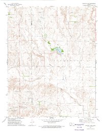 1972 Proffitt Lake1974 Print · USGSThe Kansas high plains near the turn of the 1970s reveal a landscape of creek drainages and historic borderlines. Researchers can locate the Old Indian Treaty Boundary, the Big Basin sinkhole, and remote Grave sites across the prairie.
 - 1972 Map of Englewood, 1974 Print
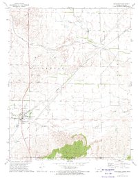 1972 Englewood1974 Print · USGSEnglewood and the surrounding plains of Clark County are captured here in the early 1970s, just north of the Oklahoma border. Genealogists and historians can trace the Atchison Topeka and Santa Fe rail line and locate the Old Indian Treaty Boundary.
 - 1972 Map of Ashland SE, 1974 Print
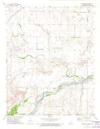 1972 Ashland SE1974 Print · USGSThe Kansas-Oklahoma borderlands are captured here in the early 1970s as the Cimarron River snakes through Clark County. Researchers can trace the Old Indian Treaty Boundary and follow the Atchison Topeka and Santa Fe railroad across Little Sandy Creek.
 - 1972 Map of Mount Helen, 1974 Print
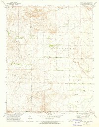 1972 Mount Helen1974 Print · USGSThe Kansas-Oklahoma borderlands in the early seventies reveal a landscape shaped by historical demarcations and modern energy production. Researchers can trace the Old Indian Treaty Boundary and locate family-interest landmarks like Mount Helen, Springs, and numerous early Gas Well sites.
 - 1972 Map of Ashland, 1974 Print
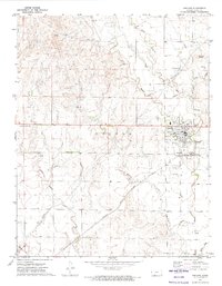 1972 Ashland1974 Print · USGSAshland and the surrounding Clark County plains are captured here in the early seventies, dominated by the vital Atchison Topeka and Santa Fe rail corridor. Researchers can trace the town's development through landmarks like Krier Airport, the Fairground, and the Ashland Oil Field.
 - 1979 Map of Sitka, 1980 Print
 1979 Sitka1980 Print · USGSSitka and the surrounding Clark County ranch lands are captured here in the late seventies, showing the area's rail-and-resource economy. Researchers can locate the St Josephs and Highland Cem or trace the Atchison Topeka and Santa Fe line past the local Oil and Gas Field.
 - 1979 Map of Bloom SE, 1980 Print
 1979 Bloom SE1980 Print · USGSClark County prairie lands in the late seventies reveal a rural landscape defined by the intersection of Appleton and Center townships. Researchers can trace the drainage of Bluff Creek, locate the landmark Mt Nebo, and follow the path of a major regional Pipeline.2 unique versions available
 - 1979 Map of Sugarloaf, 1980 Print
 1979 Sugarloaf1980 Print · USGSThe Kansas borderlands between Sitka and Protection come into focus during the late seventies, showing a landscape shaped by rail and energy. Trace the path of the Atchison Topeka and Santa Fe or explore the local Gas Field and the distinctive Sugarloaf rise.2 unique versions available
 - 1979 Map of Turkey Creek, 1980 Print
 1979 Turkey Creek1980 Print · USGSSouthwest Kansas prairie land is captured here in the late seventies, showing the intersection of several historic townships and county lines. Researchers can trace the Old Indian Treaty Boundary and locate early energy infrastructure like the Gas Well sites near West Kiowa Creek.
Showing maps 1-25 of 145
Top cities of Clark County
- Ashland historical maps
- Minneola historical maps
- Englewood historical maps
- Sitka historical maps
- Lexington historical maps
Frequently asked questions
- What are the different types of historical maps available for Clark County?
- What is the oldest map of Clark County?
- Where can I purchase historical maps of Clark County for my home or office?
- Where can I download high-res historical maps of Clark County?
- Are there historical topographic maps available for Clark County?
- Is there historical aerial imagery available for Clark County?
- Where are historical maps of Clark County sourced from?