1940s Maps of Nebraska
Explore 68 historic maps of Nebraska from the 1940s. These maps offer a rare glimpse into what life looked like during the 1940s — showing old roads, neighborhoods, homes, and landmarks that have changed or disappeared over time.
Whether you're researching your family's past, planning a metal detecting trip, or studying how Nebraska's landscape evolved across the 1940s, these high-resolution maps are a powerful tool for exploring the history of this region.
- Focus on a specific era: All maps on this page are from the 1940s, giving you a focused view of this time period.
- See what’s changed: Compare century-old streets, trails, and buildings to today's modern landscape using overlays and satellite layers.
- Research with precision: Use these maps for genealogy, historical research, land use analysis, or educational projects.
- View, download, or print: Maps are fully viewable online in high resolution, and can be downloaded or printed for your own records.
Start exploring Nebraska's history through authentic maps from the 1940s. This is your window into the past.
Nebraska maps
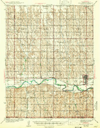
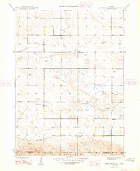
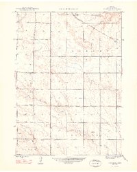
(68)- 1940 Map of Nehawka
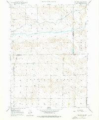
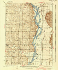 1940 Nehawka1940 Print · USGSThe Missouri River valley comes to life in this pre-war survey of Cass County and the Iowa border. Genealogists can locate family names at Youngs Cem or trace dozens of rural school sites like Cottonwood Sch and Eightmile Grove Sch.3 unique versions available
 - 1940 Map of Dorchester
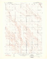
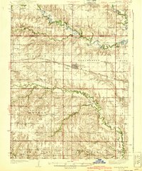 1940 Dorchester1940 Print · USGSSaline County and Seward County farm country is shown here in the mid-1930s, when small district schools and rural halls anchored every township. Genealogists can locate family landmarks like Gilbert Cem, Tabor Hall, and the West Blue Ch church.3 unique versions available
 - 1940 Map of Red Cloud, 1954 Print
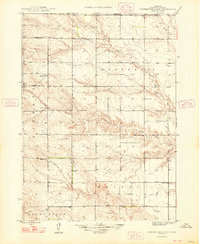
 1940 Red Cloud1954 Print · USGSSouthern Nebraska at the end of the Great Depression is characterized by its close-knit rural school districts and river-valley rail lines. Genealogists can trace family roots through numerous landmarks like Catherton Cem, St Stevens Ch, and the Poor Farm Sch.2 unique versions available
 - 1941 Map of Hamburg
 1941 Hamburg1941 Print · USGSThe Missouri-Iowa borderlands come alive in this pre-war survey of the river's winding oxbows and rural townships. Genealogists can trace family roots through a dense network of country schools and churches, from Mayflower Sch to the Stoner Cem.2 unique versions available
 - 1942 Map of Red Cloud
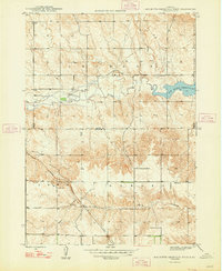
 1942 Red Cloud1942 Print · USGSRed Cloud and the surrounding Republican River valley are shown here just before the mid-century, when the rural school system remained remarkably intact. Researchers can trace family roots through numerous sites like New Virginia Cem, Poor Farm Sch, and Inavale.
 - 1946 Map of Nonpareil, 1966 Print
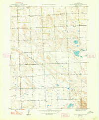
 1946 Nonpareil1966 Print · USGSBox Butte County was a landscape of remote farmsteads and rural school districts in the years following World War II. Researchers can trace the path of the Chicago Burlington and Quincy railroad and locate local landmarks like Prairie Flower Sch and Nonpareil.
 - 1946 Map of Berea Creek East, 1977 Print
 1946 Berea Creek East1977 Print · USGSBox Butte County in the mid-forties reveals a classic Nebraska Panhandle ranching landscape marked by a network of rural schoolhouses. Genealogists can locate family landmarks like Plainview Cem or trace the early paths of Hemingford Creek and School No 78.
 - 1946 Map of Box Butte Reservoir West, 1978 Print
 1946 Box Butte Reservoir West1978 Print · USGSThe Nebraska Panhandle's ranching country comes into focus in this mid-century survey, documenting the early years of the Box Butte Reservoir. Genealogists and local historians can locate remote landmarks such as Sch No 62, Sch No 50, and the breaks of Sand Canyon.
 - 1947 Map of Dismal River Ranch, 1963 Print
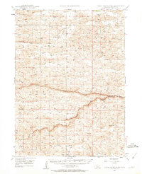 1947 Dismal River Ranch1963 Print · USGSHooker County ranching country is captured here just after the war, showing the vital water and school networks of the Nebraska Sandhills. Researchers can locate the Dismal River Ranch and trace the many family-named school sites like Maire Sch and Shimmin Sch.2 unique versions available
 - 1947 Map of Alliance, 1967 Print
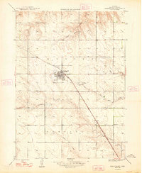
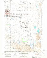 1947 Alliance1967 Print · USGSAlliance emerges as a bustling panhandle hub in the late 1940s, balancing its railroad roots with new aviation infrastructure. Researchers can locate the Courthouse, trace the Chicago Burlington and Quincy rail lines, and find rural landmarks like Greenwood Cem.2 unique versions available
 - 1947 Map of Bronco Lake, 1970 Print
 1947 Bronco Lake1970 Print · USGSThe Nebraska panhandle comes into focus in the late 1940s as the rail lines and rural school districts of Box Butte County are mapped in detail. Genealogists can trace the rural landscape through landmarks like Letan Sch, St Josephs Hospital, and the small settlement of Letan.2 unique versions available
 - 1947 Map of Box Butte NE, 1976 Print
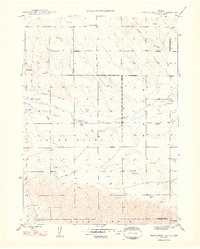
 1947 Box Butte NE1976 Print · USGSNorthwestern Nebraska at the end of the 1940s reveals a ranching landscape shaped by the Niobrara River and early irrigation projects. Researchers can locate remote homestead Windmills and the site of School No 80 near the Irrigation Canal.2 unique versions available
 - 1947 Map of Box Butte, 1977 Print
 1947 Box Butte1977 Print · USGSThe Nebraska panhandle landscape comes into focus just after the war, showing the rural townships of Running Water and Box Butte. Genealogists and researchers can trace the locations of historic rural schools like School No 46 and the winding path of Box Butte Creek.
 - 1947 Map of Box Butte NW, 1977 Print
 1947 Box Butte NW1977 Print · USGSThe Niobrara River valley in the late 1940s reveals a high plains landscape shaped by early irrigation and ranching. Genealogists and historians can trace local landmarks like Kattn Cem, the Dunlap Sch, and scientific sites including the Fossil Beds.
 - 1948 Map of Box Butte Reservoir West
 1948 Box Butte Reservoir West1948 Print · USGSThe Nebraska high plains meet the headwaters of the Niobrara River in the late 1940s, just as the reservoir began to transform the local landscape. Researchers can locate remote rural schoolhouses like Sch No 52 and trace the early route of the Chicago Burlington and Quincy railroad.2 unique versions available
 - 1948 Map of Hemingford
 1948 Hemingford1948 Print · USGSThe Nebraska panhandle town of Hemingford is captured shortly after the war, showing its role as a vital rail-side agricultural center. Genealogists and researchers can locate several rural schoolhouses, St Johns Cem, and the path of the Chicago Burlington and Quincy railroad.2 unique versions available
 - 1948 Map of Hemingford 4 SW
 1948 Hemingford 4 SW1948 Print · USGSBox Butte and Morrill counties appear here in the late forties, revealing a working landscape of prairie ranching and isolated schoolhouses. Genealogists can locate family landmarks like School No 36 or trace the path of an Abandoned Canal and Snake Creek.4 unique versions available
 - 1948 Map of Hemingford 4 SE
 1948 Hemingford 4 SE1948 Print · USGSWestern Nebraska's ranching country comes into focus in the late 1940s, showing a landscape defined by water management and rural schooling. Genealogists can locate Hagaman Cem and trace the exact positions of School No 9 and School No 16 among the high plains.3 unique versions available
 - 1948 Map of Berea Creek West
 1948 Berea Creek West1948 Print · USGSBox Butte County was a landscape of rail-dependent prairie settlements in the years following World War II. Genealogists and local historians can locate rural landmarks like School No 45, the tiny community of Berea, and the Yale Siding railroad stop.2 unique versions available
 - 1948 Map of Berea Creek East
 1948 Berea Creek East1948 Print · USGSBox Butte County was a landscape of remote farmsteads and rural schoolhouses just after the war. Researchers can trace the placement of local landmarks like School No 78, Plainview Cem, and the headwaters of Berea Creek.2 unique versions available
 - 1948 Map of Hemingford 4 NE
 1948 Hemingford 4 NE1948 Print · USGSBox Butte County farmland and prairie drainages are captured here in the late 1940s. Genealogists can locate rural school districts like School No 7 and School No 58 or trace the early path of the C B and Q railroad.4 unique versions available
 - 1948 Map of Hemingford 4 NW
 1948 Hemingford 4 NW1948 Print · USGSBox Butte County was a landscape of isolated homesteads and country schoolhouses shortly after the war. Local historians can trace the exact locations of rural education centers like School No 27 and landmarks such as Point of Rocks.3 unique versions available
 - 1948 Map of Nonpareil
 1948 Nonpareil1948 Print · USGSBox Butte County is shown in the late 1940s, highlighting a high-plains landscape shaped by the Chicago Burlington and Quincy railroad. Genealogists can locate rural schoolhouses like Prairie Flower Sch and trace the drainage of Point of Rocks Creek.2 unique versions available
 - 1948 Map of Box Butte Reservoir East
 1948 Box Butte Reservoir East1948 Print · USGSThe Nebraska panhandle comes into focus just after the war as the Box Butte Dam begins to reshape the Niobrara River valley. Researchers can trace rural school districts like Sch No 17 and explore the rugged breaks of Sand Canyon.
 - 1948 Map of Alliance
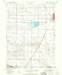
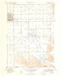 1948 Alliance1948 Print · USGSAlliance emerges as a bustling post-war rail and aviation hub in the Nebraska panhandle during the late forties. Genealogists and researchers can trace local landmarks like Greenwood Cem, East Point Sch, and the expansive Alliance Airport.2 unique versions available
Showing maps 1-25 of 68
Top cities of Nebraska
- Omaha historical maps
- Lincoln historical maps
- Bellevue historical maps
- Grand Island historical maps
- Kearney historical maps
- Fremont historical maps
See more
Top counties of Nebraska
- Douglas County historical maps
- Lancaster County historical maps
- Sarpy County historical maps
- Hall County historical maps
- Buffalo County historical maps
- Dodge County historical maps
See more
Frequently asked questions
- What are the different types of historical maps available for Nebraska?
- What is the oldest map of Nebraska?
- Where can I purchase historical maps of Nebraska for my home or office?
- Where can I download high-res historical maps of Nebraska?
- Are there historical topographic maps available for Nebraska?
- Is there historical aerial imagery available for Nebraska?
- Where are historical maps of Nebraska sourced from?