1960s Maps of Nebraska
Explore 523 historic maps of Nebraska from the 1960s. These maps offer a rare glimpse into what life looked like during the 1960s — showing old roads, neighborhoods, homes, and landmarks that have changed or disappeared over time.
Whether you're researching your family's past, planning a metal detecting trip, or studying how Nebraska's landscape evolved across the 1960s, these high-resolution maps are a powerful tool for exploring the history of this region.
- Focus on a specific era: All maps on this page are from the 1960s, giving you a focused view of this time period.
- See what’s changed: Compare century-old streets, trails, and buildings to today's modern landscape using overlays and satellite layers.
- Research with precision: Use these maps for genealogy, historical research, land use analysis, or educational projects.
- View, download, or print: Maps are fully viewable online in high resolution, and can be downloaded or printed for your own records.
Start exploring Nebraska's history through authentic maps from the 1960s. This is your window into the past.
Nebraska maps
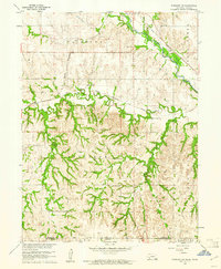
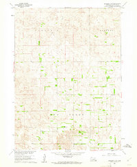
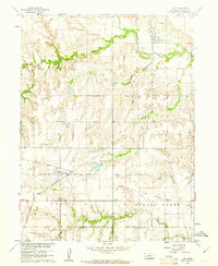
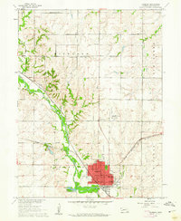
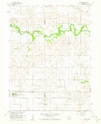
(523)- 1960 Map of Tremain
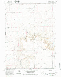 1960 Tremain1960 Print · USGSThe high plains of the Wyoming-Nebraska border come into focus in 1960, showing a landscape defined by cattle ranching and rail infrastructure. Researchers can trace historic family-named homesteads like Bull Canyon Ranch and Spahr Ranch alongside the Epworth Cem.3 unique versions available
 - 1960 Map of Kansas City
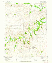
 1960 Kansas City1960 Print · USGSMid-century Kansas and Missouri meet at the river forks, showing a sprawling rail-and-river economy during the 1950s growth era. Genealogists and researchers can trace tribal lands like the Kickapoo Indian Reservation or follow the early interstate corridors through Saint Joseph and Independence.3 unique versions available
 - 1960 Map of Bruning
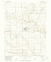
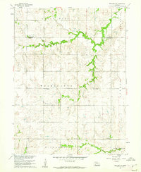
 1960 Bruning1960 Print · USGSThayer County agriculture and rail networks are well-established in the early sixties, centered on the villages of Bruning and Belvidere. Genealogists can locate Keim Cem and trace the paths of the Union Pacific and Burlington railroads.
 - 1960 Map of Byron, 1961 Print
 1960 Byron1961 Print · USGSThe Nebraska-Kansas borderlands in the early sixties remain a patchwork of small-town school districts and prairie parishes. Trace family history through landmarks like Bethany Ch, School No 91, and Zion Cem along the winding Spring Creek.
 - 1960 Map of Edgar, 1961 Print
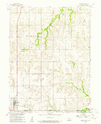
 1960 Edgar1961 Print · USGSClay and Nuckolls Counties come to life at the turn of the 1960s as a hub of Nebraska rail commerce. Genealogists and historians can trace the foundations of local life through rural landmarks like Pioneer Sch, the town of Edgar, and the winding Little Blue River.
 - 1960 Map of Fairbury SW, 1961 Print
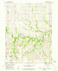
 1960 Fairbury SW1961 Print · USGSThe Jefferson County borderlands at the start of the 1960s reveal a landscape of rural schools and intersecting rail lines. Genealogists and historians can trace family roots through landmarks like Silver Creek Cem, Pleasant Valley Sch, and the Little Blue River valley.
 - 1960 Map of Davenport, 1961 Print
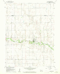
 1960 Davenport1961 Print · USGSDavenport was a bustling rail crossroads in the early sixties where two major lines intersected amidst the creek valleys of southern Nebraska. Researchers can trace the town's original footprint, find the local Cem, and follow the Union Pacific and Chicago and North Western tracks.
 - 1960 Map of Chester, 1961 Print
 1960 Chester1961 Print · USGSThe Nebraska-Kansas border in the early sixties was a landscape of rail-connected farming communities and rural schools. Genealogists can locate family burial sites at Chester Cem or St Johns Cem and trace the path of the Chicago Burlington and Quincy railroad.2 unique versions available
 - 1960 Map of Reynolds, 1961 Print
 1960 Reynolds1961 Print · USGSJefferson County at the dawn of the sixties shows a landscape of rural school districts and dual rail lines. Genealogists can trace family footprints near Reynolds and Rose Creek Cem, or follow the path of the Chicago Burlington and Quincy railroad.2 unique versions available
 - 1960 Map of Spalding 2 SW, 1961 Print
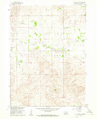
 1960 Spalding 2 SW1961 Print · USGSWheeler County ranching country is shown at the start of the sixties, documenting a landscape of rolling sandhills and section-line roads. Genealogists and local historians can pinpoint rural school sites like School No 20 and School No 24 near the path of Mud Creek.3 unique versions available
 - 1960 Map of Fairfield SE, 1961 Print
 1960 Fairfield SE1961 Print · USGSThe rural landscapes of Clay and Nuckolls Counties come into focus here during the early sixties. Genealogists and local historians can trace the foundations of these prairie communities through sites like Pleasant Hill Cem, Oxbow Sch, and the Chicago Burlington and Quincy rail line.
 - 1960 Map of Hubbell, 1961 Print
 1960 Hubbell1961 Print · USGSThe Nebraska-Kansas borderlands come alive in the early sixties, showing a landscape defined by rail and river. Genealogists can trace family footprints through St Pauls Cem, Williams Cem, and the tracks of the Chicago Burlington and Quincy.2 unique versions available
 - 1960 Map of Spalding 2 NW, 1961 Print
 1960 Spalding 2 NW1961 Print · USGSWheeler County ranching culture comes into focus at the dawn of the sixties, where life centered on the water of Beaver Creek. Researchers can trace old family holdings like Stokes Ranch and locate the rural Wayside Sch.3 unique versions available
 - 1960 Map of Hay Springs SW, 1961 Print
 1960 Hay Springs SW1961 Print · USGSSheridan County agricultural lands are documented here during the height of the mid-century irrigation boom. Genealogists and local historians can locate rural landmarks such as St Peters Ch, Sandridge Sch, and the Mirage Flats Project Headquarters.
 - 1960 Map of Oak, 1961 Print
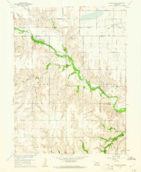
 1960 Oak1961 Print · USGSNuckolls County during the early sixties shows a landscape defined by the Little Blue River and the Chicago and North Western rail line. Researchers can locate the Oak Mill, trace the Old Railroad Grade, and find family sites at Nora Cem.
 - 1960 Map of Hay Springs SE, 1961 Print
 1960 Hay Springs SE1961 Print · USGSNorthwestern Nebraska ranching country comes alive in the early sixties, showing a landscape defined by the Niobrara River. Researchers can locate landmarks like Banner Sch and Sacred Heart Ch in the Hay Springs area.
 - 1960 Map of Mc Compsey Pass, 1962 Print
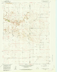 1960 Mc Compsey Pass1962 Print · USGSThe Wyoming-Nebraska borderlands in the early sixties reveal a landscape defined by isolated ranches and essential water sources. Trace the movement of livestock and early settlers through Mc Compsey Pass, the Spahr Ranch, and remote landmarks like Devils Armchair.3 unique versions available
 - 1960 Map of Western SW, 1962 Print
 1960 Western SW1962 Print · USGSJefferson County farm country is captured here in the early 1960s as a landscape of small schools and creek-side settlements. Trace the locations of rural landmarks like Victory Sch, Immanuel Ch, and Bower Cem across the prairie.
 - 1960 Map of Carleton, 1962 Print
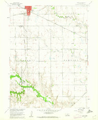
 1960 Carleton1962 Print · USGSThayer and Fillmore Counties are captured here at the start of the 1960s, centered on the railroad village of Carleton. Genealogists and historians can trace family locations near landmarks like Bethel Ch, Summit Cem, and along the Union Pacific corridor.
 - 1960 Map of Fairbury, 1962 Print
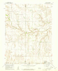
 1960 Fairbury1962 Print · USGSFairbury and the surrounding Jefferson County townships are shown here during the early sixties as a bustling rail and agricultural center. Researchers can locate numerous vanished country schools like Happy Hollow School, trace the path of the Union Pacific, and find family names at Grandy Cemetery.2 unique versions available
 - 1960 Map of Tobias SW, 1962 Print
 1960 Tobias SW1962 Print · USGSThayer and Fillmore counties are shown at the start of the 1960s, centered on the massive footprint of the Bruning State Airfield. Genealogists can trace family plots at Alexandria Cem or locate the old School No 21 near the Union Pacific line.
 - 1960 Map of Lyman, 1962 Print
 1960 Lyman1962 Print · USGSThe Nebraska-Wyoming border comes alive in the early sixties, showing the agricultural heart of the North Platte valley. Researchers can trace the Emigrant Trail, locate the Historical Mon, and study the rail sidings of Lyman and Henry.3 unique versions available
 - 1960 Map of Stegall, 1962 Print
 1960 Stegall1962 Print · USGSWestern Nebraska at the start of the sixties reveals a landscape of high-plains agriculture and dramatic bluffs. Genealogists and local historians can locate the Wheatland Sch, Kiowa Community Ch, and the landmark Signal Butte.2 unique versions available
 - 1960 Map of Ruskin, 1962 Print
 1960 Ruskin1962 Print · USGSAgricultural life in South Central Nebraska is captured here at the start of the 1960s, centered on the village of Ruskin. Genealogists and local historians can locate specific sites like St Marks Cem, Bethlehem Sch, and the Chicago Rock Island and Pacific rail corridor.
 - 1960 Map of Alexandria, 1962 Print
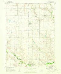
 1960 Alexandria1962 Print · USGSThayer County's rolling prairie is captured here in the early sixties as a network of rail lines and river bends. Local historians can trace the foundations of Alexandria and Gilead or locate family plots at Alexandria Cem and St Marys Cem.2 unique versions available
Showing maps 1-25 of 523
Top cities of Nebraska
- Omaha historical maps
- Lincoln historical maps
- Bellevue historical maps
- Grand Island historical maps
- Kearney historical maps
- Fremont historical maps
See more
Top counties of Nebraska
- Douglas County historical maps
- Lancaster County historical maps
- Sarpy County historical maps
- Hall County historical maps
- Buffalo County historical maps
- Dodge County historical maps
See more
Frequently asked questions
- What are the different types of historical maps available for Nebraska?
- What is the oldest map of Nebraska?
- Where can I purchase historical maps of Nebraska for my home or office?
- Where can I download high-res historical maps of Nebraska?
- Are there historical topographic maps available for Nebraska?
- Is there historical aerial imagery available for Nebraska?
- Where are historical maps of Nebraska sourced from?