1980s Maps of Nebraska
Explore 370 historic maps of Nebraska from the 1980s. These maps offer a rare glimpse into what life looked like during the 1980s — showing old roads, neighborhoods, homes, and landmarks that have changed or disappeared over time.
Whether you're researching your family's past, planning a metal detecting trip, or studying how Nebraska's landscape evolved across the 1980s, these high-resolution maps are a powerful tool for exploring the history of this region.
- Focus on a specific era: All maps on this page are from the 1980s, giving you a focused view of this time period.
- See what’s changed: Compare century-old streets, trails, and buildings to today's modern landscape using overlays and satellite layers.
- Research with precision: Use these maps for genealogy, historical research, land use analysis, or educational projects.
- View, download, or print: Maps are fully viewable online in high resolution, and can be downloaded or printed for your own records.
Start exploring Nebraska's history through authentic maps from the 1980s. This is your window into the past.
Nebraska maps
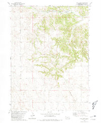
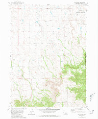
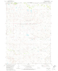
(370)- 1980 Map of Harlan
 1980 Harlan1980 Print · USGSWestern Iowa and the Nebraska borderlands are shown in the early eighties as a vital corridor of rail and river commerce. Genealogists and local historians can trace family roots through old rural crossroads like Beebeetown and Westphalia, or locate landmarks like Rose Hill Cem.
 - 1980 Map of Horn, 1981 Print
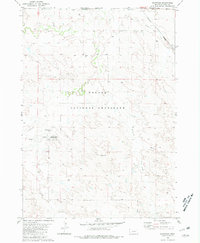
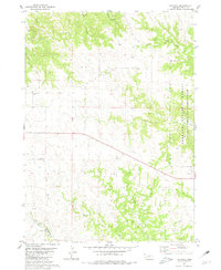
 1980 Horn1981 Print · USGSDawes County in the late 1970s shows a landscape of wide-open ranching country and railroad infrastructure. Genealogists and local historians can trace the community around the Willowdale Sch, the small siding at Horn, and the remote Cem near Benedict Buttes.
 - 1980 Map of Kyle Creek, 1981 Print
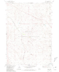
 1980 Kyle Creek1981 Print · USGSIn Sioux County during the 1980s, the White River corridor served as the primary artery for the Chicago and North Western railroad. Trace the local rural infrastructure at Hillview Sch and follow the branching waters of Kyle Creek and Borngrover Creek.
 - 1980 Map of Crow Butte, 1981 Print
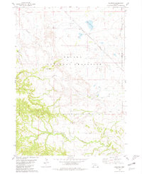
 1980 Crow Butte1981 Print · USGSThe Pine Ridge region of Dawes County comes alive in the early 1980s, showcasing a landscape of high plains and canyonlands. Trace the Chicago and North Western rail line or locate the Crow Butte Cem and the prominent Crow Butte formation.
 - 1980 Map of Montrose, 1981 Print
 1980 Montrose1981 Print · USGSSioux County ranching country and frontier history meet in the early eighties at the South Dakota border. Researchers can find the site of Montrose, trace old ranch boundaries like Wasserburger Ranch, and locate the Pioneer Cem or the Warbonnet Battlefield Mon.
 - 1980 Map of Coffee Mill Butte SE, 1981 Print
 1980 Coffee Mill Butte SE1981 Print · USGSThe Nebraska Panhandle's high plains are documented here in the early eighties, showing the remote ranching lands of Dawes County. Trace the locations of rural water sources and the Table Center Sch near Pebble Creek and Cottonwood Creek.
 - 1980 Map of Wolf Butte, 1981 Print
 1980 Wolf Butte1981 Print · USGSThe Nebraska-South Dakota borderlands are shown in the early 1980s as a landscape of remote ranching and water management. Researchers can trace the drainage of Horsehead Creek past landmarks like Wolf Butte and reservoirs such as Snook Reservoir and McMeekin Reservoir.
 - 1980 Map of Coffee Mill Butte, 1981 Print
 1980 Coffee Mill Butte1981 Print · USGSDawes County is shown here in the early eighties as a landscape of dramatic buttes and forest preserves. Researchers can trace rural landmarks from the Flag Butte Sch to the Open Door Ch and explore the early layout of Chadron State Park.
 - 1980 Map of Smiley Canyon, 1981 Print
 1980 Smiley Canyon1981 Print · USGSThe Nebraska Panhandle's public lands are on full display in the late 1970s, showcasing the intersection of state parks and national forests. Trace the Chicago and North Western rail line through Smiley Canyon or locate Johnson Lake within Fort Robinson State Park.
 - 1980 Map of Story, 1981 Print
 1980 Story1981 Print · USGSSioux County ranching life in the early eighties is meticulously detailed on this map of the Nebraska-South Dakota borderlands. Researchers can locate established family holdings like the Story Ranch and Locker Ranch amid the sprawling Oglala National Grassland.
 - 1980 Map of Five Points, 1981 Print
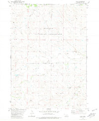
 1980 Five Points1981 Print · USGSSioux County, Nebraska, is shown during the late 1970s, revealing a landscape of high plains ranching and public grasslands. Researchers can trace land use patterns near the Licket Ranch or locate natural landmarks like Five Points and Beans Canyon.
 - 1980 Map of Coffee Mill Butte SW, 1981 Print
 1980 Coffee Mill Butte SW1981 Print · USGSDawes County ranching country is captured here during the early 1980s, showing the intersection of the national forest and high plains. Researchers can locate the Highland Center Cem, Highland Center Sch, and Willow Creek Ch among the deep canyons of Cottonwood Creek.
 - 1980 Map of Lone Tree Ranch, 1981 Print
 1980 Lone Tree Ranch1981 Print · USGSDawes County ranching country at the turn of the 1980s reveals a landscape shaped by intermittent waters and isolated homesteads. Researchers can locate specific legacy sites like Lone Tree Ranch and Felt Ranch or trace the seasonal paths of Messenger Creek and Fisher Creek.
 - 1980 Map of Andrews, 1981 Print
 1980 Andrews1981 Print · USGSSioux County ranching country and federal forest lands are captured here in the early 1980s. Genealogists and local historians can trace the Chicago and North Western rail line through Andrews or locate water sources like Soldier Spring and Tucker Creek.
 - 1980 Map of Orella, 1981 Print
 1980 Orella1981 Print · USGSSioux County, Nebraska, is seen here during the late 1970s as a landscape of isolated ranching outposts and prairie conservation. Genealogists and researchers can trace the rail siding at Orella and landmarks like Sugar Loaf Butte and Twin Butte.
 - 1980 Map of Roundtop, 1981 Print
 1980 Roundtop1981 Print · USGSWestern Nebraska rangeland in the late seventies is captured here within the Oglala National Grassland and along the Sioux and Dawes County border. Researchers can locate remote rural institutions and landmarks like Union Star Cem, Roundtop Sch, and Toadstool Park.
 - 1980 Map of Wayside, 1981 Print
 1980 Wayside1981 Print · USGSDawes County ranching country and the Nebraska-South Dakota border are captured in the early eighties as the railroad still shaped the plains. Researchers can trace the Chicago and North Western line past Wayside and the McDonald Ranch.
 - 1980 Map of Dead Mans Creek, 1981 Print
 1980 Dead Mans Creek1981 Print · USGSDawes and Sioux Counties appear here in the early eighties as a landscape of timbered ridges and public land. Researchers can trace the rugged drainages of Dead Mans Creek and Starvation Gulch or locate the Cochran State Wayside Area along the forest boundary.
 - 1980 Map of Trunk Butte, 1981 Print
 1980 Trunk Butte1981 Print · USGSDawes County ranch lands and rail corridors are captured in the early 1980s as the railroad crossed the Nebraska panhandle. Researchers can trace rural infrastructure and family landmarks like Trunk Butte Sch, the settlement of Hammond, and Baldwin Res.
 - 1980 Map of Chimney Butte, 1981 Print
 1980 Chimney Butte1981 Print · USGSNorthwestern Nebraska’s Pine Ridge landscape is captured here during the late 1970s, showing the high plains where ranching and forest meet. You can trace the rural community through landmarks like the Hard Scrabble Sch, Bethel Ch, and the prominent Chimney Butte.
 - 1980 Map of Story NE, 1981 Print
 1980 Story NE1981 Print · USGSSioux County ranching country is captured here in the early 1980s as it borders South Dakota. Researchers can trace family-named landmarks and water sources like Wasserburger Ranch, Miller Ranch, and the winding Antelope Creek.
 - 1980 Map of Belmont, 1981 Print
 1980 Belmont1981 Print · USGSDawes County in the early 1980s reveals a landscape defined by the Nebraska National Forest and the critical rail corridor at Belmont. Researchers can trace the path of the Burlington Northern through the Belmont Tunnel and locate the historic Belmont Cem.
 - 1980 Map of Crawford, 1981 Print
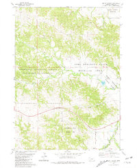
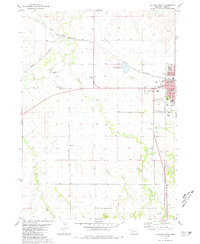
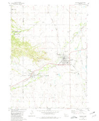 1980 Crawford1981 Print · USGSCrawford served as a vital rail and river junction in the Nebraska panhandle during the early eighties. Researchers can trace the layout of Fort Robinson State Park, locate the St John Cem, and explore landmarks like Lovers Leap Butte.
 - 1980 Map of Chadron West, 1981 Print
 1980 Chadron West1981 Print · USGSChadron and the White River valley are documented here in the early eighties as the town's educational and rail connections flourished. Researchers can trace the grounds of Chadron State College, find Dakota Junction, and locate rural landmarks like Shisler Cem.2 unique versions available
 - 1980 Map of Warbonnet Ranch, 1981 Print
 1980 Warbonnet Ranch1981 Print · USGSSioux County ranching country is captured here during the early 1980s, showing a landscape of high-plains drainages and remote outposts. Researchers can trace land use at Warbonnet Ranch, find the Campground in Monroe Canyon, and follow the winding path of Dirty Jim Creek.
Showing maps 1-25 of 370
Top cities of Nebraska
- Omaha historical maps
- Lincoln historical maps
- Bellevue historical maps
- Grand Island historical maps
- Kearney historical maps
- Fremont historical maps
See more
Top counties of Nebraska
- Douglas County historical maps
- Lancaster County historical maps
- Sarpy County historical maps
- Hall County historical maps
- Buffalo County historical maps
- Dodge County historical maps
See more
Frequently asked questions
- What are the different types of historical maps available for Nebraska?
- What is the oldest map of Nebraska?
- Where can I purchase historical maps of Nebraska for my home or office?
- Where can I download high-res historical maps of Nebraska?
- Are there historical topographic maps available for Nebraska?
- Is there historical aerial imagery available for Nebraska?
- Where are historical maps of Nebraska sourced from?