1900s (20th Century) Maps of Nebraska
Explore 1,756 historic maps of Nebraska from the 1900s (20th Century). These maps offer a rare glimpse into what life looked like during the 1900s — showing old roads, neighborhoods, homes, and landmarks that have changed or disappeared over time.
Whether you're researching your family's past, planning a metal detecting trip, or studying how Nebraska's landscape evolved across the 1900s, these high-resolution maps are a powerful tool for exploring the history of this region.
- Focus on a specific era: All maps on this page are from the 1900s, giving you a focused view of this time period.
- See what’s changed: Compare century-old streets, trails, and buildings to today's modern landscape using overlays and satellite layers.
- Research with precision: Use these maps for genealogy, historical research, land use analysis, or educational projects.
- View, download, or print: Maps are fully viewable online in high resolution, and can be downloaded or printed for your own records.
Start exploring Nebraska's history through authentic maps from the 1900s. This is your window into the past.
Nebraska maps
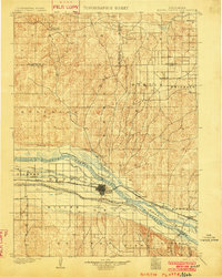
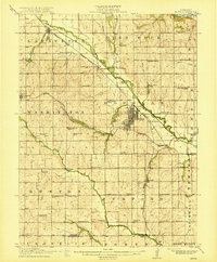
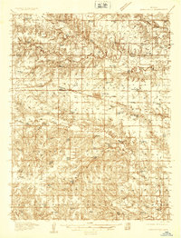
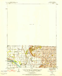
(1,756)- 1900 Map of Oelrichs
 1900 Oelrichs1900 Print · USGSFall River County at the close of the nineteenth century reveals a landscape defined by the arrival of the railroad and the growth of early quarrying operations. Genealogists and historians can trace the Missouri Valley and Elkhorn RR through stops like Buffalo Gap and Oelrichs.4 unique versions available
 - 1900 Map of Chappell
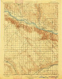 1900 Chappell1900 Print · USGSWestern Nebraska at the dawn of the new century is captured here as a landscape of early irrigation and historic pioneer trails. Trace the path of the Old California Trail past Ash Hollow or locate ranching outposts like Coombe's Ranch and Libbey's Ranch.3 unique versions available
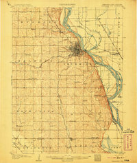
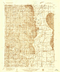
 - 1900 Map of Ogallala
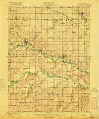
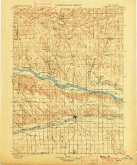 1900 Ogallala1900 Print · USGSThe Platte River valley in the late 1890s shows the crucial intersection of the Union Pacific R. R. and the historic Old California Trail. Researchers can trace early irrigation canals and family-owned landmarks like Fairchild's Ranch and California Hill.6 unique versions available
 - 1901 Map of Paxton
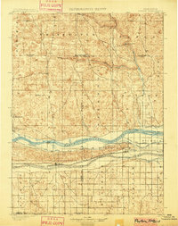 1901 Paxton1901 Print · USGSThe confluence of the Platte Rivers in western Nebraska appears here at a pivotal moment for irrigation and rail expansion. Researchers can trace early water rights through the Sutherland Canal and locate historic livestock operations like Duck Brand Ranch and Knights Ranch.4 unique versions available
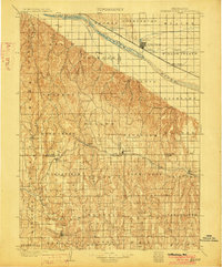
 - 1901 Map of Elk Point
 1901 Elk Point1901 Print · USGSThe tri-state borderlands of South Dakota, Nebraska, and Iowa are captured here at the turn of the century during the peak of the steam rail era. Researchers can trace the original paths of the Chicago Milwaukee and St. Paul Ry. and locate early settlements like Spirit Mound, Newcastle, and Burbank.
 - 1902 Map of Edgemont
 1902 Edgemont1902 Print · USGSThe Black Hills frontier meets the Nebraska plains at the turn of the century, centered on the rail hub of Edgemont. Trace early settlements and rail stops like Minnekahta, Ardmore, and the Quarry as they appeared in this early 1902 survey.4 unique versions available
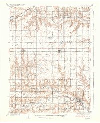
 - 1902 Map of Gothenburg
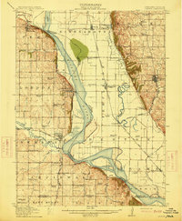
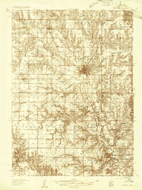
 1902 Gothenburg1902 Print · USGSThe Platte River valley in the early twentieth century was a landscape defined by new railroads and irrigation. Genealogists and historians can trace the early rail stops at Gothenburg and Cozad or locate remote frontier outposts like Stockville and Moorefield.3 unique versions available
 - 1902 Map of North Platte
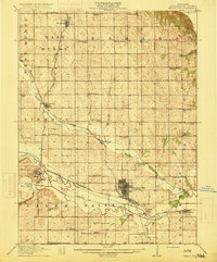
 1902 North Platte1902 Print · USGSNorth Platte and the Platte River forks are shown here at the start of the twentieth century, during a period of massive irrigation expansion. Researchers can trace early railroad siding stops like Spuds and Gannett or find old crossroads like Newberries Crossroads.3 unique versions available
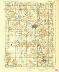
 - 1903 Map of Weeping Water
 1903 Weeping Water1903 Print · USGSSoutheast Nebraska at the start of the twentieth century was a thriving patchwork of rail-dependent prairie towns and river valleys. Genealogists and local historians can trace early property boundaries and township seats like Weeping Water, Syracuse, and the riverside town of Louisville.2 unique versions available
 - 1907 Map of Nebraska City
 1907 Nebraska City1907 Print · USGSNebraska City and its surrounding Missouri River bluffs are captured here in the first decade of the 1900s during a period of significant rail expansion. Genealogists can locate numerous rural schoolhouses and small settlements like Minersville, Wyoming, and the historic St Lukes Church.3 unique versions available
 - 1907 Map of Elk Point
 1907 Elk Point1907 Print · USGSThe tri-state borderlands of South Dakota, Nebraska, and Iowa are shown here at the start of the century, centered on the Missouri and Big Sioux river valleys. Researchers can trace the river's old path through oxbows like Mc Cook Lake and locate early river crossings including Vermilion Ferry and Ponca Ferry.6 unique versions available
 - 1915 Map of Falls City
 1915 Falls City1915 Print · USGSRichardson County was a bustling corridor of rail lines and rural school districts during the early twentieth century. Genealogists can trace family footprints across dozens of local landmarks like Williamsville School, Straussville, and the Stone Quarry along the river.3 unique versions available
 - 1915 Map of Nemaha
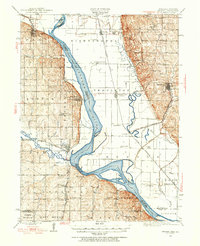
 1915 Nemaha1915 Print · USGSThe Missouri River borderlands between Nebraska and Missouri are captured here in the years before major flood control altered the channel. Genealogists can trace family roots through dozens of rural landmarks, including Mt Vernon Cemetery, Antioch Church, and the river landing at St Deroin.2 unique versions available
 - 1915 Map of Howe
 1915 Howe1915 Print · USGSSoutheast Nebraska’s agricultural heartland is documented here just before the First World War, centered on the growing rail hub of Auburn. Researchers can trace early rural life through dozens of named country schoolhouses like Grand Prairie School and local shipping points such as Borton Siding.2 unique versions available
 - 1916 Map of Humboldt
 1916 Humboldt1916 Print · USGSRichardson County was a landscape of river-valley farming and emerging drainage projects during the mid-1910s. Researchers can trace the development of rural education and transport through dozens of local landmarks like Windy Lonesome School, Miles Ranch, and the Missouri Pacific line.3 unique versions available
 - 1920 Map of Craig
 1920 Craig1920 Print · USGSThe Missouri River bottoms and neighboring bluffs come alive in this post-war survey of the Nebraska-Missouri border. Researchers can trace dozens of rural landmarks, from the streets of Rulo and Bigelow to scattered schoolhouses like Brush College School and Idlewild School.5 unique versions available
 - 1929 Map of Weeping Water
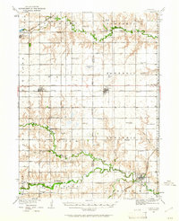
 1929 Weeping Water1929 Print · USGSEastern Nebraska's fertile prairie was a hub of railroad development and river-valley settlement at the start of the twentieth century. Researchers can trace the early layout of communities like Weeping Water, Syracuse, and Louisville along the Missouri Pacific R. R. and Platte River.
 - 1934 Map of Seward
 1934 Seward1934 Print · USGSSeward County at the height of the mid-thirties reveals a landscape of thriving river towns and essential rail connections. Genealogists and historians can trace numerous rural districts from School No 87 to the Old Soldiers and Sailors Home and Perry Mound Cem.
 - 1934 Map of Utica, 1961 Print
 1934 Utica1961 Print · USGSThe Seward County plains in the 1930s reveal a landscape of small towns and rural school districts connected by the Chicago and Northwestern. Trace family history at Prairie Grove Cem or locate forgotten sites like Midget Sch and the Flowing Well.2 unique versions available
 - 1935 Map of Dorchester
 1935 Dorchester1935 Print · USGSSaline County agricultural life is frozen in time during the mid-1930s, centered on the railroad town of Dorchester. Genealogists and historians can trace dozens of country school sites like Red Brick Sch and family-named landmarks like Gilbert Cem.
 - 1935 Map of Nehawka
 1935 Nehawka1935 Print · USGSThe Missouri River valley along the Nebraska-Iowa border appears here during the mid-1930s, showing a landscape defined by riverside bluffs and fertile bottomlands. Genealogists can trace family roots through numerous local landmarks, from Sargents Spur and Nehawka to rural schools like Ameck Sch and Eight Mile Grove Sch.2 unique versions available
 - 1937 Map of Utica
 1937 Utica1937 Print · USGSThe Seward County plains are captured in the mid-1930s, showing a landscape defined by rail lines and rural school districts. Genealogists can locate family landmarks like Prairie Grove Cem and numerous schools such as Rosemound Sch and Kinkaid Sch.2 unique versions available
 - 1939 Map of Seward
 1939 Seward1939 Print · USGSSeward County in the mid-1930s shows a thriving network of rail-side towns and rural school districts at the heart of the Nebraska plains. Genealogists and local historians can trace hundreds of farmstead locations and community anchors like Old Salem Cem, Evangelical Ch, and Goehner.3 unique versions available
 - 1939 Map of Hamburg
 1939 Hamburg1939 Print · USGSThe Missouri River lowlands at the triple-state border are captured here just before the mid-century. Genealogists can trace family footprints across a dense network of rural schoolhouses like Miller Sch and Star Sch, or locate the Stoner Cem and Lone Chapel.2 unique versions available
 - 1939 Map of Nemaha, 1954 Print
 1939 Nemaha1954 Print · USGSThe Missouri River floodplain and the bluffs of Nebraska and Missouri are captured here just before the mid-century. Researchers can trace the path of the Chicago Burlington and Quincy railroad and find vanished locations like St Deroin, Aspinwall, and McCandless Siding.
Showing maps 1-25 of 1,756
Top cities of Nebraska
- Omaha historical maps
- Lincoln historical maps
- Bellevue historical maps
- Grand Island historical maps
- Kearney historical maps
- Fremont historical maps
See more
Top counties of Nebraska
- Douglas County historical maps
- Lancaster County historical maps
- Sarpy County historical maps
- Hall County historical maps
- Buffalo County historical maps
- Dodge County historical maps
See more
Frequently asked questions
- What are the different types of historical maps available for Nebraska?
- What is the oldest map of Nebraska?
- Where can I purchase historical maps of Nebraska for my home or office?
- Where can I download high-res historical maps of Nebraska?
- Are there historical topographic maps available for Nebraska?
- Is there historical aerial imagery available for Nebraska?
- Where are historical maps of Nebraska sourced from?