Old Maps of Wheeler County, Nebraska for Academic Research
Study the evolution of Wheeler County with 108 high-resolution historic maps. Whether you're teaching, researching, or modeling changes in land use, these maps provide essential visual documentation of urban, environmental, and geographic change.
- Analyze long-term change: Track patterns in development, transportation, and natural features.
- Ideal for environmental or urban studies: Support academic projects with primary historical map data.
- Use in the classroom or lab: Educators and researchers rely on these maps to bring historical context to life.
These maps are a powerful tool for teaching, research, and visualizing how Wheeler County has changed over the decades.
Wheeler County, NE maps
(108)- 1954 Map of Gables SE, 1955 Print
 1954 Gables SE1955 Print · USGSThe Sandhills of Garfield and Wheeler counties are shown in the mid-1950s, revealing a landscape defined by ranching and small rural school districts. You can trace early 20th-century education sites like School No 10 and School No 10 (Abandoned) along the banks of Cedar Creek.2 unique versions available
 - 1954 Map of Ord NE, 1955 Print
 1954 Ord NE1955 Print · USGSThe rural Nebraska prairie in the mid-1950s was a landscape defined by small township school districts and essential water infrastructure. Researchers can trace the locations of historic schools like Plain Valley and Brick Sch or follow the paths of Elm Creek and Spring Creek.2 unique versions available
 - 1954 Map of Greeley NE, 1955 Print
 1954 Greeley NE1955 Print · USGSGreeley and Wheeler counties in the mid-1950s show a rural Nebraska landscape defined by river valleys and the early stages of the Missouri River Basin project. Genealogists can trace early rural life through Cedar Valley Ch, Belfast, and an Old Railroad Grade.3 unique versions available
 - 1954 Map of Greeley NW, 1955 Print
 1954 Greeley NW1955 Print · USGSGreeley and Wheeler counties are shown here in the mid-1950s, revealing a landscape of remote townships and rural schools. Genealogists and local historians can trace the foundations of these communities at Amity Cem, Fairdale Sch, and along the Old Railroad Grade.3 unique versions available
 - 1954 Map of Spalding, 1956 Print
 1954 Spalding1956 Print · USGSGreeley County and its neighbors in the mid-1950s show a landscape defined by the Union Pacific rail line and the Cedar River. Genealogists and local historians can trace a dozen numbered school sites and several family burial grounds, including Dublin Cem and Grand View Cem.3 unique versions available
 - 1954 Map of Bartlett NW, 1956 Print
 1954 Bartlett NW1956 Print · USGSWheeler County ranching country is captured here during the mid-fifties, showing a landscape defined by water and wind. Researchers can trace rural life through the Gritta Ridge Sch and dozens of individual Windmill sites across Buffalo Flats.2 unique versions available
 - 1954 Map of Spalding NW, 1956 Print
 1954 Spalding NW1956 Print · USGSGreeley and Wheeler counties are shown in the mid-1950s as the rural school system and river valleys defined local life. Genealogists can locate specific farmstead schoolhouses like Pritchard Sch and Troy Valley Sch along the Cedar River.5 unique versions available
 - 1954 Map of Bartlett SE, 1956 Print
 1954 Bartlett SE1956 Print · USGSWheeler County ranching country is captured here in the mid-fifties, showing a landscape shaped by scattered schoolhouses and small creek valleys. Researchers can locate the Pibel Cem and Pibel Lake Recreational Area, or trace the rural routes connecting Highway Sch and Four Corners Sch.2 unique versions available
 - 1954 Map of Bartlett, 1956 Print
 1954 Bartlett1956 Print · USGSWheeler County ranching and rural life are centered around Bartlett and the surrounding prairie in the mid-fifties. Genealogists and researchers can trace local school districts at Red Top Sch and Headquarters Sch or locate the Bartlett Cemetery north of the village.2 unique versions available
 - 1954 Map of Ericson, 1956 Print
 1954 Ericson1956 Print · USGSThe Cedar River valley and the village of Ericson are captured here in the mid-1950s, showing a landscape defined by water and ranching. Researchers can trace the locations of rural schoolhouses like School No 32 and the site of School No 42 (Abandoned).2 unique versions available
 - 1954 Map of Gables, 1958 Print
 1954 Gables1958 Print · USGSGarfield County ranching country and the small outpost of Gables are shown here during the mid-fifties. Genealogists and local historians can trace rural school districts like School No 9 and locate scattered Windmill sites along Cedar Creek.3 unique versions available
 - 1955 Map of Broken Bow
 1955 Broken Bow1955 Print · USGSCentral Nebraska in the mid-fifties is defined by the sweeping Sand Hills and the vital river valleys that supported its ranching and rail towns. Researchers can trace the rail corridors of the Union Pacific RR and locate settlements like Dannebrog, Broken Bow, and Brewster.5 unique versions available
 - 1955 Map of O'Neill, 1974 Print
 1955 O'Neill1974 Print · USGSNorth-central Nebraska in the 1950s reveals a vast cattle-ranching landscape transitioning from the Missouri River breaks to the iconic Sand Hills. Researchers can trace the path of the Chicago and North Western rail line and locate rural landmarks like the Dustin Post Office and St Johns Lake Ch.2 unique versions available
 - 1956 Map of Broken Bow
 1956 Broken Bow1956 Print · USGSCentral Nebraska during the mid-fifties reveals a region defined by its river-valley railroads and the rolling Sand Hills. Genealogists and local historians can trace the paths of the Chicago Burlington and Quincy through towns like Broken Bow, Merna, and Anselmo.
 - 1959 Map of O'Neill
 1959 O'Neill1959 Print · USGSNorth-central Nebraska in the late fifties is defined by the vast Sand Hills and the vital Chicago and North Western rail line. Genealogists and researchers can trace family roots through settlements like Atkinson, Bassett, and Stuart or follow the waters of the Niobrara River.2 unique versions available
 - 1960 Map of Spalding 2 SW, 1961 Print
 1960 Spalding 2 SW1961 Print · USGSWheeler County ranching country is shown at the start of the sixties, documenting a landscape of rolling sandhills and section-line roads. Genealogists and local historians can pinpoint rural school sites like School No 20 and School No 24 near the path of Mud Creek.3 unique versions available
 - 1960 Map of Spalding 2 NW, 1961 Print
 1960 Spalding 2 NW1961 Print · USGSWheeler County ranching culture comes into focus at the dawn of the sixties, where life centered on the water of Beaver Creek. Researchers can trace old family holdings like Stokes Ranch and locate the rural Wayside Sch.3 unique versions available
 - 1960 Map of Spalding 2 NE, 1962 Print
 1960 Spalding 2 NE1962 Print · USGSThe rural borderlands of Wheeler and Antelope counties appear here as they were in the early 1960s, prior to widespread school consolidation. Genealogists can trace early landmarks like Park Ch and several district schools, such as Sunnyside Sch and School No 27.3 unique versions available
 - 1960 Map of Spalding 2 SE, 1962 Print
 1960 Spalding 2 SE1962 Print · USGSWheeler and Boone counties in the early sixties reveal a landscape of dispersed ranching townships and rural school districts. Genealogists and local historians can trace the locations of School No 39, School No 19, and the small Cem near the banks of Mud Creek.3 unique versions available
 - 1963 Map of Deloit, 1964 Print
 1963 Deloit1964 Print · USGSAgricultural life in the early sixties centers on the rural township of Deloit. Researchers can trace the network of country schoolhouses like School No 60, find family landmarks at Knievels Corner, or locate the Wolf Cem.2 unique versions available
 - 1963 Map of Deloit SW, 1964 Print
 1963 Deloit SW1964 Print · USGSWheeler and Holt counties appear here in the early sixties as a landscape of remote ranching and rural township life. Genealogists and local historians can locate St Anthonys Cem, the remote School No 146, and the winding course of Clearwater Creek.2 unique versions available
 - 1969 Map of O'Neill
 1969 O'Neill1969 Print · USGSCentral Nebraska in the mid-fifties is defined here by the expansive Sand Hills and the winding Niobrara River. Trace the Chicago and North Western rail line through cattle towns like O'Neill and Ainsworth.
 - 1981 Map of Goose Lake SW
 1981 Goose Lake SW1981 Print · USGSThe Nebraska Sandhills come into focus in the early eighties at the boundary of Holt and Wheeler counties. Genealogists can locate Farmers Hill Cem, Conley Cem, and the old District 115 Sch among the artesian wells of Cache Creek.2 unique versions available
 - 1981 Map of Goose Lake, 1982 Print
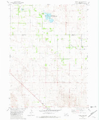 1981 Goose Lake1982 Print · USGSThe Nebraska Sandhills come alive in the early eighties as this survey documents the rural boundary of Holt and Wheeler Counties. Genealogists and outdoorsmen can trace remote landmarks like the Corning Sch, the settlement of Hoerle, and the Goose Lake State Wildlife Area.2 unique versions available
 - 1981 Map of Miles Ranch, 1982 Print
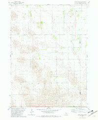 1981 Miles Ranch1982 Print · USGSGarfield and Wheeler counties are captured in the early eighties as a world of expansive ranching operations and isolated prairie outposts. Genealogists and historians can trace family landholdings like Miles Ranch, Schmidt Ranch, and the small settlement of Dumas.2 unique versions available
Showing maps 1-25 of 108
Top cities of Wheeler County
Frequently asked questions
- What are the different types of historical maps available for Wheeler County?
- What is the oldest map of Wheeler County?
- Where can I purchase historical maps of Wheeler County for my home or office?
- Where can I download high-res historical maps of Wheeler County?
- Are there historical topographic maps available for Wheeler County?
- Is there historical aerial imagery available for Wheeler County?
- Where are historical maps of Wheeler County sourced from?