1950s Maps of Nevada
Explore 804 historic maps of Nevada from the 1950s. These maps offer a rare glimpse into what life looked like during the 1950s — showing old roads, neighborhoods, homes, and landmarks that have changed or disappeared over time.
Whether you're researching your family's past, planning a metal detecting trip, or studying how Nevada's landscape evolved across the 1950s, these high-resolution maps are a powerful tool for exploring the history of this region.
- Focus on a specific era: All maps on this page are from the 1950s, giving you a focused view of this time period.
- See what’s changed: Compare century-old streets, trails, and buildings to today's modern landscape using overlays and satellite layers.
- Research with precision: Use these maps for genealogy, historical research, land use analysis, or educational projects.
- View, download, or print: Maps are fully viewable online in high resolution, and can be downloaded or printed for your own records.
Start exploring Nevada's history through authentic maps from the 1950s. This is your window into the past.
Nevada maps
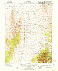
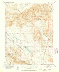
- 1950 Map of Mt. Lewis
 1950 Mt. Lewis1950 Print · USGSLander County mining history is preserved here in the mid-twentieth century, centered on the high peaks of the Shoshone Range. Genealogists and researchers can trace old ranching boundaries at Home Ranch or locate historic mineral sites like the Betty O'Neal Mine and Utah Mine Camp.
 - 1950 Map of Paradise Peak
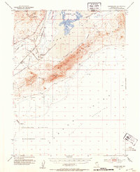
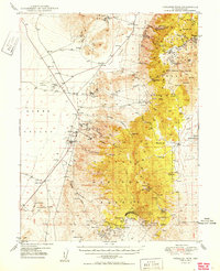 1950 Paradise Peak1950 Print · USGSMid-century mining operations dominate this Nye County landscape as industrial magnesite and tungsten extraction centers around Brucite. Local historians can trace the foundations of Downeyville or the active Illinois Mine and Paradise Mine.
 - 1950 Map of Wheeler Peak
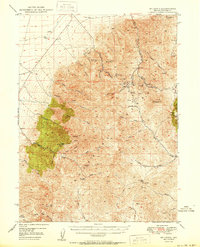
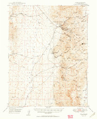
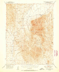
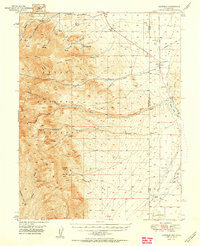
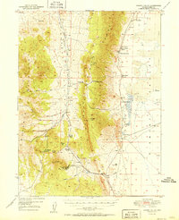
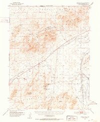
 1950 Wheeler Peak1950 Print · USGSEastern Nevada's high-mountain terrain and valley floors come into focus during the late 1940s, showing a landscape shaped by mining and ranching. Genealogists and historians can trace family-held sites like Kirkeby Ranch, find the Shoshone PO Swallow Ranch, and locate various extraction sites including the Everett Mines.2 unique versions available
 - 1950 Map of Treasure Hill
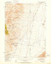
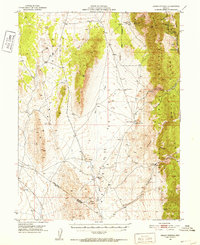
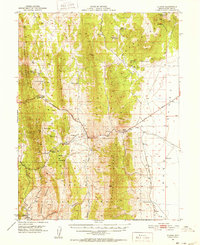
 1950 Treasure Hill1950 Print · USGSThe White Pine mining district is captured here at mid-century, revealing the legacy of Nevada's silver boom. Genealogists and historians can trace the foundations of Eberhardt (Site), the Treasure Cem, and various tunnels like the Icehouse Tunnel.2 unique versions available
 - 1950 Map of Ione
 1950 Ione1950 Print · USGSThe Toiyabe Range in the early post-war years reveals a landscape of high-altitude mining claims and remote Nevada ranches. Genealogists and historians can trace the foundations of Ione and Berlin, or locate the Kohinoor Mine and Milton Ranch.2 unique versions available
 - 1950 Map of Crescent Valley
 1950 Crescent Valley1950 Print · USGSCrescent Valley at the mid-century reveals a landscape of active gold mining and earlier silver-era relics. Researchers can trace the lineage of local mining at the Gold Acres Mine or locate the historic town of Tenabo and the Lander (Site).2 unique versions available
 - 1950 Map of Chilcoot, 1952 Print
 1950 Chilcoot1952 Print · USGSThe high Sierra gateway at Beckwourth Pass is documented here at mid-century as the railroad and highway networks expanded. Researchers can trace the routes of the Western Pacific and locate local landmarks like Summit Sch and Hallelujah Junction.5 unique versions available
 - 1950 Map of Stillwater, 1952 Print
 1950 Stillwater1952 Print · USGSMid-century Churchill County is defined here by the intricate irrigation of the Fallon Indian Reservation and the sprawling wetlands of the Stillwater Wildlife Management Area. You can trace rural life at Leter Ranch or the Stillwater School while locating lost landmarks like Wolf Dam and the Canvasback Gun Club.4 unique versions available
 - 1950 Map of Virginia City, 1955 Print
 1950 Virginia City1955 Print · USGSVirginia City and the Comstock mining corridor are seen here at mid-century, amidst a dense concentration of historic shafts and early settlement sites. Researchers can trace the legacy of silver mining through Gold Hill, the Utah Shaft, and several cemeteries that overlook the mountain ranges.3 unique versions available
 - 1950 Map of Davis Dam, 1955 Print
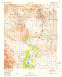 1950 Davis Dam1955 Print · USGSThe Colorado River corridor was undergoing a massive transformation in the early fifties as the newly completed Davis Dam began reshaping the tri-state border. Researchers can trace vanished river landings and frontier outposts such as the Hardyville Site, Mohave City, and the Fort Mohave Ruins.2 unique versions available
 - 1950 Map of Mt. Rose, 1956 Print
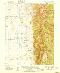
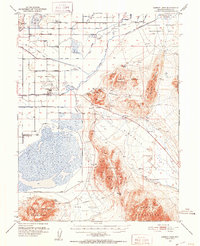
 1950 Mt. Rose1956 Print · USGSMid-century Nevada comes into focus as the Reno area expands south toward the Washoe Valley and the high peaks of the Toiyabe National Forest. Genealogists and historians can trace old homesteads near Franktown, the Ophir Mill Site, and the grounds of the Bowers Mansion.3 unique versions available
 - 1950 Map of Reno, 1957 Print
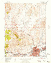 1950 Reno1957 Print · USGSMid-century Reno and Sparks appear here alongside the vital irrigation networks that sustained the Truckee Meadows. Researchers can trace the development of older neighborhoods and outlying sites like Poeville (Site), the Reno Fair Grounds, and Skyline Airfield.3 unique versions available
 - 1951 Map of Roberts Creek Mtn
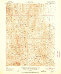
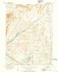
 1951 Roberts Creek Mtn1951 Print · USGSIn the early fifties, the remote ranching country of Eureka County was a land of high peaks and vital water holes. Researchers can trace the heritage of local landholdings at Indian Ranch and Roberts Creek Ranch or find mineral history near the Prospect by Jackass Creek.2 unique versions available
 - 1951 Map of Reno
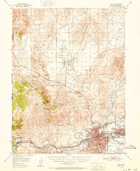 1951 Reno1951 Print · USGSMid-century Nevada comes into focus as Reno and Sparks expand along the Truckee River and transcontinental rail lines. Trace family history and local industry through features like Mtnview Cem, the Golden Fleece Mine, and early aviation at Skyline Airfield.2 unique versions available
 - 1951 Map of Garrison
 1951 Garrison1951 Print · USGSThe Nevada-Utah borderlands are captured here in the early fifties, where the high peaks of the Snake Range descend into the ranching country of Snake Valley. Researchers can trace early family landholdings at Davies Ranch and Dearden Ranch, or locate the Burbank Cem near the state line.2 unique versions available
 - 1951 Map of Garden Valley
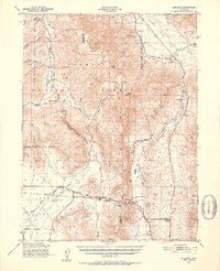
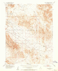
 1951 Garden Valley1951 Print · USGSCentral Nevada's high desert ranching and mining life are documented here during the mid-century. Researchers can trace ancestral property lines and mineral ventures at Siri Ranch, the Diamond Valley School, and the Mt Hope Mine.2 unique versions available
 - 1951 Map of Green Springs, 1952 Print
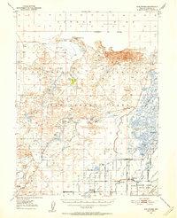
 1951 Green Springs1952 Print · USGSWhite Pine County mining and ranching are recorded here in the early fifties. Local historians can trace old silver operations like the Ne Plus Ultra Mine or locate sites such as Shermantown and the Bull Creek Ranch.4 unique versions available
 - 1951 Map of Illipah, 1952 Print
 1951 Illipah1952 Print · USGSIn the early 1950s, this area of White Pine County centered on the intersection of ranching life and the early auto age. Genealogists and historians can trace the Lincoln Highway through the Illipah (Moorman Ranch) and explore the site of Hamilton (Historic Ruins).4 unique versions available
 - 1951 Map of Pancake Summit, 1952 Print
 1951 Pancake Summit1952 Print · USGSWhite Pine County's high-altitude mining and transit corridors are captured here in the early fifties as they existed before modern bypasses. Researchers can trace the Hamilton-Elko Stage Line and explore mining operations like the Belmont Mill and Seligman Mine.3 unique versions available
 - 1951 Map of Carson Lake, 1953 Print
 1951 Carson Lake1953 Print · USGSChurchill County in the early fifties shows a transition from high-desert flats to complex irrigation projects and military installations. Genealogists and historians can trace the Harmon School, Fallen Cem, and several named archaeological sites like Hidden Cave.3 unique versions available
 - 1951 Map of Allen Springs, 1953 Print
 1951 Allen Springs1953 Print · USGSChurchill and Mineral counties at the start of the 1950s reveal a landscape of mining claims and remote outposts. Researchers can trace early mineral works at Pyramid Mine and locate ephemeral desert water at Allen Springs or Lee Hot Springs.3 unique versions available
 - 1951 Map of Soda Lake, 1953 Print
 1951 Soda Lake1953 Print · USGSThe Nevada desert in the early fifties reveals a critical junction of pioneer trails and mid-century rail infrastructure near the Carson Sink. Researchers can trace the Old California Trail past the Ragtown (Site) and through the volcanic craters of Soda Lake.3 unique versions available
 - 1951 Map of Weber Reservoir, 1953 Print
 1951 Weber Reservoir1953 Print · USGSLyon and Churchill Counties appear in the early fifties as a landscape of essential water management and mountain transit. Researchers can trace the Southern Pacific rail line, mining prospects in the Terrill Mts, and the construction of the Weber Dam.5 unique versions available
 - 1951 Map of Carson Sink, 1953 Print
 1951 Carson Sink1953 Print · USGSThe high desert of Churchill County is captured here in the early fifties, documenting a landscape of ancient caves and historic migration routes. Trace the paths of the Old California Trail Road and the St Anthony Mine near the vast Humboldt Lake.4 unique versions available
 - 1951 Map of Desert Peak, 1953 Print
 1951 Desert Peak1953 Print · USGSThe Nevada desert in the early fifties reveals a landscape shaped by both pioneer migration and the search for minerals. Researchers can trace the Old California Trail and locate several active workings like the Mule Train Mines and Jessup.3 unique versions available
Showing maps 1-25
Top cities of Nevada
- Las Vegas historical maps
- Henderson historical maps
- Reno historical maps
- North Las Vegas historical maps
- Enterprise historical maps
- Spring Valley historical maps
See more
Top counties of Nevada
- Clark County historical maps
- Washoe County historical maps
- Carson City historical maps
- Lyon County historical maps
- Elko County historical maps
- Douglas County historical maps
See more
Frequently asked questions
- What are the different types of historical maps available for Nevada?
- What is the oldest map of Nevada?
- Where can I purchase historical maps of Nevada for my home or office?
- Where can I download high-res historical maps of Nevada?
- Are there historical topographic maps available for Nevada?
- Is there historical aerial imagery available for Nevada?
- Where are historical maps of Nevada sourced from?