
Historical Maps of Doña Ana County, New Mexico
What stories do these 264 old maps tell about Doña Ana County's past? From 1891 to present day, these maps reveal the evolution of streets, neighborhoods, iconic landmarks, and natural features in stunning high-res detail. Whether you're a history enthusiast, genealogist, or professional in education, environmental work, or architecture, these maps are perfect for exploration, research, and discovery.
Discover Doña Ana County's history through maps:
- Trace Doña Ana County's growth: Explore earlier and latest maps and editions to uncover how the region changed over time.
- Examine technical details: Each map includes its creators, publishers, scale, dimensions, and full source information.
- Layer maps with modern tools & imagery: Compare historical maps to modern-day with high-resolution satellite imagery and detailed LiDAR layers.
- Sourced from trusted archives: Carefully preserved and digitized by institutions like the United Stated Geological Survey and the US Library of Congress.
- Access in any format: View and explore in high resolution, download for offline use, or order a museum-quality print for yourself or a loved one.
Begin your journey into Doña Ana County's history with these remarkable must-see maps.
Doña Ana County, NM maps
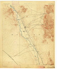
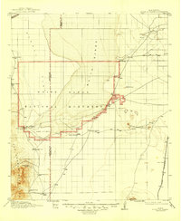
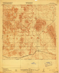
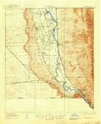
(264)- 1891 Map of Las Cruces
 1891 Las Cruces1891 Print · USGSCovers Doña Ana County, including El Paso, Las Cruces, and other nearby areas
 - 1893 Map of Las Cruces
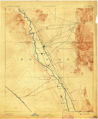
 1893 Las Cruces1893 Print · USGSCovers Doña Ana County, including El Paso, Las Cruces, and other nearby areas
 - 1893 Map of Las Cruces, 1900 Print
 1893 Las Cruces1900 Print · USGSCovers Doña Ana County, including El Paso, Las Cruces, and other nearby areas
 - 1893 Map of Las Cruces, 1908 Print
 1893 Las Cruces1908 Print · USGSCovers Doña Ana County, including El Paso, Las Cruces, and other nearby areas
 - 1893 Map of Las Cruces, 1911 Print
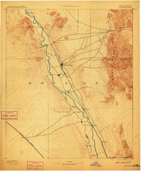 1893 Las Cruces1911 Print · USGSCovers Doña Ana County, including El Paso, Las Cruces, and other nearby areas
 - 1916 Map of Tonuco
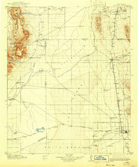
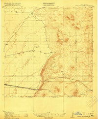
 1916 Tonuco1916 Print · USGSCovers Doña Ana County, including Tonuco, Radium Springs, and other nearby areas
 - 1916 Map of Tularosa
 1916 Tularosa1916 Print · USGSCovers Doña Ana County, including Tularosa, Salinas, and other nearby areas
 - 1916 Map of Point Of Sands
 1916 Point Of Sands1916 Print · USGSCovers Doña Ana County, including Alamogordo, Boles Acres, and other nearby areas
 - 1916 Map of Tularosa, 1943 Print
 1916 Tularosa1943 Print · USGSCovers Doña Ana County, including Tularosa, Salinas, and other nearby areas
 - 1916 Map of Point Of Sands, 1946 Print
 1916 Point Of Sands1946 Print · USGSCovers Doña Ana County, including Alamogordo, Boles Acres, and other nearby areas
 - 1917 Map of Camel Mountain
 1917 Camel Mountain1917 Print · USGSCovers Doña Ana County, including Malpais, Arena, and other nearby areas
 - 1917 Map of Camel Mountain, 1947 Print
 1917 Camel Mountain1947 Print · USGSCovers Doña Ana County, including Malpais, Arena, and other nearby areas
 - 1917 Map of Canutillo, 1957 Print
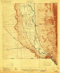
 1917 Canutillo1957 Print · USGSCovers Doña Ana County, including El Paso, Sunland Park, and other nearby areas
 - 1917 Map of Noria, 1963 Print
 1917 Noria1963 Print · USGSCovers Doña Ana County, including Noria, Potrillo, and other nearby areas
 - 1917 Map of Mt. Riley, 1974 Print
 1917 Mt. Riley1974 Print · USGSCovers Doña Ana County, including Ascensión, United States, and other nearby areas
 - 1918 Map of Mt. Riley
 1918 Mt. Riley1918 Print · USGSCovers Doña Ana County, including Ascensión, United States, and other nearby areas
 - 1918 Map of Noria
 1918 Noria1918 Print · USGSCovers Doña Ana County, including Noria, Potrillo, and other nearby areas
 - 1918 Map of Mt. Riley, 1929 Print
 1918 Mt. Riley1929 Print · USGSCovers Doña Ana County, including Ascensión, United States, and other nearby areas
 - 1918 Map of Noria, 1931 Print
 1918 Noria1931 Print · USGSCovers Doña Ana County, including Noria, Potrillo, and other nearby areas
 - 1919 Map of Canutillo
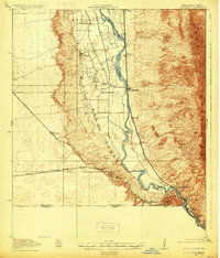
 1919 Canutillo1919 Print · USGSCovers Doña Ana County, including El Paso, Sunland Park, and other nearby areas
 - 1919 Map of Canutillo, 1930 Print
 1919 Canutillo1930 Print · USGSCovers Doña Ana County, including El Paso, Sunland Park, and other nearby areas
 - 1919 Map of Canutillo, 1946 Print
 1919 Canutillo1946 Print · USGSCovers Doña Ana County, including El Paso, Sunland Park, and other nearby areas
 - 1929 Map of Mt. Riley, 1942 Print
 1929 Mt. Riley1942 Print · USGSCovers Doña Ana County, including Ascensión, United States, and other nearby areas
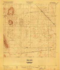
 - 1932 Map of Tonuco
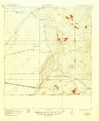
 1932 Tonuco1932 Print · USGSCovers Doña Ana County, including Tonuco, Radium Springs, and other nearby areas
 - 1940 Map of Newman, 1965 Print
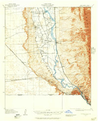
 1940 Newman1965 Print · USGSCovers Doña Ana County, including El Paso, Chaparral, and other nearby areas
Showing maps 1-25 of 264
Top cities in Doña Ana County
- Las Cruces historical maps
- Sunland Park historical maps
- Chaparral historical maps
- Anthony, NM historical maps
- Santa Teresa historical maps
- Mesilla historical maps
See more
Frequently asked questions
- What are the different types of historical maps available for Doña Ana County?
- What is the oldest map of Doña Ana County?
- Where can I purchase historical maps of Doña Ana County for my home or office?
- Where can I download high-res historical maps of Doña Ana County?
- Are there historical topographic maps available for Doña Ana County?
- Is there historical aerial imagery available for Doña Ana County?
- Where are historical maps of Doña Ana County sourced from?