1900s (20th Century) Maps of Hyde County, North Carolina
Explore 44 historic maps of Hyde County from the 1900s (20th Century). These maps offer a rare glimpse into what life looked like during the 1900s — showing old roads, neighborhoods, homes, and landmarks that have changed or disappeared over time.
Whether you're researching your family's past, planning a metal detecting trip, or studying how Hyde County's landscape evolved across the 1900s, these high-resolution maps are a powerful tool for exploring the history of this region.
- Focus on a specific era: All maps on this page are from the 1900s, giving you a focused view of this time period.
- See what’s changed: Compare century-old streets, trails, and buildings to today's modern landscape using overlays and satellite layers.
- Research with precision: Use these maps for genealogy, historical research, land use analysis, or educational projects.
- View, download, or print: Maps are fully viewable online in high resolution, and can be downloaded or printed for your own records.
Start exploring Hyde County's history through authentic maps from the 1900s. This is your window into the past.
Hyde County, NC maps
(44)- 1914 Map of Belhaven
 1914 Belhaven1914 Print · USGSIn the decade before the Great War, the North Carolina coast was a landscape of timber trams and swamp landings. Researchers can trace the John L. Roper Lumber Co. Tram and locate family landmarks like Morrisons Store and Lower Pungo School.
 - 1916 Map of Belhaven
 1916 Belhaven1916 Print · USGSCoastal Beaufort County comes to life in the years before World War I, when the Pungo River landings were essential hubs. Genealogists can trace family roots through rural schools like Haslin School and rail stops like Bishops Cross or Pungo P.O.3 unique versions available
 - 1943 Map of Columbia
 1943 Columbia1943 Print · USGSCoastal Tyrrell and Hyde Counties are captured in the early 1940s, showing a landscape defined by timber industry and federal land projects. Researchers can trace the industrial docks at the Richmond Cedar Works Lumber Mill or locate the rural Scuppernong Farms (F.S.A.).
 - 1943 Map of Plymouth
 1943 Plymouth1943 Print · USGSThe coastal plains and swamps of eastern North Carolina are captured here during the wartime era, showing a landscape defined by river navigation and drainage canals. Genealogists can trace family roots through rural landmarks like Ellis Store, St Lukes Ch, and small rail stops such as Acre Sta.
 - 1943 Map of Roanoke Island
 1943 Roanoke Island1943 Print · USGSCoastal North Carolina during the war years shows a network of maritime outposts and isolated mainland settlements connected by ferry. Trace the old village of Buffalo City, locate the Bodie Island Lighthouse, and find historic Coast Guard stations at Nags Head and Chicamacomico CG.
 - 1948 Map of Portsmouth, 1976 Print
 1948 Portsmouth1976 Print · USGSThe Outer Banks at Portsmouth Island are captured here during the mid-1940s, showing a remote maritime community before modern coastal changes. Trace the docks at Portsmouth, find navigation aids like Shell Castle, and locate the ferry routes that linked these isolated shoals.2 unique versions available
 - 1948 Map of Ocracoke, 1984 Print
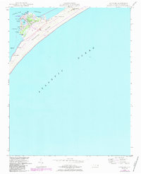 1948 Ocracoke1984 Print · USGSThe outer banks of North Carolina are captured here just as the national seashore was being established after the war. You can trace the village of Ocracoke around the harbor at Silver Lake, locating the Ocracoke Light and the nearby Coast Guard Sta.2 unique versions available
 - 1950 Map of Howard Reef
 1950 Howard Reef1950 Print · USGSThe Outer Banks during the late 1940s reveals a sparse, windswept landscape of barrier islands and sound-side camps. Genealogists and coastal historians can trace early footprints at Cass Williams Camp, Parkers Hill, and along the lone Telephone Line.3 unique versions available
 - 1950 Map of Portsmouth
 1950 Portsmouth1950 Print · USGSThe Outer Banks village of Portsmouth is captured at mid-century, before it was completely vacated. Genealogists and maritime historians can trace the foundations of this island community and landmarks like Shell Castle, The High Hills, and Beacon Island.2 unique versions available
 - 1950 Map of Green Island
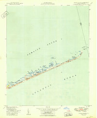 1950 Green Island1950 Print · USGSOcracoke Island and the Outer Banks are captured mid-century, showing a landscape defined by shifting sands and maritime service. Trace the isolation of the Hatteras Inlet Coast Guard Sta and local camps like the Old Green Island Club.3 unique versions available
 - 1950 Map of Lowland, 1952 Print
 1950 Lowland1952 Print · USGSThe remote marshlands of Pamlico County are captured here in the mid-century, centered on the isolated community of Lowland. Researchers can trace old family roots at Watson Cem and locate historic rural congregations such as Antioch Ch and Shiloh Ch.4 unique versions available
 - 1951 Map of Middletown Anchorage, 1952 Print
 1951 Middletown Anchorage1952 Print · USGSCoastal Hyde County is captured here in the early fifties, documenting the shifting interface of water and land along the Pamlico Sound. Historians can trace maritime navigation markers and local drainages like Middletown Creek, Back Creek, and Gibbs Shoal.2 unique versions available
 - 1951 Map of Bluff Point, 1952 Print
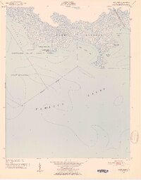 1951 Bluff Point1952 Print · USGSThe Hyde County coast in the early fifties is captured here as a labyrinth of marshes and tidal bays. Researchers can trace the original boundaries of the Swanquarter National Wildlife Refuge and locate points like Bluff Point and Cunning Harbor Island.2 unique versions available
 - 1951 Map of Middletown, 1952 Print
 1951 Middletown1952 Print · USGSCoastal Hyde County in the early fifties is captured here as a landscape of canals, levees, and waterfront hamlets along the sound. Researchers can locate small communities like Lake Landing, Gulrock, and Nebraska, and trace the shoreline around Wysocking Bay.2 unique versions available
 - 1951 Map of Pamlico Point, 1952 Print
 1951 Pamlico Point1952 Print · USGSThe Hyde County coast and the waters of Pamlico Sound meet in this early 1950s survey of the marshlands. Trace the intricate shoreline of the Swanquarter National Wildlife Refuge and locate family-named features like Voliva Cove and Yaupon Hammock Point.
 - 1951 Map of Great Island, 1952 Print
 1951 Great Island1952 Print · USGSCoastal Hyde County in the early fifties is mapped here at the edge of the Pamlico Sound. Maritime historians can trace navigational hazards and landmarks across the Swanquarter National Wildlife Refuge, Judith Island, and Great Island.2 unique versions available
 - 1951 Map of Pamlico Beach, 1953 Print
 1951 Pamlico Beach1953 Print · USGSThe Pungo and Pamlico Rivers meet in this early 1950s coastal survey, revealing a landscape of tide-water guts and isolated fishing villages. Researchers can trace family roots in Makleyville or Pamlico Beach and locate landmarks like St Mahala Chapel and Schoolhouse Landing.2 unique versions available
 - 1951 Map of Engelhard West, 1953 Print
 1951 Engelhard West1953 Print · USGSHyde County's coastal wetlands and reclaimed lands are captured here in the early fifties, centered on the northern reaches of Lake Mattamuskeet. Researchers can trace the drainage network of the Jarvis Canal or locate local sites like Pleasant Grove Ch and the Fulford Cem.4 unique versions available
 - 1951 Map of Belhaven, 1953 Print
 1951 Belhaven1953 Print · USGSThe coastal port of Belhaven and the surrounding marshes are shown in detail during the early fifties. Genealogists and historians can trace old family sites at Hoophole Landing, Haslin Corner, and Leechville, or follow the Norfolk Southern rail line to the water's edge.4 unique versions available
 - 1951 Map of Scranton, 1953 Print
 1951 Scranton1953 Print · USGSHyde County's coastal reaches are documented here in the early fifties, showing a landscape defined by the Pamlico River and vast marshlands. Genealogists can locate family landmarks like Weeping Mary Ch, the County Training Sch, and the small settlement of Sladesville.2 unique versions available
 - 1951 Map of New Holland, 1953 Print
 1951 New Holland1953 Print · USGSCoastal Hyde County in the early fifties shows a landscape defined by large-scale drainage canals and wildlife conservation. Researchers can trace family sites like Donald Farm Cem, find the New Holland Sch, and locate Old Richmond Ch.2 unique versions available
 - 1951 Map of Swanquarter, 1953 Print
 1951 Swanquarter1953 Print · USGSCoastal Hyde County is captured here in the early fifties, showing the intricate balance of canal-drained farmland and protected marshes. Genealogists can locate family landmarks such as Jobs Chapel, Swindell Fork, and the Rose Bay School.2 unique versions available
 - 1951 Map of Long Shoal Point, 1953 Print
 1951 Long Shoal Point1953 Print · USGSThe Outer Banks coastline near the Hyde and Dare county line is captured in the early 1950s, showing a landscape defined by water and wetlands. Genealogists and maritime historians can trace coastal landmarks like the Lookout Tower, Pains Point, and Rawls Island.2 unique versions available
 - 1951 Map of Engelhard East, 1953 Print
 1951 Engelhard East1953 Print · USGSThe coastal village of Engelhard stands at the edge of the sound during the early 1950s, surrounded by a complex network of marshes and tidal creeks. Researchers can trace the maritime geography of Berrys Bay and family-named landmarks like Pingleton Point and Gibbs Point.4 unique versions available
 - 1951 Map of Fairfield, 1953 Print
 1951 Fairfield1953 Print · USGSHyde County’s unique intersection of coastal wetlands and reclaimed farmland is captured here in the early fifties. Genealogists and local historians can locate rural landmarks like Star Zion Zion Ch, the settlement at Carmur, and the infrastructure of the Intracoastal Waterway.4 unique versions available
Showing maps 1-25 of 44
Top cities of Hyde County
Frequently asked questions
- What are the different types of historical maps available for Hyde County?
- What is the oldest map of Hyde County?
- Where can I purchase historical maps of Hyde County for my home or office?
- Where can I download high-res historical maps of Hyde County?
- Are there historical topographic maps available for Hyde County?
- Is there historical aerial imagery available for Hyde County?
- Where are historical maps of Hyde County sourced from?