Old Maps of Divide County, North Dakota for Genealogy
Trace your family roots with 189 historic maps of Divide County. These high-res maps reveal old neighborhoods, homesites, landmarks, and streets — helping you uncover where your ancestors lived and how the area evolved over time.
- Explore historic neighborhoods: Identify where your relatives may have lived in the 1800s or 1900s.
- Compare maps over time: Trace the changes in streets, buildings, and landmarks for multi-generational research.
- Perfect for genealogy & ancestry research: Used by family historians and researchers to map out lineage and migration.
These maps are an incredible resource for exploring your personal connection to Divide County's past.
Divide County, ND maps
(189)- 1947 Map of Noonan, 1963 Print
 1947 Noonan1963 Print · USGSThe North Dakota borderlands come alive in the late 1940s, showing a prairie landscape shaped by coal mining and competing rail lines. Genealogists and historians can trace local farm life through several rural schools and the neighboring settlements of Noonan and Kermit.2 unique versions available
 - 1948 Map of Smoky Butte
 1948 Smoky Butte1948 Print · USGSDivide County is captured here in the late 1940s, showing a prairie landscape of isolated farmsteads and rural schoolhouses. Genealogists can locate family landmarks like the Herman Cem or trace local history through Roseville No 2 Sch and Musta Lake.
 - 1948 Map of Alamo N.E.
 1948 Alamo N.E.1948 Print · USGSNorthwestern North Dakota is captured here just after the war, showing a landscape of prairie potholes and township sections. Genealogists can locate the East Opdal Cem (Old), Liberty Sch, and the Great Northern rail line.
 - 1948 Map of Crosby SW
 1948 Crosby SW1948 Print · USGSDivide County in the late 1940s shows a landscape of distributed farmsteads and rural townships before the era of school consolidation. Genealogists can trace local landmarks like Bethlehem Ch, the Town Hall, and several schoolhouses including Lexington Sch.2 unique versions available
 - 1948 Map of Ambrose
 1948 Ambrose1948 Print · USGSThe northern border of Divide County comes into focus in the years after the war, where the Minneapolis St Paul and Sault Ste Marie railroad serves the prairie town of Ambrose. Trace local roots at Emmanuel Ch and identify early district schoolhouses like School No 1.3 unique versions available
 - 1948 Map of Stady
 1948 Stady1948 Print · USGSDivide County farming life in the late forties is recorded here, where isolated schoolhouses and country churches formed the backbone of the community. Genealogists can locate family landmarks like Stady, Rudser Ch, and Elmgren No. 3 Sch.
 - 1948 Map of Bright Water Lake
 1948 Bright Water Lake1948 Print · USGSDivide County farming country is documented here just after the war, showing the precise grid of North Dakota's rural townships. Genealogists can locate specific homestead sites near Skabo Ch and several local schools like Outlook No 1 Sch.
 - 1948 Map of Crosby
 1948 Crosby1948 Print · USGSDivide County sits at the international border in the late 1940s, anchored by the rail hub at Crosby. Researchers can trace the dual rail lines of the Great Northern and the Soo Line, alongside family-history landmarks like St Patricks Cem and rural schools.2 unique versions available
 - 1948 Map of Crosby SE
 1948 Crosby SE1948 Print · USGSDivide County townships are captured here in the late 1940s, showing the early post-war prairie landscape of northwestern North Dakota. Genealogists and local historians can locate community landmarks such as Town Hall, Hawkeye Sch, and McCullough Sch.
 - 1949 Map of Columbus SW
 1949 Columbus SW1949 Print · USGSNorthwestern North Dakota's coal and farming country is captured here in the late forties, detailing a landscape of dispersed prairie homesteads. Genealogists can locate family landmarks like South St Olaf Ch, School No 2, and the Prairie Chapel Cem.3 unique versions available
 - 1949 Map of Paulson
 1949 Paulson1949 Print · USGSThe northern prairie of Divide County meets the international boundary in the late 1940s, revealing a landscape of remote farmsteads and rail sidings. Genealogy researchers can locate the Town Hall, Bounty Sch, and the rail junction at Paulson.
 - 1949 Map of Atcoal
 1949 Atcoal1949 Print · USGSNorth Dakota's northern coal country is captured here shortly after the war, showing the industrial landscape along the international border. Genealogists and industrial historians can trace early mining operations at the Strip Mine and find rural landmarks like Strange Siding and School No 4.2 unique versions available
 - 1949 Map of Noonan SW
 1949 Noonan SW1949 Print · USGSDivide County was a landscape of small rural school districts and prairie parishes shortly after the war. Researchers can trace the exact locations of local landmarks like Blooming Prairie Ch and schools like Bluffton No 2 Sch and McCullough No 2 Sch.2 unique versions available
 - 1949 Map of Noonan SE
 1949 Noonan SE1949 Print · USGSDivide County, North Dakota, was a landscape of lignite mining and remote prairie schoolhouses at the end of the 1940s. Trace the rural roots of local families at Bluffton Sch No 1, Highland Sch No 1, and the Zion Ch.
 - 1949 Map of Noonan
 1949 Noonan1949 Print · USGSNoonan and the northern Divide County borderlands are captured here in the late 1940s, showing a landscape defined by mining and rail. Local researchers can trace the early industrial footprint of the Coal Field and Strip Mine near Kermit and Bluffton.
 - 1950 Map of Crosby
 1950 Crosby1950 Print · USGSDivide County sits at the intersection of the Canadian and Montana borders in the mid-century, defined by a vast grid of prairie townships and rail lines. Genealogists can trace rural life through numerous country schools like Hawkeye Sch and Roseville Sch, or local landmarks like Ambrose Cem and the Crosby Country Club.2 unique versions available
 - 1950 Map of Columbus
 1950 Columbus1950 Print · USGSThe Burke County borderlands at the dawn of the fifties reveal a landscape defined by international boundaries and a thriving coal industry. Local historians can trace the rail-side growth of Columbus and Kincaid, or locate rural landmarks like the Strip Mine and South St Olaf Ch.2 unique versions available
 - 1950 Map of Noonan
 1950 Noonan1950 Print · USGSThe North Dakota borderlands come alive in the mid-century, showing a landscape defined by the Great Northern railroad and rural townships. Genealogists can trace family roots through a dense network of schoolhouses and country churches like Zion Ch and Long Creek Ch.2 unique versions available
 - 1953 Map of Williston, 1968 Print
 1953 Williston1968 Print · USGSThe North Dakota high plains meet the waters of Sakakawea Lake in this mid-century survey of the northern borderlands. Trace the rail-and-ranch economy through sites like Anderson Sky Ranch, Sevenmile Corner, and the strip mines near Columbus.2 unique versions available
 - 1954 Map of Wolf Point, 1967 Print
 1954 Wolf Point1967 Print · USGSNortheastern Montana and the North Dakota borderlands are shown here in the mid-fifties, dominated by the Missouri River and the Fort Peck Indian Reservation. Genealogists and historians can trace the Great Northern rail line through river towns like Poplar and Culbertson or locate northern border outposts like the U S Custom Office at Raymond.2 unique versions available
 - 1957 Map of Williston
 1957 Williston1957 Print · USGSNorthwestern North Dakota is shown here during the mid-fifties, dominated by the sweeping plains and the Missouri River valley. Genealogists and local historians can trace the paths of the Great Northern railroad through Williston, Tioga, and Ray, or locate early industry like the coal strip mines near Lignite.
 - 1958 Map of Wolf Point
 1958 Wolf Point1958 Print · USGSNortheastern Montana is shown during the mid-fifties, featuring the extensive Fort Peck Indian Reservation and the Missouri River valley. Researchers can trace the Great Northern railroad through Wolf Point or locate sites like Slab Crossing and the Coal Mine near Medicine Lake.
 - 1974 Map of Wildrose, 1977 Print
 1974 Wildrose1977 Print · USGSWildrose and the Divide-Williams county line appear here in the mid-seventies, showing a landscape shaped by rail and agriculture. Researchers can trace the Burlington Northern corridor and find local landmarks like Grace Cem and Willow Lake.
 - 1974 Map of Hamlet, 1977 Print
 1974 Hamlet1977 Print · USGSThe northwestern prairie of North Dakota near the Divide and Williams county line is shown here in the mid-1970s. Researchers can locate the railroad settlement of Hamlet, the Trinity Cem, and early energy landmarks like an Oil Well and Burlington Northern infrastructure.
 - 1974 Map of Bush Lake, 1978 Print
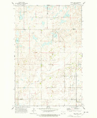 1974 Bush Lake1978 Print · USGSNorthwestern North Dakota's prairie landscape is shown during the mid-seventies energy boom. Genealogists and local historians can trace rural landmarks like Our Saviors Ch, the local Town Hall, and the expanding Stoneview Oil and Gas Field.
Showing maps 1-25 of 189
Top cities of Divide County
Frequently asked questions
- What are the different types of historical maps available for Divide County?
- What is the oldest map of Divide County?
- Where can I purchase historical maps of Divide County for my home or office?
- Where can I download high-res historical maps of Divide County?
- Are there historical topographic maps available for Divide County?
- Is there historical aerial imagery available for Divide County?
- Where are historical maps of Divide County sourced from?