1960s Maps of McLean County, North Dakota
Explore 32 historic maps of McLean County from the 1960s. These maps offer a rare glimpse into what life looked like during the 1960s — showing old roads, neighborhoods, homes, and landmarks that have changed or disappeared over time.
Whether you're researching your family's past, planning a metal detecting trip, or studying how McLean County's landscape evolved across the 1960s, these high-resolution maps are a powerful tool for exploring the history of this region.
- Focus on a specific era: All maps on this page are from the 1960s, giving you a focused view of this time period.
- See what’s changed: Compare century-old streets, trails, and buildings to today's modern landscape using overlays and satellite layers.
- Research with precision: Use these maps for genealogy, historical research, land use analysis, or educational projects.
- View, download, or print: Maps are fully viewable online in high resolution, and can be downloaded or printed for your own records.
Start exploring McLean County's history through authentic maps from the 1960s. This is your window into the past.
McLean County, ND maps
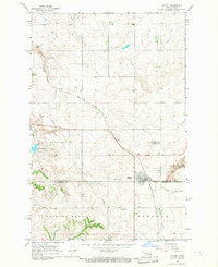
(32)- 1961 Map of Turtle Creek SW, 1963 Print
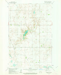
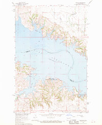
 1961 Turtle Creek SW1963 Print · USGSMcLean and Oliver counties meet along the Missouri River in the early sixties, where the prairie landscape is shaped by wandering coulees. Genealogists and local historians can locate rural landmarks like Koenig Sch No 3, Satterlund Sch No 2, and the Lost Lake National Wildlife Refuge.
 - 1961 Map of Turtle Lake, 1963 Print
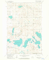
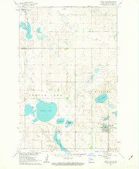 1961 Turtle Lake1963 Print · USGSIn the early sixties, the town of Turtle Lake remained a vital prairie hub at the end of the Northern Pacific line. Genealogists and historians can trace rural roots through landmarks like St Olaf Ch, School No 2, and the Turtle Lake Cem.2 unique versions available
 - 1961 Map of Lake Nettie, 1963 Print
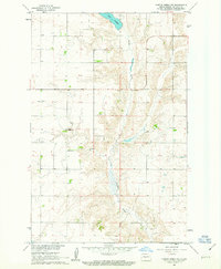
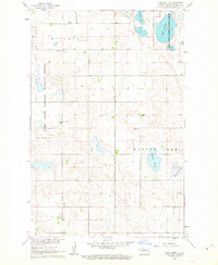 1961 Lake Nettie1963 Print · USGSMcLean County's glacial wetlands and rural townships are captured here in the early 1960s. Genealogists and local historians can pinpoint the Bethel Ch, Darling Cem, and several schoolhouses like School No 6 scattered across the prairie.2 unique versions available
 - 1961 Map of Washburn, 1963 Print
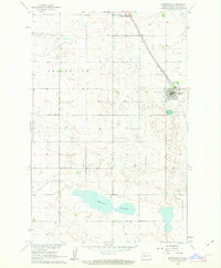
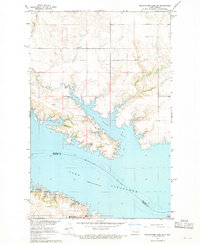
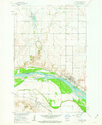 1961 Washburn1963 Print · USGSWashburn and the Missouri River bottoms are captured here in the early sixties as the regional rail and river economy evolved. Genealogists and local historians can trace family roots through the Riverview Cem, Hensler, and the Buffalo Lake Sch No 2.3 unique versions available
 - 1961 Map of Turtle Creek NE, 1963 Print
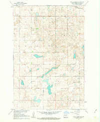 1961 Turtle Creek NE1963 Print · USGSMcLean County is captured during the early 1960s Missouri River Basin development, showing a landscape defined by prairie potholes and rural industry. Genealogists can trace local community roots at South St Olaf Ch, Koenig Sch No 1, and along the Northern Pacific rail line.2 unique versions available
 - 1961 Map of Washburn NE, 1963 Print
 1961 Washburn NE1963 Print · USGSMcLean County is captured here in the early sixties as a landscape of prairie coulees and rural homesteads. Genealogists and local historians can locate the Bible Tabernacle, the Sverdrup Sch, and several small-scale Mines near Coal Lake.2 unique versions available
 - 1961 Map of Peterson Lake, 1963 Print
 1961 Peterson Lake1963 Print · USGSThe Missouri River Basin development era shaped this central North Dakota landscape as the railroad still influenced the prairie. Genealogists can locate family landmarks like School No 4, Medicine Hill Cem, and the Northern Pacific tracks.2 unique versions available
 - 1961 Map of Turtle Creek NW, 1963 Print
 1961 Turtle Creek NW1963 Print · USGSMcLean County is captured here in the early sixties, showing a landscape of structured prairie farmsteads and creek drainages. Researchers can locate specific family landmarks like Veeder School No 2, Veeder Ch, and the shoreline of Lake Ordway.2 unique versions available
 - 1961 Map of Turtle Creek SE, 1963 Print
 1961 Turtle Creek SE1963 Print · USGSMcLean County farming life is preserved here during the early sixties, showing the Missouri River Basin at a time of active development. Genealogists and local historians can locate early rural landmarks like Fairview Ch, Zion Cem, and Iowa Sch No 2.
 - 1961 Map of Underwood, 1963 Print
 1961 Underwood1963 Print · USGSMcLean County prairie life comes into focus during the early sixties as the Missouri River Basin project moves forward. Genealogists and local historians can locate Underwood Cem, the community Fairground, and the rail hub at Riverdale Junction.2 unique versions available
 - 1961 Map of Pelican Lake, 1963 Print
 1961 Pelican Lake1963 Print · USGSThe rural landscapes of McLean and Sheridan Counties come into focus during the early sixties, showing a region of high ridges and prairie lakes. Researchers can locate vanished rural landmarks like School No 1, Our Savior Cemetery, and the prominent Prophets Mountain.
 - 1966 Map of Sanger, 1967 Print
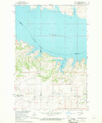
 1966 Sanger1967 Print · USGSThe Missouri River bottoms north of Bismarck come alive in the mid-1960s, showing a landscape defined by shifting water and steam-era rail lines. Researchers can trace the river's influence from the settlement of Sanger to the wetlands of the National Wildlife Refuge and Wildwood Lake.
 - 1966 Map of Wilton, 1967 Print
 1966 Wilton1967 Print · USGSThe McLean and Burleigh county line bisects the prairie landscape near Wilton during the mid-sixties. Genealogists and local historians can trace family locations through the Riverview Cem, the Sacred Heart Cem SS Peter and Paul Cem St Nicholas Cem, and the rail corridors of the Soo Line.
 - 1967 Map of Watford City
 1967 Watford City1967 Print · USGSWestern North Dakota is captured during a period of landscape transformation as the Missouri River valley was reshaped by the new Garrison Reservoir. Genealogists and local historians can trace the foundations of Watford City, find the Elkhorn Ranch Site, or locate rural landmarks like Ziner Butte and Grassy Butte.
 - 1967 Map of Washburn SW, 1968 Print
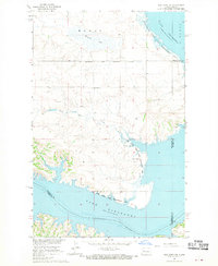
 1967 Washburn SW1968 Print · USGSAlong the Missouri River in the mid-1960s, the landscape of McLean and Oliver Counties reveals a blend of prairie agriculture and industry. Genealogists and historians can trace family ties at Birka Ch Cem or locate the site of the Black Diamond Mine near the Coal Lake Coulee.2 unique versions available
 - 1967 Map of Stanton SE, 1969 Print
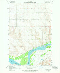
 1967 Stanton SE1969 Print · USGSThe Missouri River valley in the late 1960s serves as a hub of both frontier legacy and industrial utility. Genealogists and historians can locate family landmarks like Basto Cem alongside major sites including Fort Mandan Historic Site and the Northern Pacific rail line.2 unique versions available
 - 1967 Map of Emmet SE, 1969 Print
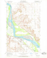
 1967 Emmet SE1969 Print · USGSThe Missouri River valley in the late sixties shows the rising waters of Lake Sakakawea as they reshaped the McLean County landscape. Trace the legacy of the western frontier along the Old Fort Stevenson Military Road or find family roots at Geminde Cem.2 unique versions available
 - 1967 Map of Blackwater Lake SE, 1969 Print
 1967 Blackwater Lake SE1969 Print · USGSThe Missouri River breaks into the sprawling Lake Sakakawea during the late sixties, reshaping the McLean County landscape. Genealogists and historians can trace local landmarks like St Andrews Ch, St Pauls Ch, and early coal interests at the Strip Mines.
 - 1967 Map of Raub SE, 1969 Print
 1967 Raub SE1969 Print · USGSThe Missouri River breaks into the sprawling Lake Sakakawea in the late sixties, defining this Mercer and McLean County landscape. Genealogists and historians can locate the Red Butte Cem and explore the Beaver Creek State Game Management Area.
 - 1967 Map of Raub NW, 1969 Print
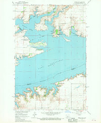
 1967 Raub NW1969 Print · USGSThe Missouri River Basin landscape comes into focus during the late sixties as the reservoir reshapes the McLean County shoreline. Genealogists and historians can trace the Fort Berthold Indian Reservation Boundary and locate the Memorial Ch near Arikara Bay.
 - 1967 Map of Raub, 1969 Print
 1967 Raub1969 Print · USGSMcLean County, North Dakota, is captured in the late sixties as the rising waters of Lake Sakakawea reshaped the northern landscape. Local historians can trace rural life through sites like Raub, Immaculate Conception Ch, and the Buffalo Rock Community Hall.
 - 1967 Map of Twin Buttes, 1969 Print
 1967 Twin Buttes1969 Print · USGSThe rising waters of Lake Sakakawea define this part of Mercer and Dunn County during the late 1960s. Researchers can locate numerous local landmarks including St Joseph Ch, Twin Buttes, and several rural cemeteries like Chase Cem.
 - 1967 Map of Blackwater Lake SW, 1969 Print
 1967 Blackwater Lake SW1969 Print · USGSThe McLean County shoreline was significantly transformed by the mid-1960s as the rising Missouri River reshaped the landscape. Trace the geography of Nishu Bay and find local landmarks like Beaver Creek Cem and the Buffalo Rock Coulee.2 unique versions available
 - 1967 Map of New Town SW, 1970 Print
 1967 New Town SW1970 Print · USGSMountrail County's shoreline was dramatically reshaped by the mid-1960s as the Missouri River valley transitioned into a vast reservoir. Researchers can trace the Fort Berthold Indian Reservation Boundary and locate local landmarks like Little Shell Ch and the Van Hook State Game Management Area.
 - 1967 Map of Emmet SW, 1970 Print
 1967 Emmet SW1970 Print · USGSThe Missouri River valley undergoes a profound change in the late sixties as the Garrison Dam alters the landscape. Researchers can trace the submerged boundaries of the Old Fort Stevenson Military Reservation and locate the Lilly Dale Cem.
Showing maps 1-25 of 32
Top cities of McLean County
- Washburn historical maps
- Garrison historical maps
- Underwood historical maps
- Turtle Lake historical maps
- Riverdale historical maps
- Max historical maps
See more
Frequently asked questions
- What are the different types of historical maps available for McLean County?
- What is the oldest map of McLean County?
- Where can I purchase historical maps of McLean County for my home or office?
- Where can I download high-res historical maps of McLean County?
- Are there historical topographic maps available for McLean County?
- Is there historical aerial imagery available for McLean County?
- Where are historical maps of McLean County sourced from?