1980s Maps of McLean County, North Dakota
Explore 16 historic maps of McLean County from the 1980s. These maps offer a rare glimpse into what life looked like during the 1980s — showing old roads, neighborhoods, homes, and landmarks that have changed or disappeared over time.
Whether you're researching your family's past, planning a metal detecting trip, or studying how McLean County's landscape evolved across the 1980s, these high-resolution maps are a powerful tool for exploring the history of this region.
- Focus on a specific era: All maps on this page are from the 1980s, giving you a focused view of this time period.
- See what’s changed: Compare century-old streets, trails, and buildings to today's modern landscape using overlays and satellite layers.
- Research with precision: Use these maps for genealogy, historical research, land use analysis, or educational projects.
- View, download, or print: Maps are fully viewable online in high resolution, and can be downloaded or printed for your own records.
Start exploring McLean County's history through authentic maps from the 1980s. This is your window into the past.
McLean County, ND maps
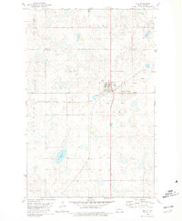
(16)- 1980 Map of Turtle Creek SE
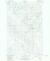
 1980 Turtle Creek SE1980 Print · USGSMcLean County as it appeared in the late fifties and early sixties, showing a landscape of small school districts and country churches. Genealogists can locate family-named landmarks and rural hubs such as Zion Cem, Iowa Sch No 3, and Fairview Ch.
 - 1980 Map of Douglas East, 1981 Print
 1980 Douglas East1981 Print · USGSThe McLean and Ward County border comes alive in the early eighties as a landscape of prairie lakes and rail-line heritage. Genealogists and local historians can locate Douglas, trace the Soo Line tracks, and find local landmarks like Trinity Cem and the Townhall.
 - 1980 Map of Max, 1981 Print
 1980 Max1981 Print · USGSThe prairie town of Max is captured in the late 1970s at the junction of the Ward and McLean county lines. Researchers can trace the local heritage of the region through several rural burial sites like Peace Cem and Zion Cem or follow the path of the SOO LINE railroad.
 - 1981 Map of Benedict
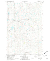 1981 Benedict1981 Print · USGSThe prairie landscape of McLean and Ward counties in the early eighties is defined by the Soo Line and small agricultural centers. Genealogists and local historians can trace the foundations of Benedict, Berg, and the Concordia Cem across this detailed terrain.
 - 1981 Map of Garrison, 1982 Print
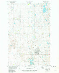 1981 Garrison1982 Print · USGSGarrison stands at the edge of the Missouri River reservoir system during the early eighties, showing the town's expansion and its rail connections. Genealogists and historians can locate St Nicholas Cem, trace the Soo Line, and see the shoreline of Lake Sakakawea.
 - 1981 Map of Horseshoe Valley, 1982 Print
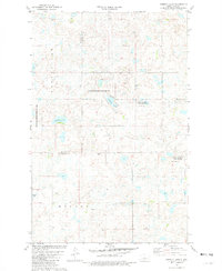
 1981 Horseshoe Valley1982 Print · USGSMcLean County prairie land in the early 1980s reveals a complex network of glacial wetlands and small-scale industry. Genealogists and historians can trace section lines near Borgen, explore the margins of Crooked Lake, and locate numerous Gravel Pits and Wells across the plains.
 - 1981 Map of Garrison NE, 1982 Print
 1981 Garrison NE1982 Print · USGSMcLean County is shown in the early eighties as a landscape of prairie potholes and industrial extraction. Genealogists and local historians can trace burial sites at German Congregational Cem and the reclaimed grounds of the Strip Mine.
 - 1981 Map of Coleharbor NW, 1982 Print
 1981 Coleharbor NW1982 Print · USGSThe prairie landscape of McLean County in the early eighties shows the expansive waters of Lake Audubon and its surrounding wildlife areas. Genealogists and local historians can locate rural landmarks like St Adolphs Cem, Gemeinde-Giek Cem, and the settlement at Townhall.
 - 1981 Map of Long Lake, 1982 Print
 1981 Long Lake1982 Print · USGSMcLean County's prairie wetland complex is captured here in the early eighties, showcasing the intricate landscape of Horseshoe Valley. Genealogists and local historians can locate the St Johns Cem, St Peters Ch, and the local Townhall among the numerous glacial lakes.
 - 1981 Map of Coleharbor NE, 1982 Print
 1981 Coleharbor NE1982 Print · USGSMcLean County is mapped here in the early 1980s, showcasing a landscape of significant conservation efforts and rural community centers. Researchers can trace local heritage at Greatstone Ch or explore the vast wetlands of the National Waterfowl Production Area.
 - 1981 Map of Kongsberg, 1982 Print
 1981 Kongsberg1982 Print · USGSThe McLean and McHenry county line comes alive in the early eighties, showcasing a prairie landscape filled with wetlands and conservation areas. Researchers can locate the settlement of Kongsberg, trace the Soo Line tracks, and find local landmarks like St Johns Ch and Dogden Butte.
 - 1981 Map of Alkali Lake, 1982 Print
 1981 Alkali Lake1982 Print · USGSThe prairie pothole region of McLean and Sheridan Counties is captured here in the early eighties, showing a landscape shaped by water and conservation. Researchers can locate remote rural landmarks like Tabor Cem, the local Townhall, and the shores of Alkali Lake.
 - 1981 Map of Siebold Lake, 1982 Print
 1981 Siebold Lake1982 Print · USGSThe Sheridan and McLean county line in the early 1980s reveals a prairie landscape shifting toward conservation and wildlife management. Researchers can trace land usage across Byersville and Holmes, locating features like Siebold Lake and several Gravel Pits.
 - 1981 Map of Benedict SW, 1982 Print
 1981 Benedict SW1982 Print · USGSThe prairie wetlands of McLean and Ward Counties come to life in this early 1980s survey. Genealogists and local historians can locate the Russian Cem, Benedict Cem, and the Soo Line tracks through Poplar and Rushville.
 - 1981 Map of Ruso, 1982 Print
 1981 Ruso1982 Print · USGSThe North Dakota prairie near the McLean and McHenry county borders is captured here in the early eighties, showcasing a landscape of glacial potholes and conservation lands. Genealogists and local historians can locate Ruso, the Ruso Cemetery, and rural sites like Bauer and Boozinny along the Soo Line rail corridor.
 - 1982 Map of Parshall, 1983 Print
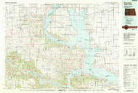 1982 Parshall1983 Print · USGSNorth Dakota's badlands and reservoir shorelines meet during the early eighties, showcasing a landscape shaped by both water and oil. Researchers can trace the development of New Town, locate the Riverview Cem, and explore the extent of the Antelope Oil Field.
End of results
Showing maps 1-16 of 16
Top cities of McLean County
- Washburn historical maps
- Garrison historical maps
- Underwood historical maps
- Turtle Lake historical maps
- Riverdale historical maps
- Max historical maps
See more
Frequently asked questions
- What are the different types of historical maps available for McLean County?
- What is the oldest map of McLean County?
- Where can I purchase historical maps of McLean County for my home or office?
- Where can I download high-res historical maps of McLean County?
- Are there historical topographic maps available for McLean County?
- Is there historical aerial imagery available for McLean County?
- Where are historical maps of McLean County sourced from?