1910s Maps of Tillman County, Oklahoma
Explore 4 historic maps of Tillman County from the 1910s. These maps offer a rare glimpse into what life looked like during the 1910s — showing old roads, neighborhoods, homes, and landmarks that have changed or disappeared over time.
Whether you're researching your family's past, planning a metal detecting trip, or studying how Tillman County's landscape evolved across the 1910s, these high-resolution maps are a powerful tool for exploring the history of this region.
- Focus on a specific era: All maps on this page are from the 1910s, giving you a focused view of this time period.
- See what’s changed: Compare century-old streets, trails, and buildings to today's modern landscape using overlays and satellite layers.
- Research with precision: Use these maps for genealogy, historical research, land use analysis, or educational projects.
- View, download, or print: Maps are fully viewable online in high resolution, and can be downloaded or printed for your own records.
Start exploring Tillman County's history through authentic maps from the 1910s. This is your window into the past.
Tillman County, OK maps
(4)- 1915 Map of Clara, 1961 Print
 1915 Clara1961 Print · USGSWichita County was a land of rural schoolhouses and river crossings during the early twentieth century. Researchers can trace the original locations of Fairview School, Wyeth School, and the settlement of Clara along the banks of the Red River.
 - 1915 Map of Barwise School, 1961 Print
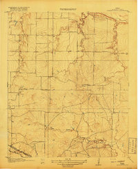
 1915 Barwise School1961 Print · USGSWichita County was a landscape of remote school districts and winding prairie creeks during the early years of the twentieth century. Researchers can trace the rural infrastructure of the era through landmarks like Barwise School, the Fort Worth and Denver City rail line, and Tenth Cavalry Creek.
 - 1918 Map of Barwise School
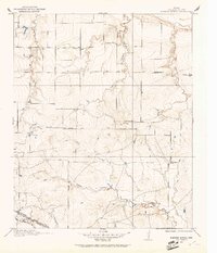
 1918 Barwise School1918 Print · USGSWichita County was a landscape of emerging rural school districts and early transit corridors during the First World War. Genealogists and historians can trace the early property lines and routes connecting Barwise School and Sunshine School with the Fort Worth and Denver City Road.2 unique versions available
 - 1918 Map of Clara
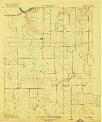 1918 Clara1918 Print · USGSThe North Texas borderlands along the Red River appear here during the height of the early twentieth-century oil boom era. Researchers can locate the early rural settlements of Clara and Stringtown, alongside historic country schoolhouses like Wyeth School.2 unique versions available
End of results
Showing maps 1-4 of 4
Top cities of Tillman County
- Frederick historical maps
- Grandfield historical maps
- Tipton historical maps
- Davidson historical maps
- Manitou historical maps
- Hollister historical maps
See more
Frequently asked questions
- What are the different types of historical maps available for Tillman County?
- What is the oldest map of Tillman County?
- Where can I purchase historical maps of Tillman County for my home or office?
- Where can I download high-res historical maps of Tillman County?
- Are there historical topographic maps available for Tillman County?
- Is there historical aerial imagery available for Tillman County?
- Where are historical maps of Tillman County sourced from?