1980s Maps of Jefferson County, Oregon
Explore 34 historic maps of Jefferson County from the 1980s. These maps offer a rare glimpse into what life looked like during the 1980s — showing old roads, neighborhoods, homes, and landmarks that have changed or disappeared over time.
Whether you're researching your family's past, planning a metal detecting trip, or studying how Jefferson County's landscape evolved across the 1980s, these high-resolution maps are a powerful tool for exploring the history of this region.
- Focus on a specific era: All maps on this page are from the 1980s, giving you a focused view of this time period.
- See what’s changed: Compare century-old streets, trails, and buildings to today's modern landscape using overlays and satellite layers.
- Research with precision: Use these maps for genealogy, historical research, land use analysis, or educational projects.
- View, download, or print: Maps are fully viewable online in high resolution, and can be downloaded or printed for your own records.
Start exploring Jefferson County's history through authentic maps from the 1980s. This is your window into the past.
Jefferson County, OR maps
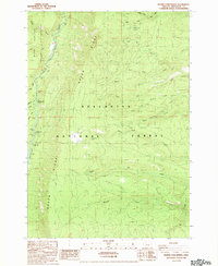
(34)- 1980 Map of Bend, 1993 Print
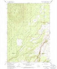
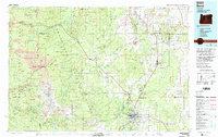 1980 Bend1993 Print · USGSCentral Oregon was evolving rapidly in the early eighties as outdoor recreation and transit hubs like Bend and Redmond expanded. Trace the historical footprints of Sisters, the Metolius River basin, and the Oregon Trunk Railway through the high desert.2 unique versions available
 - 1981 Map of Prineville
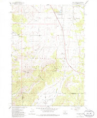
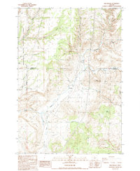
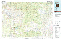 1981 Prineville1981 Print · USGSPrineville and the Crooked River valley are seen here in the early eighties as the region balanced timber, ranching, and new water management projects. Genealogists and local historians can trace family-named landmarks like Watkins, locate the Cem, or find old mining sites such as the Amity Mine.
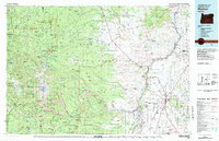
 - 1981 Map of Stephenson Mountain, 1997 Print
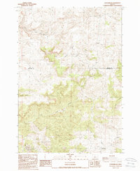
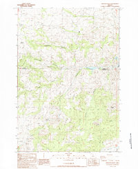
 1981 Stephenson Mountain1997 Print · USGSThe high-desert ranching and mining heart of North Central Oregon is captured here in the early eighties. Genealogists and historians can trace old settlements and mineral prospects from Shaniko to the Oregon King Mine and the John Day River canyon.
 - 1983 Map of Madras
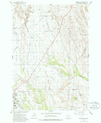
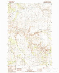
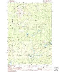
 1983 Madras1983 Print · USGSJefferson County and the Warm Springs Indian Reservation are shown in detail during the early 1980s, from the Cascade peaks to the high desert. Researchers can trace the legacy of tribal lands at Simnasho, find the Abbot Cemetery, or follow the rail lines through Madras Sta.
 - 1985 Map of Steelhead Falls, 1986 Print
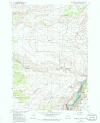
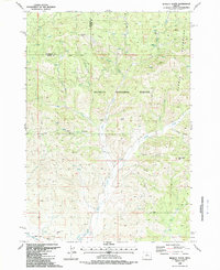
 1985 Steelhead Falls1986 Print · USGSThe high desert canyons of Jefferson and Deschutes counties are captured here in the mid-1980s, showcasing the dramatic river confluences. You can trace the rugged gorge landscapes from Geneva to Steelhead Falls, alongside landmarks like Opal Springs and the Grandview Cemetery.
 - 1985 Map of Round Butte Dam, 1986 Print
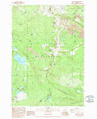
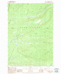
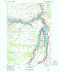 1985 Round Butte Dam1986 Print · USGSJefferson County’s high desert landscape was profoundly changed by the mid-1980s following the completion of the Round Butte Dam. Local history researchers can trace the former settlement at Grandview (Site) and the canyon-carving paths of the Metolius River and Crooked River.3 unique versions available
 - 1985 Map of Madras East, 1986 Print
 1985 Madras East1986 Print · USGSJefferson County's high desert plateau comes alive in this mid-eighties survey, showing the agricultural grids and canyon lands east of the Deschutes. Researchers can locate the Madras community core, the Cem, and rural outposts like Paxton and Schmoker Well.2 unique versions available
 - 1985 Map of Culver, 1986 Print
 1985 Culver1986 Print · USGSJefferson County's high desert plateau comes into sharp focus during the mid-eighties, showing the agricultural grids and rail lines connecting Culver and Metolius. Genealogists and historians can trace local landmarks like German Cem, the Burlington Northern tracks, and the Haystack Dam.2 unique versions available
 - 1985 Map of Buck Butte, 1986 Print
 1985 Buck Butte1986 Print · USGSJefferson County ranching and water management are front and center in this mid-1980s survey of central Oregon. Local researchers can trace family-named landmarks and essential infrastructure like the Dayton-Grant Well, Willow Creek Corral, and Buck Butte.2 unique versions available
 - 1985 Map of Madras West, 1986 Print
 1985 Madras West1986 Print · USGSJefferson County’s high desert landscape is shown during the mid-eighties as the Deschutes River canyon meets the agricultural Agency Plains. Trace local history through the Milo Gard Cem, the Vanora (Site), and the rail operations at Madras Sta.
 - 1985 Map of Seekseequa Junction, 1986 Print
 1985 Seekseequa Junction1986 Print · USGSThe high plateau country of central Oregon is captured here in the 1980s, where the reservation boundary meets the national grassland. Researchers can trace remote landmarks like Coyote Butte, find the cemeteries near Seekseequa Junction, and locate camps along Lake Simtustus.2 unique versions available
 - 1985 Map of Opal City, 1986 Print
 1985 Opal City1986 Print · USGSJefferson and Deschutes counties are captured here in the mid-1980s as agricultural irrigation and recreation reshaped the high desert. Researchers can trace the sprawling Crooked River Ranch, the tracks of the Union Pacific Northern, and the waters of Haystack Reservoir.
 - 1985 Map of Squaw Back Ridge, 1986 Print
 1985 Squaw Back Ridge1986 Print · USGSJefferson and Deschutes counties are captured here in the mid-1980s as the high desert meets the canyonlands of the Crooked River. Trace the history of remote ranching outposts like Flying 8 Ranch and the former settlement at Geneva (Site).
 - 1985 Map of Gray Butte, 1988 Print
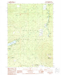
 1985 Gray Butte1988 Print · USGSCentral Oregon ranching and grassland conservation intersect in the mid-1980s, revealing a landscape of high-country springs and early rural landmarks. Genealogists and local historians can trace the Gray Butte Cem, find the Lone Pine Sch, and locate numerous named water sources like Lithgow Spring.
 - 1987 Map of Donnybrook, 1988 Print
 1987 Donnybrook1988 Print · USGSJefferson and Wasco counties meet in this high-desert survey of the late eighties, documenting a remote stretch of central Oregon. Local history researchers can trace the drainage of Eagle Creek Valley and identify small settlements like Post and Donnybrook.
 - 1987 Map of Degner Canyon, 1988 Print
 1987 Degner Canyon1988 Print · USGSThe border of Wasco and Jefferson counties comes alive in the late 1980s, showing a landscape shaped by water and early land claims. Trace family history at Maupin Cem or explore the rugged topography of The Flatirons, Paulina Butte, and Timber Culture Gulch.
 - 1987 Map of Willowdale, 1988 Print
 1987 Willowdale1988 Print · USGSThe high desert landscape around the Wasco and Jefferson County line is captured here in the late eighties. Researchers can trace the path of Route 97 past Willowdale or locate landforms like Friends Peak and the Deschutes River Recreation Lands.
 - 1987 Map of Muddy Ranch, 1988 Print
 1987 Muddy Ranch1988 Print · USGSThe high desert of Jefferson and Wasco counties comes into focus during the late eighties, centered on the rugged canyons of the John Day River. Researchers can trace old property boundaries and landmarks like Muddy Ranch, Wagner Mountain, and the Rock Fort (Site).
 - 1987 Map of Arrastra Butte, 1988 Print
 1987 Arrastra Butte1988 Print · USGSCentral Oregon high country near the Jefferson and Wasco county line is shown here in the late eighties. Trace mining history at Queen Oregon Mines and explore the complex terrain of Arrastra Butte and Gallagher Canyon.
 - 1988 Map of Hensley Butte
 1988 Hensley Butte1988 Print · USGSCrook County’s high-altitude forest and irrigation networks are documented here in the late eighties. Researchers can trace the path of the Ochoco Canal and locate remote natural landmarks such as Cougar Rock or Rail Hollow.
 - 1988 Map of Marion Lake
 1988 Marion Lake1988 Print · USGSThe high Cascade wilderness of Linn and Jefferson counties is captured here in the late eighties, showing a landscape shaped by volcanic peaks and glacial basins. Hikers and historians can trace the Pacific Crest National Scenic Trail past Marion Lake to the remote John Swallow Grave.2 unique versions available
 - 1988 Map of Prairie Farm Spring
 1988 Prairie Farm Spring1988 Print · USGSJefferson County's high forest and river country are documented here in the late eighties, showing the managed lands of the Deschutes National Forest. Researchers can locate the Prairie Farm Guard Sta and trace the many forks of South Fork Spring Creek and North Fork Street Creek.2 unique versions available
 - 1988 Map of Three Fingered Jack
 1988 Three Fingered Jack1988 Print · USGSThe Oregon Cascades at Santiam Pass come into focus in the late eighties, showing a wilderness area shaped by both fire and ice. Researchers can trace the Old Wagon Road and the Pacific Crest National Scenic Trail near Three Fingered Jack.2 unique versions available
 - 1988 Map of Boulder Lake
 1988 Boulder Lake1988 Print · USGSThe Oregon Cascades during the late 1980s reveal a landscape shaped by historical tribal boundaries and high-altitude water systems. Researchers can trace the Old Indian Reservation Boundary (Rumsey Line 1882) and locate remote landmarks like Francis Lake and Lookout Butte.2 unique versions available
 - 1988 Map of Black Butte
 1988 Black Butte1988 Print · USGSThe Metolius River basin and the massive volcanic cone of Black Butte are captured here during the late eighties. Trace the historic Old Santiam Wagon Road or locate the many campsites near Camp Sherman and Suttle Lake.2 unique versions available
Showing maps 1-25 of 34
Top cities of Jefferson County
Frequently asked questions
- What are the different types of historical maps available for Jefferson County?
- What is the oldest map of Jefferson County?
- Where can I purchase historical maps of Jefferson County for my home or office?
- Where can I download high-res historical maps of Jefferson County?
- Are there historical topographic maps available for Jefferson County?
- Is there historical aerial imagery available for Jefferson County?
- Where are historical maps of Jefferson County sourced from?