2000s (21st Century) Maps of Jefferson County, Oregon
Explore 230 historic maps of Jefferson County from the 2000s (21st Century). These maps offer a rare glimpse into what life looked like during the 2000s — showing old roads, neighborhoods, homes, and landmarks that have changed or disappeared over time.
Whether you're researching your family's past, planning a metal detecting trip, or studying how Jefferson County's landscape evolved across the 2000s, these high-resolution maps are a powerful tool for exploring the history of this region.
- Focus on a specific era: All maps on this page are from the 2000s, giving you a focused view of this time period.
- See what’s changed: Compare century-old streets, trails, and buildings to today's modern landscape using overlays and satellite layers.
- Research with precision: Use these maps for genealogy, historical research, land use analysis, or educational projects.
- View, download, or print: Maps are fully viewable online in high resolution, and can be downloaded or printed for your own records.
Start exploring Jefferson County's history through authentic maps from the 2000s. This is your window into the past.
Jefferson County, OR maps
(230)- 2011 Map of Teller Butte, 2011 Print
 2011 Teller Butte2011 Print · USGSJefferson County ranchlands and high-desert relief are documented here in the early twenty-first century. Researchers can locate the Hay Creek Cemetery and trace water rights through landmarks like Lyle Dam and Hunter Spring.
 - 2011 Map of Grizzly Mountain, 2011 Print
 2011 Grizzly Mountain2011 Print · USGSJefferson County ranchlands are documented here in the early twenty-first century, showing a landscape defined by high-elevation peaks and seasonal creeks. Researchers can trace family history at the Grizzly Cemetery or locate historic holdings like Negus Ranch and Joe Fisher Ranch.
 - 2011 Map of Brewer Reservoir, 2011 Print
 2011 Brewer Reservoir2011 Print · USGSJefferson County ranching and water infrastructure are documented in this 2011 survey, showing the relationship between early landholdings and modern management. Researchers can trace the legacy of family operations at Hay Creek Ranch, Morrow Ranch, and the Morrow Brothers Dam.
 - 2011 Map of Foley Butte, 2011 Print
 2011 Foley Butte2011 Print · USGSJefferson County in the early 21st century remains a landscape of high summits and essential water sources. You can trace fire-watch history at Foley Butte Lookout Tower or locate remote watering points like Rainbow Trough Spring and Butte Spring.
 - 2011 Map of Dutchman Creek, 2011 Print
 2011 Dutchman Creek2011 Print · USGSJefferson County’s high country is captured here in the early 2000s, showing a landscape defined by timber roads and vital water sources. Researchers can locate remote landmarks like the Trout Creek Cow Camp, Cat Mountain, and numerous named springs such as Ruth Spring.
 - 2011 Map of Opal Mountain, 2011 Print
 2011 Opal Mountain2011 Print · USGSJefferson County’s high forest plateaus are captured here during the early twenty-first century. Researchers can trace land use through seasonal sites like Symons Wood Camp, geographic markers such as McKay Saddle, and remote outposts like Divide Cabin.
 - 2011 Map of Akawa Butte, 2011 Print
 2011 Akawa Butte2011 Print · USGSThe high desert of Deschutes County comes into focus here during the early 2000s, showing a landscape of volcanic buttes and isolated ranching outposts. Researchers can locate family sites near Geneva, the Geneva Cemetery, and the rugged Akawa Gulch.
 - 2011 Map of Little Akawa Butte, 2011 Print
 2011 Little Akawa Butte2011 Print · USGSUpper Deschutes County forest lands are mapped here in the early 2010s, showing a detailed network of timber and access roads. Researchers can trace the Metolius Windiego Trl or locate landmarks like Little Akawa Butte and Whiskey Spring.
 - 2011 Map of Buck Butte, 2011 Print
 2011 Buck Butte2011 Print · USGSJefferson County rangeland comes into focus in this early twenty-first-century survey of the high desert near Madras. Researchers can trace the importance of water to local ranching through the locations of Willow Creek Corral, Wagonblast Canyon, and Juniper Spring.
 - 2011 Map of Steelhead Falls, 2011 Print
 2011 Steelhead Falls2011 Print · USGSDeschutes County land patterns at the turn of the decade show the meeting of river canyons and residential growth. Researchers can trace the legacy of early ranching and settlement at the Geneva Cemetery, Gates Ranch, and the eponymous Steelhead Falls.
 - 2011 Map of Lionshead, 2011 Print
 2011 Lionshead2011 Print · USGSJefferson County’s high country is captured here during the early twenty-first century, showcasing a landscape of significant peaks and vital headwaters. Researchers can trace remote routes like BIA 40 Rd through Biddle Pass and along the Whitewater River.
 - 2011 Map of Black Butte, 2011 Print
 2011 Black Butte2011 Print · USGSJefferson County’s resort and forest landscapes are captured here at the start of the 2010s. Local researchers can trace the developed grounds of Black Butte Ranch or the historic recreation hubs of Camp Sherman and Suttle Lake Resort.
 - 2011 Map of Metolius Bench, 2011 Print
 2011 Metolius Bench2011 Print · USGSJefferson County benchlands are captured here in the early twenty-first century, showing a landscape defined by forest service roads and high plateaus. Researchers can trace the river corridor at Drift Campground or locate remote water sources like Peters Spring and Beachcomb Spring.
 - 2011 Map of Mount Jefferson, 2011 Print
 2011 Mount Jefferson2011 Print · USGSThe high Cascades come into focus during this modern era, documenting the ice fields and alpine meadows surrounding the Oregon interior. Trace the glacial extent at Mount Jefferson and locate backcountry landmarks like Grizzly Flat and Jefferson Park.
 - 2011 Map of Marion Lake, 2011 Print
 2011 Marion Lake2011 Print · USGSHigh in the Cascades during the early twenty-first century, this alpine landscape is defined by its volcanic peaks and glacial lakes. Hikers and historians can trace routes through Minto Pass or locate remote landmarks like Camp Marion, Gatch Falls, and The Table.
 - 2011 Map of Hensley Butte, 2011 Print
 2011 Hensley Butte2011 Print · USGSJefferson County ranching and forest lands are detailed here during the early twenty-first century. Researchers can trace land boundaries near Elliot Ranch or locate geographic landmarks such as Little Table Mountain and McKay Creek Forest Camp.
 - 2011 Map of Prairie Farm Spring, 2011 Print
 2011 Prairie Farm Spring2011 Print · USGSJefferson County’s high forest plateaus are documented here in the early twenty-first century as a landscape of timber management and remote springs. Researchers can locate the Green Ridge Lookout Tower and trace historical access points like Sugar Pine Camp and Bridge 99.
 - 2011 Map of Madras East, 2011 Print
 2011 Madras East2011 Print · USGSMadras and its northeastern hinterlands are captured here during the early twenty-first century as the city expanded into the surrounding plateau. Researchers can trace the layout of the Mount Jefferson IOOF Cemetery or locate landmarks like Paxton and Cotter Pond.
 - 2011 Map of Olallie Butte, 2011 Print
 2011 Olallie Butte2011 Print · USGSHigh in the Cascades during the early twenty-first century, this area shows a dense concentration of alpine lakes and volcanic peaks. Hikers and researchers can trace routes between Olallie Butte, Olallie Meadow, and the Breitenbush Cascades View Point.
 - 2011 Map of Candle Creek, 2011 Print
 2011 Candle Creek2011 Print · USGSJefferson County’s high-country terrain and river systems are captured here in the early 21st century. Researchers can trace forest access routes to the Wizard Falls State Fish Hatchery, find Sheep Spring Horse Camp, and locate remote landmarks like Abbot Butte.
 - 2011 Map of Stephenson Mountain, 2011 Print
 2011 Stephenson Mountain2011 Print · USGSThe high country of the Ochoco Mountains comes into focus in this early twenty-first century study of central Oregon. Genealogists and local historians can trace legacy landmarks like Old Stephenson Ranch, Ludwick Cabin, and several vital mountain springs.
 - 2011 Map of Shitike Butte, 2011 Print
 2011 Shitike Butte2011 Print · USGSJefferson County’s high plateaus and river canyons are documented here in the early twenty-first century, showing a landscape of volcanic buttes and forest service routes. Researchers can trace the drainage of the Metolius River and locate landmarks like Castle Rocks and the Alder Spring Lookout.
 - 2011 Map of Fly Creek, 2011 Print
 2011 Fly Creek2011 Print · USGSJefferson County’s high desert landscape appears in the early twenty-first century as a mix of recreation and remote ranching. Searchers can find the 3 Rivers Recreation Area Airport, the Fly Lake Lookout, and landmarks like Balanced Rocks above Lake Billy Chinook.
 - 2011 Map of Three Fingered Jack, 2011 Print
 2011 Three Fingered Jack2011 Print · USGSHigh in the Oregon Cascades during the early 2010s, this area centers on the volcanic peaks and alpine lakes surrounding Santiam Pass. Outdoor historians and researchers can trace the footprint of Blue Lake Resort, Camp Tamarack, and the iconic Three Fingered Jack.
 - 2011 Map of Gray Butte, 2011 Print
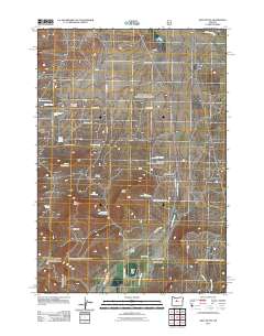 2011 Gray Butte2011 Print · USGSDeschutes County ranching and recreation are detailed in this survey from the early twenty-first century. Genealogists and historians can trace the foundations of the area through Gray Butte Cemetery, McCoin Orchard, and Cyrus Horse Camp.
Showing maps 1-25 of 230
Top cities of Jefferson County
Frequently asked questions
- What are the different types of historical maps available for Jefferson County?
- What is the oldest map of Jefferson County?
- Where can I purchase historical maps of Jefferson County for my home or office?
- Where can I download high-res historical maps of Jefferson County?
- Are there historical topographic maps available for Jefferson County?
- Is there historical aerial imagery available for Jefferson County?
- Where are historical maps of Jefferson County sourced from?