Old Maps of Jefferson County, Oregon for Genealogy
Trace your family roots with 334 historic maps of Jefferson County. These high-res maps reveal old neighborhoods, homesites, landmarks, and streets — helping you uncover where your ancestors lived and how the area evolved over time.
- Explore historic neighborhoods: Identify where your relatives may have lived in the 1800s or 1900s.
- Compare maps over time: Trace the changes in streets, buildings, and landmarks for multi-generational research.
- Perfect for genealogy & ancestry research: Used by family historians and researchers to map out lineage and migration.
These maps are an incredible resource for exploring your personal connection to Jefferson County's past.
Jefferson County, OR maps
(334)- 1926 Map of Mitchell
 1926 Mitchell1926 Print · USGSCentral Oregon ranching and geology are documented here in the mid-1920s, showing a landscape defined by the winding John River. Genealogists can locate family holdings like Old Frizzell Ranch and Laird Ranch alongside remote schoolhouses like Gable School.3 unique versions available
 - 1926 Map of Bend, 1963 Print
 1926 Bend1963 Print · USGSCentral Oregon in the mid-1920s was a landscape of emerging irrigation districts and busy timber rails centered around the growing hub of Bend. Researchers can trace early rural life through family-named landmarks like Gales Ranch and numerous country schoolhouses including Young Sch and Pine Ridge Sch.
 - 1927 Map of Mt. Jefferson, 1956 Print
 1927 Mt. Jefferson1956 Print · USGSThe Oregon Cascades in the late twenties were defined by high-altitude trails and the early management of the Santiam and Mount Hood forests. Trace the historic Skyline Trail past remote outposts like Lemiti Ranger Sta and the Breitenbush Hot Sprs.2 unique versions available
 - 1928 Map of Madras, 1956 Print
 1928 Madras1956 Print · USGSJefferson County was a landscape of high plateaus and deep river canyons in the late twenties, where new highways met tribal lands. Genealogists can trace family footprints at Hebe Mill, Simnasho, and rural schoolhouses like Mountain View Sch.
 - 1929 Map of Bend
 1929 Bend1929 Print · USGSCentral Oregon in the late twenties shows a landscape shaped by irrigation and the expansion of the rail lines. Genealogists can locate family-named sites like Gates Ranch and numerous rural schoolhouses including Arnold Sch and Lava Rock Sch.5 unique versions available
 - 1929 Map of Three Sisters, 1956 Print
 1929 Three Sisters1956 Print · USGSThe High Cascades meet the Deschutes plateau in the late 1920s, a time when fire lookouts and cow camps dotted the volcanic peaks. Genealogists and historians can trace the early footprints of Sisters, Camp Sherman, and the historic Old Toll Station.2 unique versions available
 - 1930 Map of Mt. Jefferson
 1930 Mt. Jefferson1930 Print · USGSThe Oregon Cascades were a frontier of early forest management and tribal lands during the late 1920s. Researchers can locate remote administrative outposts like the Lemiti Ranger Sta, trace the thermal waters of Breitenbush Hot Sprs, and explore the high meadows of Independence Prairie.3 unique versions available
 - 1931 Map of Madras
 1931 Madras1931 Print · USGSCentral Oregon ranching and rail life come into focus in the late twenties, centering on the Warm Springs Agency. Trace the river-level rail stops at Mecca and Kaskela or locate early rural schoolhouses like New Era Sch and Lyle Gap Sch.2 unique versions available
 - 1932 Map of Three Sisters
 1932 Three Sisters1932 Print · USGSThe eastern Cascades and the high desert meet in the early 1930s as the regional highway system begins to pierce the mountains. Genealogists and historians can trace early settlements like Camp Polk and Sisters or locate old forest landmarks such as Camp Sherman and Black Butte.3 unique versions available
 - 1955 Map of Bend, 1964 Print
 1955 Bend1964 Print · USGSCentral Oregon was undergoing significant growth in the mid-1960s as irrigation and infrastructure transformed the high desert. Researchers can trace the path of the Oregon Trunk Line, locate old stops like Gateway, and find landmarks like Lava Butte or the Grange.3 unique versions available
 - 1957 Map of Bend
 1957 Bend1957 Print · USGSCentral Oregon in the mid-fifties is a landscape of transition between the high Cascades and the arid volcanic plateau. Local historians can trace the rail corridors of the Oregon Trunk and locate early settlements like Ashwood, Odin Falls, and Camp Sherman.
 - 1958 Map of Bend
 1958 Bend1958 Print · USGSCentral Oregon in the late fifties was a land of high desert ranching and growing mountain towns. Researchers can trace the rail lines of the Oregon Trunk Railroad, find established settlements like Madras and Sisters, or locate landmarks such as Smith Rock and Lava Butte.
 - 1959 Map of Three Fingered Jack, 1961 Print
 1959 Three Fingered Jack1961 Print · USGSThe Oregon High Cascades meet in the late fifties at the junction of the Willamette and Deschutes forests. Outdoor historians and genealogists can trace early passage routes like the Cache Creek Toll Station, the Old Santiam Railroad Grade, and the Oregon Skyline Trail.4 unique versions available
 - 1959 Map of Sisters, 1961 Print
 1959 Sisters1961 Print · USGSThe high-desert ranching and logging country around Sisters is captured here in the late fifties, just as recreational forest use was expanding. Researchers can trace historic routes like the Santiam Wagon Road, find the Black Butte Sch, or locate family sites at the Sisters Cem and Black Butte Ranch.2 unique versions available
 - 1961 Map of Whitewater River, 1963 Print
 1961 Whitewater River1963 Print · USGSJefferson County in the early sixties was a landscape of federal forest land and tribal reservation boundaries defined by the Metolius River. Researchers can locate specialized sites like the Fish Hatchery, the Camp Creek Ranger Sta, and the Alder Spring Lookout.2 unique versions available
 - 1961 Map of Fort Butte, 1963 Print
 1961 Fort Butte1963 Print · USGSThe high Cascades of Wasco and Jefferson counties are captured here in the early sixties, showing a landscape shaped by timber and range. Researchers can trace the drainage of Shitike Creek or locate local landmarks like Old Mill Camp and the Schoolie Pasture.2 unique versions available
 - 1961 Map of Mt. Jefferson, 1963 Print
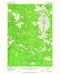 1961 Mt. Jefferson1963 Print · USGSThe Oregon Cascades at the start of the 1960s were a vast network of backcountry trails and forest service outposts. You can trace the historic Skyline Trail through the Warm Springs Indian Reservation or locate the remote John Swallow Grave and Pamelia Lake Guard Sta.3 unique versions available
 - 1961 Map of Breitenbush Hot Springs, 1964 Print
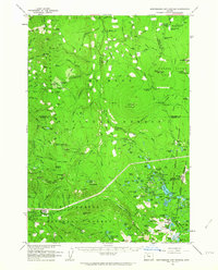 1961 Breitenbush Hot Springs1964 Print · USGSThe Oregon Cascades in the early 1960s are documented here during a period of active Forest Service management and recreational growth. Trace the development of Breitenbush Hot Springs or locate remote landmarks like the Rho Ridge Shelter and the Clackamas Ranger Sta.3 unique versions available
 - 1962 Map of Metolius Bench, 1963 Print
 1962 Metolius Bench1963 Print · USGSJefferson County’s high volcanic plateaus meet the river canyons in the early 1960s. Outdoor enthusiasts and local historians can trace the old tracks to Drift Campground and Monty Campground or locate historic water sources like Beachkomb Spring.3 unique versions available
 - 1962 Map of Opal City, 1963 Print
 1962 Opal City1963 Print · USGSCentral Oregon's high desert landscape and vital irrigation systems are documented here during the early sixties. Researchers can trace the path of the Crooked River and the development of the Oregon Trunk railway near Opal City and Peter Skene Ogden State Park.2 unique versions available
 - 1962 Map of Fly Creek, 1963 Print
 1962 Fly Creek1963 Print · USGSJefferson County’s high desert canyons and timberlands are captured here during the early 1960s as a new reservoir system begins to transform the landscape. Researchers can trace the early footprint of Lake Chinook or locate remote sites like Fly Creek Ranch and Fly Lake Lookout.2 unique versions available
 - 1962 Map of Squaw Back Ridge, 1963 Print
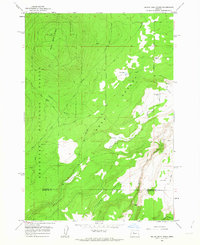 1962 Squaw Back Ridge1963 Print · USGSJefferson and Deschutes counties in the early 1960s reveal a landscape of remote ranches and high-desert canyons. Genealogists and local historians can locate the Geneva (Site) or trace family landmarks like the Squaw Flat Ranch and Rim Rock Ranch.2 unique versions available
 - 1962 Map of Gray Butte, 1963 Print
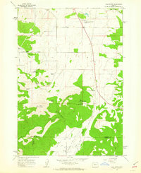 1962 Gray Butte1963 Print · USGSJefferson County ranching and water management are mapped in the early sixties as irrigation reaches the high desert. Local researchers can trace family-named water sources like Rodman Spring and visit the site of the Lone Pine Sch or Gray Butte Cem.2 unique versions available
 - 1962 Map of Prineville, 1964 Print
 1962 Prineville1964 Print · USGSCentral Oregon in the early 1960s shows a landscape of river-valley agriculture and rugged uplands centering on the growing city of Prineville. Genealogists and local historians can trace rural infrastructure from Lamonta to the Upper McKay Sch and the various Cinder Pits dotting the volcanic buttes.2 unique versions available
 - 1962 Map of Eagle Butte, 1964 Print
 1962 Eagle Butte1964 Print · USGSThe Warm Springs Indian Reservation and Agency Plains meet in the early 1960s at the confluence of the Deschutes and Warm Springs rivers. Trace local development and genealogy through the Dry Creek Cem, the Lumber Mill, and the riverside site of Mecca.
Showing maps 1-25 of 334
Top cities of Jefferson County
Frequently asked questions
- What are the different types of historical maps available for Jefferson County?
- What is the oldest map of Jefferson County?
- Where can I purchase historical maps of Jefferson County for my home or office?
- Where can I download high-res historical maps of Jefferson County?
- Are there historical topographic maps available for Jefferson County?
- Is there historical aerial imagery available for Jefferson County?
- Where are historical maps of Jefferson County sourced from?