2020s Maps of Nashville, Tennessee
Explore 20 historic maps of Nashville from the 2020s. These maps offer a rare glimpse into what life looked like during the 2020s — showing old roads, neighborhoods, homes, and landmarks that have changed or disappeared over time.
Whether you're researching your family's past, planning a metal detecting trip, or studying how Nashville's landscape evolved across the 2020s, these high-resolution maps are a powerful tool for exploring the history of this region.
- Focus on a specific era: All maps on this page are from the 2020s, giving you a focused view of this time period.
- See what’s changed: Compare century-old streets, trails, and buildings to today's modern landscape using overlays and satellite layers.
- Research with precision: Use these maps for genealogy, historical research, land use analysis, or educational projects.
- View, download, or print: Maps are fully viewable online in high resolution, and can be downloaded or printed for your own records.
Start exploring Nashville's history through authentic maps from the 2020s. This is your window into the past.
Nashville, TN maps
(20)- 2022 Map of Kingston Springs, 2022 Print
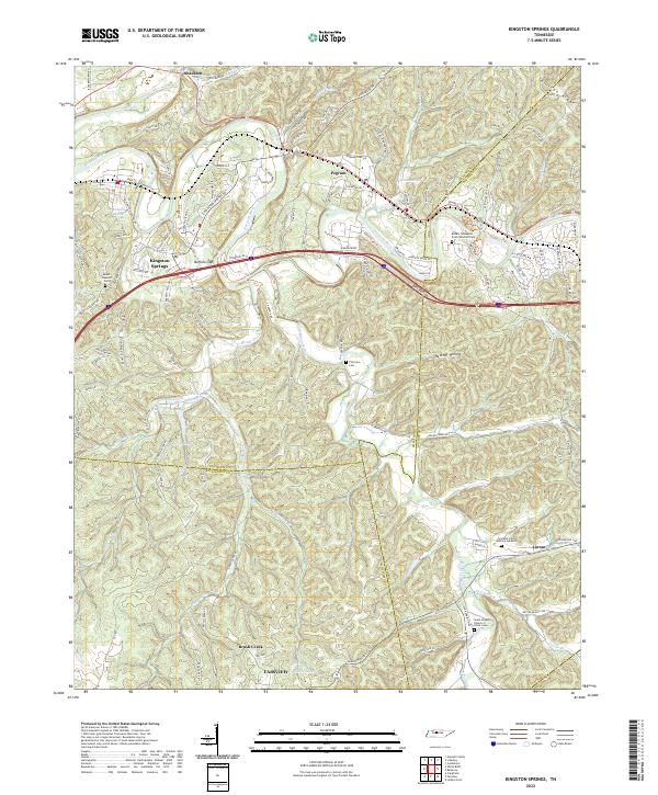 2022 Kingston Springs2022 Print · USGSThe Harpeth River valley and its surrounding hollows are captured here as they appeared in the early 2020s. Researchers can locate family landmarks like Thornton Cem, trace old routes like Old Harding Pike, or explore the settlement patterns of Kingston Springs and Linton.
 - 2022 Map of Lillamay, 2022 Print
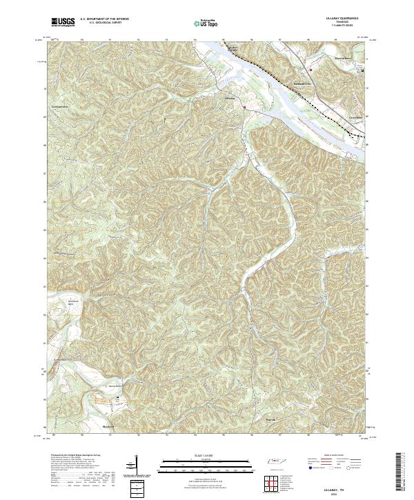 2022 Lillamay2022 Print · USGSCheatham County settlement patterns are preserved here as they appeared in the early 2020s, defined by the winding Cumberland River and prehistoric Mound Bottom. Researchers can trace local lineage through Scott Cem or locate the historic river settlements of Lillamay and Gravelotte.
 - 2022 Map of White House, 2022 Print
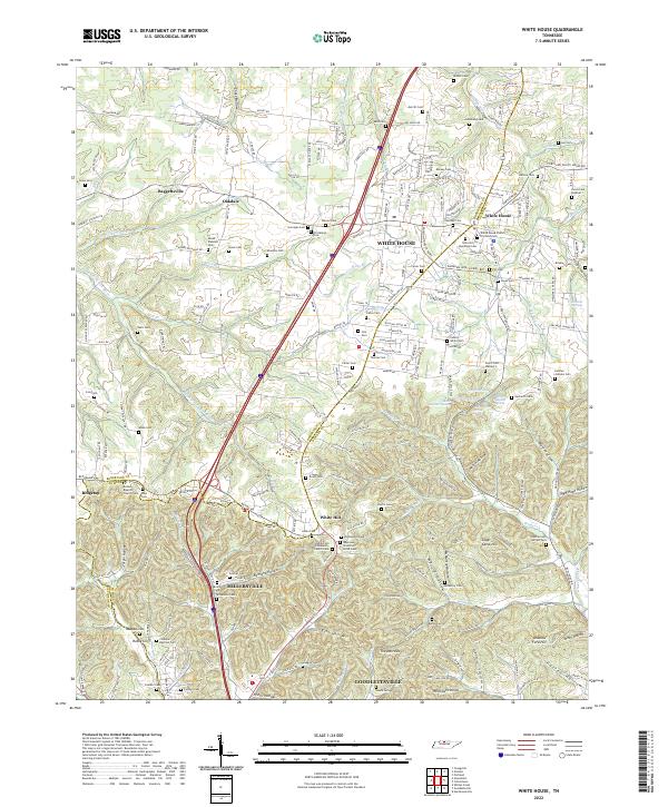 2022 White House2022 Print · USGSCovers Nashville, including Goodlettsville, White House, and other nearby areas
 - 2022 Map of Forest Grove, 2022 Print
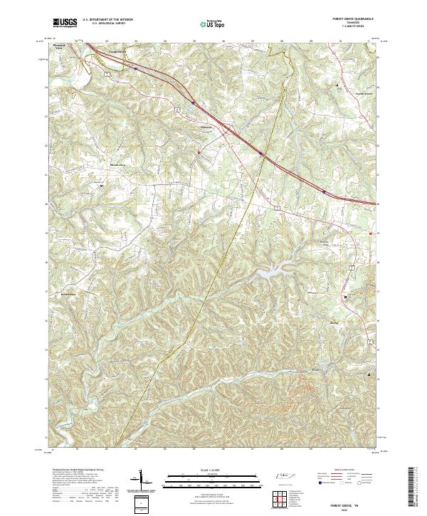 2022 Forest Grove2022 Print · USGSThe ridges and hollows of Cheatham and Robertson counties are documented here in the early twenty-first century. Researchers can locate family landmarks like Gupton Cem or trace the rural crossroads of Paradise Ridge and Bearwallow.
 - 2022 Map of Whites Creek, 2022 Print
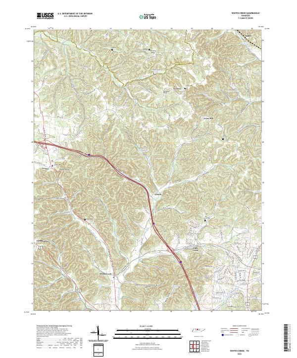 2022 Whites Creek2022 Print · USGSThe Tennessee uplands near the Robertson and Davidson county line are revealed here as a landscape of deep hollows and high ridges. Researchers can trace family history through several rural burial grounds like Union Hill Cem and settlements such as Joelton and Whites Creek.
 - 2022 Map of Antioch, 2022 Print
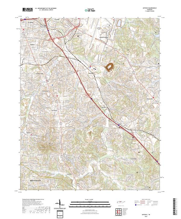 2022 Antioch2022 Print · USGSSoutheast of Nashville in the early twenty-first century, this area shows a dense mix of historical crossroads and modern suburban sprawl. Genealogists can trace family names at Whitsett Cem or Sanders Cem and locate landmarks like Mill Creek Baptist Church.
 - 2022 Map of Bellevue, 2022 Print
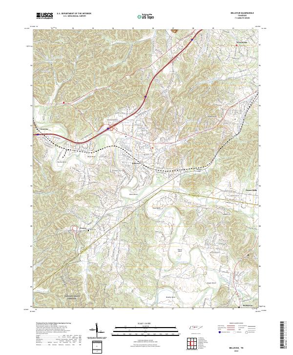 2022 Bellevue2022 Print · USGSThe Harpeth River valley and the southwestern suburbs of Nashville are captured in this modern survey. Researchers can trace historical transit routes and family-named landmarks like Pasquo Cem, the Natchez Trace Parkway, and Vaughns Gap.
 - 2022 Map of Springfield South, 2022 Print
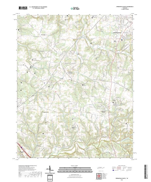 2022 Springfield South2022 Print · USGSThe rural stretches south of SPRINGFIELD come into focus during the early twenty-first century as old family homesteads meet modern suburban growth. Genealogists can trace dozens of burial sites including Billy Cothron Cem and Saint Michaels Cem near Flewellyn.
 - 2022 Map of Hendersonville, 2022 Print
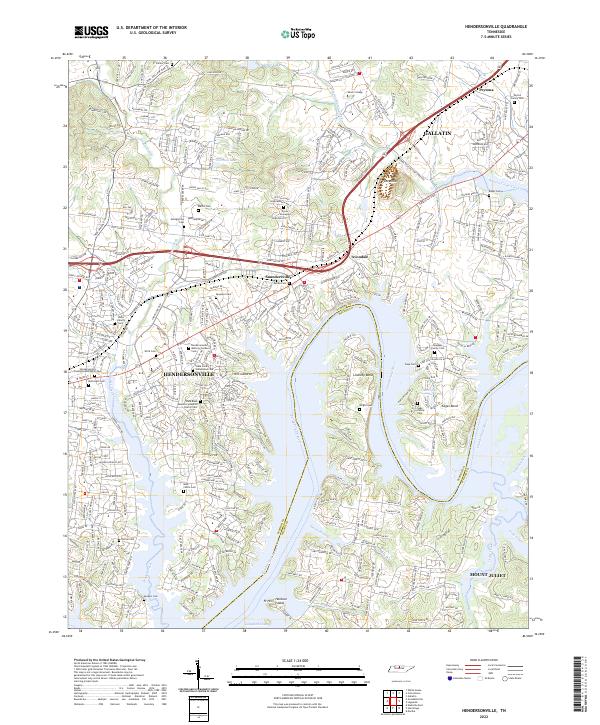 2022 Hendersonville2022 Print · USGSThe Sumner County lakefront south of Gallatin is shown here in the early twenty-first century as suburban growth meets the historic Cumberland River. Trace family roots at the Stark Family Homestead Cem or explore the landscape around Pilot Knob and Saundersville.
 - 2022 Map of Scottsboro, 2022 Print
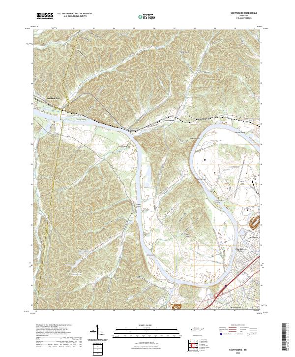 2022 Scottsboro2022 Print · USGSThe western edges of Nashville and the Cumberland River bends come into focus in this early 2020s study. Genealogists and historians can trace the landscape from established neighborhoods like Charlotte Park to the river landmarks of Whartons Bar and Robertson Island.
 - 2022 Map of Nolensville, 2022 Print
 2022 Nolensville2022 Print · USGSNolensville and its surrounding ridges come into focus in this contemporary study of the Williamson County landscape. Researchers can locate dozens of family-named burial sites such as Jane Hamer Cem and McCanless Cem, alongside landmarks like McMahan Knob.
 - 2022 Map of Goodlettsville, 2022 Print
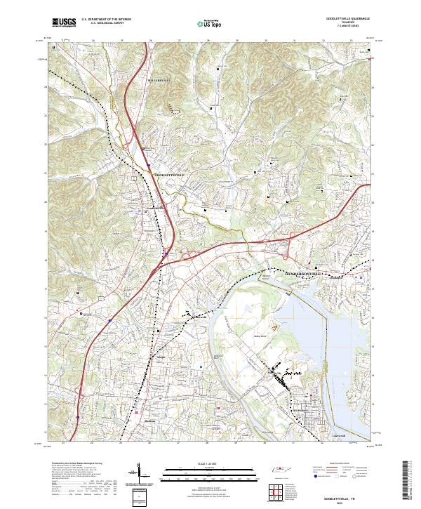 2022 Goodlettsville2022 Print · USGSThe northern Nashville suburbs and the Cumberland River valley appear in high detail during this recent period of growth. Researchers can trace numerous family burial sites and historical landmarks like the Bowen Campbell House Cem, Lutons Cem, and the Middle Tennessee School of Anesthesia.
 - 2022 Map of Greenbrier, 2022 Print
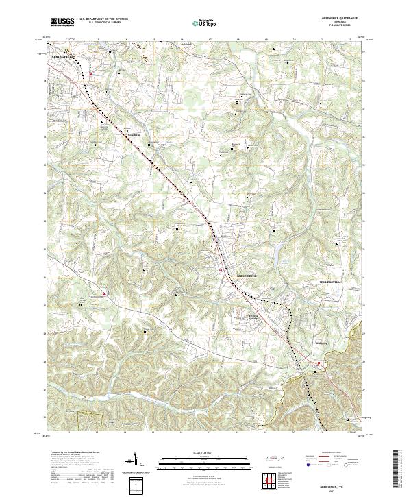 2022 Greenbrier2022 Print · USGSThe southern Robertson County plateau comes to life in this survey of the communities between Springfield and Ridgetop. Genealogists and historians can trace dozens of family-named landmarks including Wartrace Cem, Hygeia Springs, and Lutons Cem.
 - 2022 Map of Oak Hill, 2022 Print
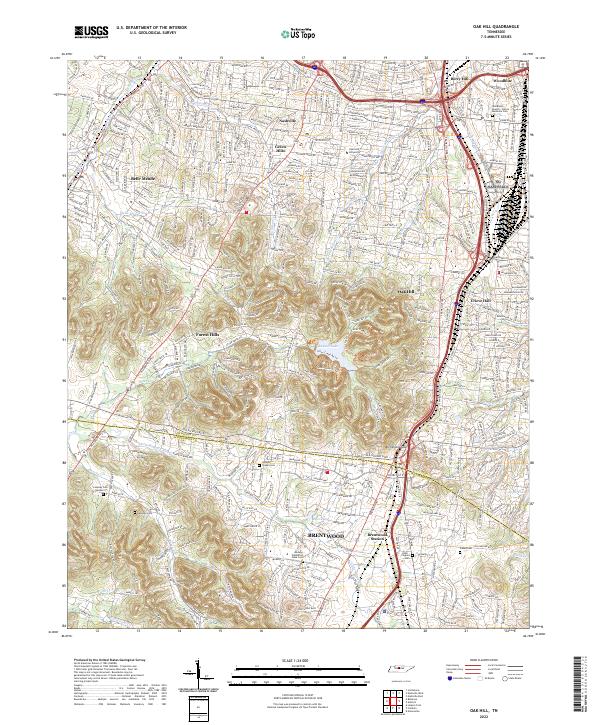 2022 Oak Hill2022 Print · USGSThe southern suburbs of Nashville and the city of Brentwood are shown here in the 2020s as modern development meets legacy landmarks. Researchers can trace historic sites like the Midway Plantation Slave Cem, Johnson Chapel Cem, and Lipscomb University.
 - 2022 Map of La Vergne, 2022 Print
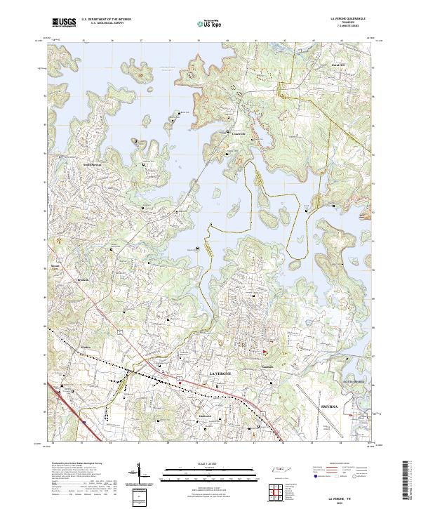 2022 La Vergne2022 Print · USGSThe La Vergne and Smyrna corridor is shown here during a period of significant growth along the J Percy Priest Reservoir. Local historians can trace dozens of small family burial sites like Pugh Cem and Mabry Cem tucked between modern residential developments.
 - 2022 Map of Hermitage, 2022 Print
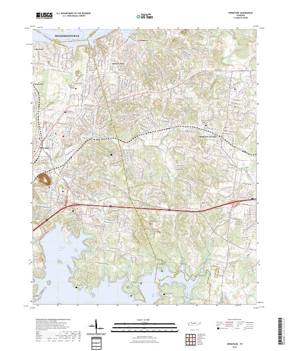 2022 Hermitage2022 Print · USGSThe eastern Nashville suburbs near Hermitage and Mount Juliet come alive in this detailed recent survey. Genealogists can trace family heritage through numerous burial sites like John G Gleaves Cem, Cowgill Cem, and Jenkins Cem tucked along the Stoners Cr watershed.
 - 2022 Map of Nashville West, 2022 Print
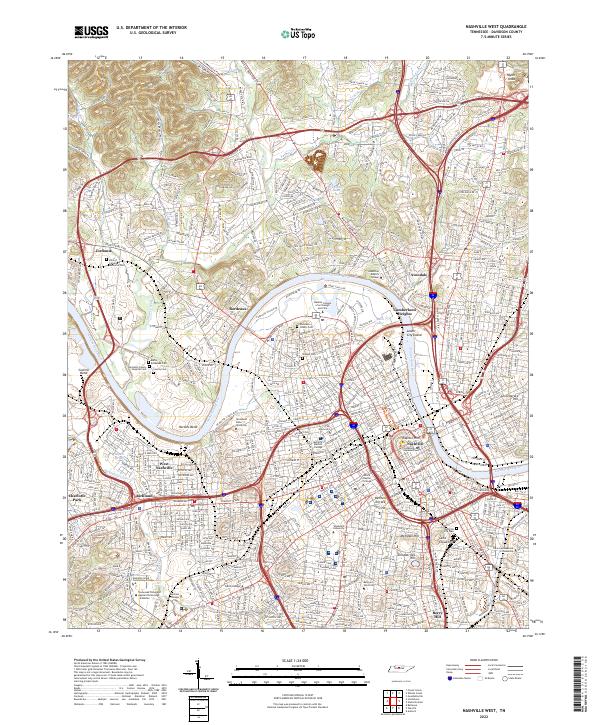 2022 Nashville West2022 Print · USGSThe Tennessee state capital and its surrounding Davidson County suburbs are mapped here during a period of significant urban density. Researchers can trace historic burial sites like the Nashville City Cem and the grounds of institutions such as Vanderbilt University and Capitol Hill.
 - 2022 Map of Nashville East, 2022 Print
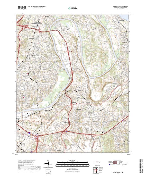 2022 Nashville East2022 Print · USGSEastern Nashville and the Cumberland River bends come alive in this recent survey. Researchers can trace family history at Nashville National Cem or explore established neighborhoods like Donelson, Inglewood, and Mudtavern.
 - 2022 Map of Fairview, 2022 Print
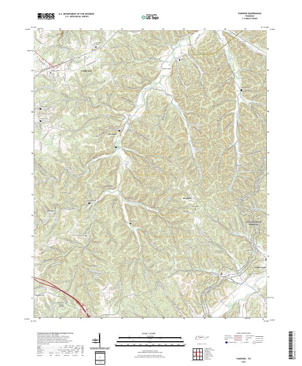 2022 Fairview2022 Print · USGSThe hills of Williamson and Davidson counties appear in sharp detail during this modern era of development. Genealogists can locate family burial grounds like Pewitt Cem and King Cem while tracing the winding path of the South Harpeth River.
 - 2022 Map of Smyrna, 2022 Print
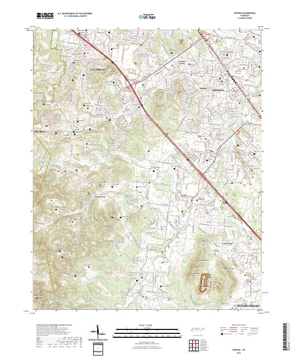 2022 Smyrna2022 Print · USGSRutherford County in the early twenty-first century shows a fascinating blend of rapid development and preserved family history. Genealogists can trace ancestral sites like the Sam Davis Cem, Hill-Roulhac Cem, and the community of Rocky Fork.
End of results
Showing maps 1-20 of 20
Top cities near Nashville
- Franklin historical maps
- Hendersonville historical maps
- Smyrna historical maps
- Brentwood historical maps
- La Vergne historical maps
- North Nashville historical maps
See more
Top neighborhoods of Nashville
- Town Park Estates historical maps
- Barclay Square historical maps
- Antioch historical maps
- Antioch Park historical maps
- Green Hills historical maps
- Huntington Ridge Estates historical maps
See more
Frequently asked questions
- What are the different types of historical maps available for Nashville?
- What is the oldest map of Nashville?
- Where can I purchase historical maps of Nashville for my home or office?
- Where can I download high-res historical maps of Nashville?
- Are there historical topographic maps available for Nashville?
- Is there historical aerial imagery available for Nashville?
- Where are historical maps of Nashville sourced from?