1950s Maps of Sevier County, Tennessee
Explore 12 historic maps of Sevier County from the 1950s. These maps offer a rare glimpse into what life looked like during the 1950s — showing old roads, neighborhoods, homes, and landmarks that have changed or disappeared over time.
Whether you're researching your family's past, planning a metal detecting trip, or studying how Sevier County's landscape evolved across the 1950s, these high-resolution maps are a powerful tool for exploring the history of this region.
- Focus on a specific era: All maps on this page are from the 1950s, giving you a focused view of this time period.
- See what’s changed: Compare century-old streets, trails, and buildings to today's modern landscape using overlays and satellite layers.
- Research with precision: Use these maps for genealogy, historical research, land use analysis, or educational projects.
- View, download, or print: Maps are fully viewable online in high resolution, and can be downloaded or printed for your own records.
Start exploring Sevier County's history through authentic maps from the 1950s. This is your window into the past.
Sevier County, TN maps
(12)- 1953 Map of Wear Cove, 1954 Print
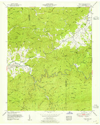 1953 Wear Cove1954 Print · USGSThe coves and ridges of Blount and Sevier Counties are captured here just as the national park era was maturing. Genealogists and hikers can trace old family sites like Hatchertown, find the Park Settlement School, and locate The Sinks along the Little River.2 unique versions available
 - 1953 Map of Shooks Gap, 1954 Print
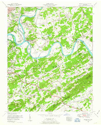 1953 Shooks Gap1954 Print · USGSEast of Knoxville in the early fifties, the landscape was a mix of river-bottom farms and rising suburban development. Genealogists can find family landmarks like McCammon Cemetery, industrial sites at Meades Quarry, and the historic Riverdale Ferry crossing.3 unique versions available
 - 1953 Map of Wildwood, 1955 Print
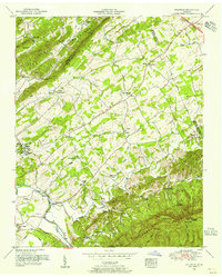 1953 Wildwood1955 Print · USGSIn the mid-1950s, this portion of Blount County shows a landscape of family farms and mountain ridges along the Little River. Genealogists can trace family names at Headrick Cemetery and McCampbell Cemetery or locate community centers like Eusebia Church and the Klondike School.5 unique versions available
 - 1953 Map of Walden Creek, 1955 Print
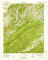 1953 Walden Creek1955 Print · USGSSevier County in the early fifties shows a landscape of deep hollows and high ridges before the era of modern development. Genealogists can trace family roots through numerous mountain churches and schools like Antioch Church, Benson School, and Ivy Hill Cemetery.4 unique versions available
 - 1953 Map of Boyds Creek, 1955 Print
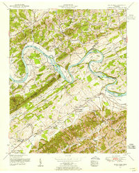 1953 Boyds Creek1955 Print · USGSThe French Broad River valley at the Sevier and Knox county line was a network of island farms and rural schoolhouses in the early fifties. Genealogists can trace family roots through the John Sevier Monument, Peters Mill, and the Harrison-Chilhowee Academy.3 unique versions available
 - 1953 Map of Mascot, 1958 Print
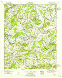 1953 Mascot1958 Print · USGSEast Tennessee river life and rail industry are captured here in the mid-fifties as the Andrew Johnson Highway was first being built. Genealogists and historians can trace family roots through numerous landmarks like Carter Mill, Wyricktown, and the McBee Cemetery.
 - 1955 Map of Knoxville
 1955 Knoxville1955 Print · USGSThe Southern Appalachians and the Smoky Mountains are shown here at a peak of mid-century development and conservation. Genealogists and historians can trace the early road networks connecting Gatlinburg, Waynesville, and the Cherokee Indian Reservation across the high ridges.
 - 1955 Map of Johnson City
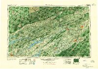 1955 Johnson City1955 Print · USGSEast Tennessee and the bordering highlands of Virginia and Kentucky appear here during the post-war industrial boom. You can trace the complex network of mountain ridges and new TVA lakes, from Johnson City to the coalfields near Middlesboro and Lynch.
 - 1956 Map of Gatlinburg, 1957 Print
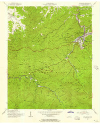 1956 Gatlinburg1957 Print · USGSGatlinburg and the Smokies are shown here in the mid-fifties, capturing the early development of this gateway community and the national park. Researchers can trace historic sites like Elkmont, Banner Sch, and the Sugarlands Ranger Station.2 unique versions available
 - 1956 Map of Pigeon Forge, 1958 Print
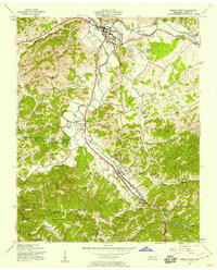 1956 Pigeon Forge1958 Print · USGSSevier County was undergoing a significant shift toward modern tourism during the 1950s. Genealogists and local historians can trace family homesteads near Henderson Springs, locate old burials at Shiloh Mem Cem, or identify vanished landmarks like the Drive-in Theater.3 unique versions available
 - 1957 Map of Knoxville, 1966 Print
 1957 Knoxville1966 Print · USGSThe Southern Appalachians of Tennessee and North Carolina are mapped here during the mid-twentieth century as new highways reached the high country. Genealogists and historians can trace the topography between Knoxville and Asheville, locating family landmarks near Fontana Lake or along the Blue Ridge Parkway.4 unique versions available
 - 1957 Map of Johnson City, 1966 Print
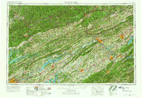 1957 Johnson City1966 Print · USGSUpper East Tennessee and Southwest Virginia are shown here during the mid-sixties transition of the Appalachians. Researchers can trace the industrial rail hubs of Kingsport, the sprawling waters of Cherokee Lake, and the historic Cumberland Gap.
End of results
Showing maps 1-12 of 12
Top cities of Sevier County
- Sevierville historical maps
- Pigeon Forge historical maps
- Gatlinburg historical maps
- Pittman Center historical maps
Frequently asked questions
- What are the different types of historical maps available for Sevier County?
- What is the oldest map of Sevier County?
- Where can I purchase historical maps of Sevier County for my home or office?
- Where can I download high-res historical maps of Sevier County?
- Are there historical topographic maps available for Sevier County?
- Is there historical aerial imagery available for Sevier County?
- Where are historical maps of Sevier County sourced from?