1970s Maps of La Salle County, Texas
Explore 20 historic maps of La Salle County from the 1970s. These maps offer a rare glimpse into what life looked like during the 1970s — showing old roads, neighborhoods, homes, and landmarks that have changed or disappeared over time.
Whether you're researching your family's past, planning a metal detecting trip, or studying how La Salle County's landscape evolved across the 1970s, these high-resolution maps are a powerful tool for exploring the history of this region.
- Focus on a specific era: All maps on this page are from the 1970s, giving you a focused view of this time period.
- See what’s changed: Compare century-old streets, trails, and buildings to today's modern landscape using overlays and satellite layers.
- Research with precision: Use these maps for genealogy, historical research, land use analysis, or educational projects.
- View, download, or print: Maps are fully viewable online in high resolution, and can be downloaded or printed for your own records.
Start exploring La Salle County's history through authentic maps from the 1970s. This is your window into the past.
La Salle County, TX maps
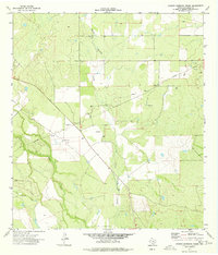
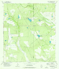
(20)- 1974 Map of Piedra Creek SW, 1977 Print
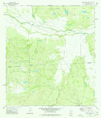 1974 Piedra Creek SW1977 Print · USGSThe South Texas brush country along the Nueces River comes into focus during the mid-seventies. Researchers can trace the ranching legacy of the Welder Dobie Ranch or locate early industrial markers like the Flowing Well and Gravel Pits.
 - 1974 Map of Snake Creek, 1977 Print
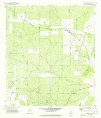 1974 Snake Creek1977 Print · USGSSouth Texas ranch and oil country come into focus during the mid-seventies where four counties meet. Trace the industrial landscape of the Big Wells Oil Field and old fence lines near the settlement of Baggett and Snake Creek.
 - 1974 Map of Burns Ranch, 1977 Print
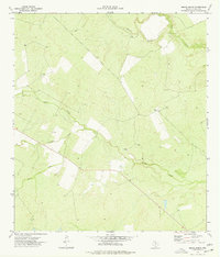 1974 Burns Ranch1977 Print · USGSSouth Texas ranch land near the Frio River is captured here in the mid-1970s. Trace the pastoral boundaries and hydrology of Burns Ranch along Cibolo Creek and Slaughter Creek.
 - 1974 Map of Flying W Ranch, 1977 Print
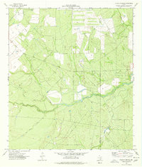 1974 Flying W Ranch1977 Print · USGSRanching and early energy development define this Dimmit County landscape in the mid-seventies. Researchers can trace land use through family-named properties like Flying W Ranch and waterway networks along the Nueces River and San Roque Creek.
 - 1974 Map of Woodward, 1977 Print
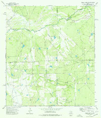
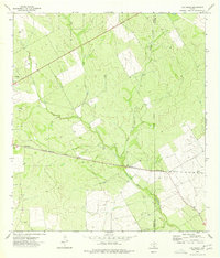
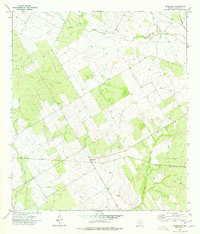 1974 Woodward1977 Print · USGSLa Salle County ranching and rail infrastructure are captured here in the mid-seventies just as the landscape was being mapped from the air. Researchers can trace the Missouri Pacific line through Woodward and locate family landmarks like the Schulze site or the local Cem.
 - 1974 Map of Caiman Creek SE, 1977 Print
 1974 Caiman Creek SE1977 Print · USGSThe brush country along the La Salle and Webb border in the mid-1970s reveals a landscape of ranching and oil exploration. Researchers can trace the path of the Nueces River and locate remote landmarks like the Landing Strip and Monte Cortado.
 - 1974 Map of Dilley, 1977 Print
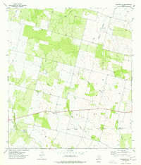
 1974 Dilley1977 Print · USGSThe South Texas brush country around Dilley appears here in the mid-1970s, shaped by the confluence of the Frio and Leona rivers. Researchers can trace local landmarks like the Winter Garden Rodeo Ground, the Missouri Pacific rail line, and the Hugo Cem.
 - 1974 Map of Caiman Creek NE, 1977 Print
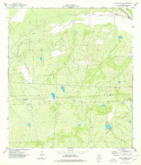
 1974 Caiman Creek NE1977 Print · USGSThe Nueces River valley in the mid-1970s reveals a quiet landscape of cattle ranching and early energy exploration. Genealogists and historians can trace the site of Hist Mon (Ft Ewell) and water sources like Flowing Well and La Mata Lake.
 - 1974 Map of Piedra Creek SE, 1977 Print
 1974 Piedra Creek SE1977 Print · USGSThe South Texas brush country at the meeting of four counties is captured here in the mid-1970s. Researchers can trace family landmarks like the Adami Cem or map the energy footprint of the Rodriguez Oil Field and scattered Gas Wells.
 - 1974 Map of Harris Lake, 1977 Print
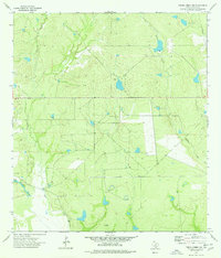
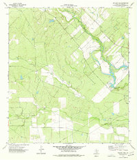
 1974 Harris Lake1977 Print · USGSLa Salle County ranch lands and the winding river corridor are documented here during the 1970s. Genealogists and researchers can trace the reach of the Cochina Ranch and local infrastructure like the Missouri Pacific railroad near Cotulla.
 - 1974 Map of Piedra Creek NW, 1977 Print
 1974 Piedra Creek NW1977 Print · USGSLa Salle County ranch lands are captured here during the mid-1970s, showing a landscape shaped by water and oil exploration. Researchers can locate a family Cem near La Mata Lake or trace industrial features like the Landing Strip and Gravel Pit.
 - 1974 Map of Millett, 1977 Print
 1974 Millett1977 Print · USGSSouth Texas ranching and rail life are captured here in the mid-seventies, centered on the Missouri Pacific corridor. Genealogists can trace the footprint of Millett and Gardendale or locate the local Cem and Gravel Pit.
 - 1974 Map of Charco Marrano Creek, 1977 Print
 1974 Charco Marrano Creek1977 Print · USGSThe Nueces River valley in the mid-1970s reveals a landscape transitioning from traditional ranching to an active energy field. Researchers can trace the sprawling Black Ranch alongside an increasing density of Gas Wells and Oil Well sites.
 - 1974 Map of Woodward NE, 1977 Print
 1974 Woodward NE1977 Print · USGSSouth Texas brush country during the mid-seventies reveals a landscape of isolated ranching outposts and winding creek beds. Genealogists and local historians can locate St Mary Chapel, Covey Chapel Cem, and the shifting waters of Dry Cibolo Creek.
 - 1974 Map of Los Angeles, 1977 Print
 1974 Los Angeles1977 Print · USGSLa Salle County ranch land is captured in the mid-1970s, showcasing the rural settlement of Los Angeles. Genealogists and historians can trace the Old Railroad Grade and remote landmarks like the Pearce Radio Facility across the brush country.
 - 1974 Map of Cotulla, 1977 Print
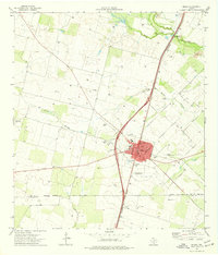
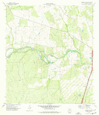
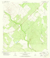
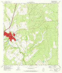 1974 Cotulla1977 Print · USGSThe county seat of Cotulla thrives alongside the Nueces River in the mid-1970s as a hub for the Missouri Pacific railroad. Genealogists and researchers can trace local landmarks like the Cem, Jr High Sch, and the outlying settlement of Altita.
 - 1974 Map of Piedra Creek NE, 1977 Print
 1974 Piedra Creek NE1977 Print · USGSThe South Texas brush country at the La Salle and McMullen county line reveals a landscape of ranching and oil exploration in the mid-1970s. Researchers can locate family landmarks like Cameron Ranch and various water sources such as Coma Tank and Piedra Creek.
 - 1974 Map of Holland Dam, 1977 Print
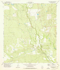
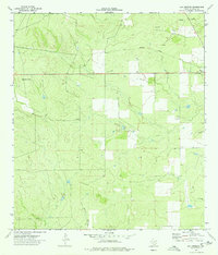
 1974 Holland Dam1977 Print · USGSLa Salle County's river-bottom lands are captured here in the mid-seventies, showing a landscape defined by water and early energy infrastructure. Researchers can trace the path of the Nueces River or locate the Holland Dam Spillway 347 and the local Gas Well.
 - 1974 Map of Dilley NE, 1977 Print
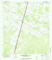
 1974 Dilley NE1977 Print · USGSSouth Texas ranch and brush country comes into focus in the mid-seventies as the Frio River winds through the borderlands. Researchers can trace land use near the Frio and La Salle county line or locate old operations like the Gravel Pits.
 - 1974 Map of Las Vegas, 1977 Print
 1974 Las Vegas1977 Print · USGSThe South Texas brush country at the Dimmit and La Salle county line is captured here in the mid-1970s. Trace the Missouri Pacific railroad through Las Vegas and Sage or locate the numerous Oil Wells and Drill Holes dotting the landscape.
End of results
Showing maps 1-20 of 20
Top cities of La Salle County
Frequently asked questions
- What are the different types of historical maps available for La Salle County?
- What is the oldest map of La Salle County?
- Where can I purchase historical maps of La Salle County for my home or office?
- Where can I download high-res historical maps of La Salle County?
- Are there historical topographic maps available for La Salle County?
- Is there historical aerial imagery available for La Salle County?
- Where are historical maps of La Salle County sourced from?