1980s Maps of Emery County, Utah
Explore 71 historic maps of Emery County from the 1980s. These maps offer a rare glimpse into what life looked like during the 1980s — showing old roads, neighborhoods, homes, and landmarks that have changed or disappeared over time.
Whether you're researching your family's past, planning a metal detecting trip, or studying how Emery County's landscape evolved across the 1980s, these high-resolution maps are a powerful tool for exploring the history of this region.
- Focus on a specific era: All maps on this page are from the 1980s, giving you a focused view of this time period.
- See what’s changed: Compare century-old streets, trails, and buildings to today's modern landscape using overlays and satellite layers.
- Research with precision: Use these maps for genealogy, historical research, land use analysis, or educational projects.
- View, download, or print: Maps are fully viewable online in high resolution, and can be downloaded or printed for your own records.
Start exploring Emery County's history through authentic maps from the 1980s. This is your window into the past.
Emery County, UT maps
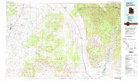
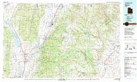
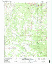
(71)- 1980 Map of Loa
 1980 Loa1980 Print · USGSCentral Utah's high plateaus and the Fremont River corridor are captured here during the 1980s, showcasing a landscape of high-elevation reservoirs and remote ranching outposts. Genealogists can trace family names and early settlements from Loa and Teasdale to the orchards of Fruita.2 unique versions available
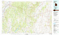
 - 1980 Map of Huntington, 1981 Print
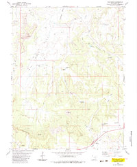
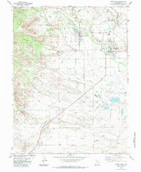
 1980 Huntington1981 Print · USGSEmery and Carbon County landscapes are captured here during the early eighties, showcasing a region defined by high plateaus and mining towns. Researchers can trace the Denver and Rio Grande Western Railroad corridor and locate landmarks like the Cleveland-Lloyd Dinosaur Quarry and Hiawatha.
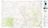
 - 1980 Map of Salina, 1981 Print
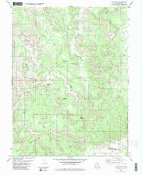
 1980 Salina1981 Print · USGSCentral Utah in the late twentieth century reveals a landscape of high plateaus and transit corridors. Trace the Denver and Rio Grande Western RR past Salina or locate remote sites like Browning Mine and Fish Lake.2 unique versions available
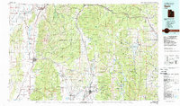
 - 1980 Map of Hanksville, 1987 Print
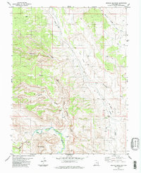
 1980 Hanksville1987 Print · USGSHanksville and the surrounding high desert are captured in the early 1980s, showcasing a landscape of dramatic topography and isolated outposts. Researchers can trace the rugged drainage of the Dirty Devil River and locate landmarks like the Factory Butte Mine and Robbers Roost Flats.2 unique versions available
 - 1981 Map of Nephi
 1981 Nephi1981 Print · USGSThe Juab and Sanpete valleys of central Utah are captured here in the early 1980s, during a period of established mountain settlement and rail-based commerce. Researchers can trace the routes of the Union Pacific and visit traditional communities like Nephi, Mount Pleasant, and Scofield.3 unique versions available
 - 1981 Map of Manti
 1981 Manti1981 Print · USGSCentral Utah in the early eighties shows a landscape of mountain-fed valleys and high plateau coal mines. Trace the rail lines of the Denver and Rio Grande Western or locate family roots in Gunnison, Orangeville, or Castle Dale.2 unique versions available
 - 1983 Map of San Rafael Knob
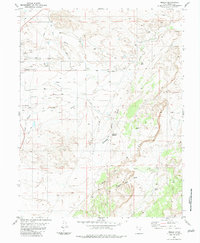
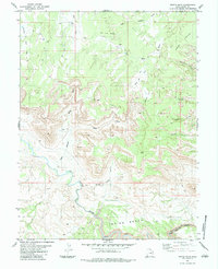
 1983 San Rafael Knob1983 Print · USGSThe San Rafael Swell in the late 1970s was a landscape of remote resource extraction and striking geology. Trace early access routes through Rods Valley to find secluded Mines, Prospect sites, and landmarks like San Rafael Knob.2 unique versions available
 - 1983 Map of Molen
 1983 Molen1983 Print · USGSEmery County agriculture and desert topography are documented here in the early 1980s. Local historians and researchers can trace vital water systems like the Dutch Flat Aqueduct, find the local Cem, and explore the geologically distinct Molen Reef.
 - 1983 Map of Sids Mountain
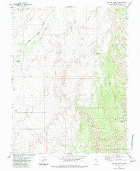
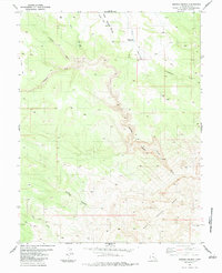
 1983 Sids Mountain1983 Print · USGSEmery County in the early eighties shows a landscape of dramatic river canyons and high desert plateaus. Trace the historic Salt Wash Trail through the Chalk Hills or explore the deep bends of the Little Grand Canyon and the crossings at Fuller Bottom.
 - 1983 Map of Devils Hole
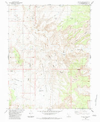
 1983 Devils Hole1983 Print · USGSEmery County's high desert plateaus and deep river canyons are captured here in the early 1980s. Trace the winding San Rafael River past Indian Bench or locate old water sources like Moonshine Waterhole and the steep narrows of the Black Box.2 unique versions available
 - 1983 Map of Sid and Charley
 1983 Sid and Charley1983 Print · USGSEmery County during the early 1980s is documented here as a vast network of canyons and mesas before modern recreation increased in the region. Researchers can trace historic access routes along Jeep Trails to reach landmarks like Sid and Charley and Secret Mesa.
 - 1983 Map of Ireland Mesa
 1983 Ireland Mesa1983 Print · USGSEmery County's high desert reveals its complex topography in the early eighties, from the high Ireland Mesa to the flats of Mussentuchit Flat. Researchers can trace remote desert landmarks like The Hondu (Natural Arch), the Slaughter Slopes Reservoir, and a secluded Mine.
 - 1983 Map of Big Bend Draw
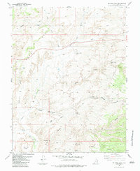 1983 Big Bend Draw1983 Print · USGSEmery County's high desert landscape is shown here in the early eighties, centered on the dramatic turn of Muddy Creek at The Big Bend. Local history researchers can trace old desert routes to remote water sources like Clyde and Neils Pond and Devils Canyon Spring.
 - 1983 Map of Drowned Hole Draw
 1983 Drowned Hole Draw1983 Print · USGSThe San Rafael River country of Emery County is captured here in the mid-seventies, showing a landscape of high benches and desert drainage. Researchers can trace remote landmarks like the Landing Strip, The Sinkhole, and the canyons of the Black Box.
 - 1983 Map of The Wickiup
 1983 The Wickiup1983 Print · USGSThe high-desert terrain of Emery County, Utah, is captured here in the early 1980s, documenting a landscape of remote resource exploration. Researchers can trace historic water sources like Mexican Seep and Sids Holes alongside early mining Prospects near The Wickiup.
 - 1983 Map of The Blocks
 1983 The Blocks1983 Print · USGSEmery County, Utah, is shown in the 1980s as a landscape of dramatic geological features and remote desert washes. Geologists and local historians can trace landmarks like The Blocks, the Devils Racetrack, and the Reid Neilson Reservoir.2 unique versions available
 - 1983 Map of Mexican Mountain
 1983 Mexican Mountain1983 Print · USGSEmery County's high desert was a landscape of deep canyons and geological barriers in the early 1980s. Trace the path of the San Rafael River through the Black Box or locate the trace of an Old Railroad Grade and isolated Springs.
 - 1983 Map of Castle Dale
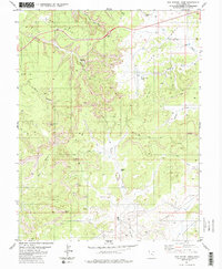
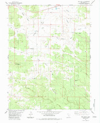
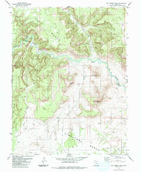
 1983 Castle Dale1983 Print · USGSEmery County during the early 1980s shows a landscape of desert agriculture and growing industrial utility. Genealogists and historians can trace the foundations of Orangeville and Castle Dale, including the High Sch, local Cem, and the Power Plant.
 - 1983 Map of Twin Knolls
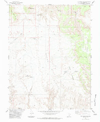
 1983 Twin Knolls1983 Print · USGSEmery County, Utah, is shown in the early 1980s as a landscape of high flats and remote water holes. Researchers can trace land use and exploration through features like Earls Road, the Georges Draw Well, and Prospects near Block Mountain.2 unique versions available
 - 1983 Map of Short Canyon
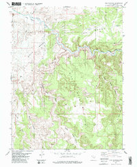
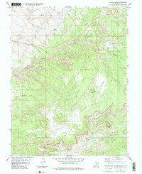
 1983 Short Canyon1983 Print · USGSEmery County was undergoing refined land-use study in the early eighties as ranching and geology converged along the Molen Reef. Researchers can trace the water history of this arid landscape through Rochester Reservoir, Hiram Corral Spring, and the John McDonald Hole.
 - 1983 Map of The Frying Pan
 1983 The Frying Pan1983 Print · USGSEmery and Wayne Counties are captured in the early eighties at the intersection of high desert ranching and resource management. Researchers can trace remote water improvements and trails through The Frying Pan, Horse Heaven Reservoir, and Last Chance Well.3 unique versions available
 - 1983 Map of Copper Globe
 1983 Copper Globe1983 Print · USGSEmery County's high desert landscape is shown here in the early eighties, highlighting a rugged network of mining and exploration. Researchers can trace the industrial footprint of the Copper Globe Mine and the Lucky Strike Mine alongside isolated landmarks like the Landing Strip on Sagebrush Bench.2 unique versions available
 - 1983 Map of Arsons Garden
 1983 Arsons Garden1983 Print · USGSThe San Rafael Swell's eastern edge is captured here in the early eighties, showcasing a landscape of uplifted reefs and deep desert canyons. Researchers can trace the path of the JEEP TRAIL across Cliff Dweller Flat or locate the seasonal Hyde Draw Reservoir.
 - 1983 Map of Moab
 1983 Moab1983 Print · USGSThe Colorado River corridor near Moab is captured here in the early eighties, showcasing a landscape of uranium mining and iconic parklands. Trace the Denver and Rio Grande Western RR as it passes through Cisco or locate landmarks like Delicate Arch and the Telluride Mines.3 unique versions available
 - 1983 Map of Bottleneck Peak
 1983 Bottleneck Peak1983 Print · USGSEmery County, Utah, is seen here in the early eighties as a landscape of deep canyons and prominent mesas. Researchers can trace the winding San Rafael River past geologic landmarks like Bottleneck Peak and numerous Mines on Calf Mesa.
Showing maps 1-25 of 71
Top cities of Emery County
- Huntington historical maps
- Castle Dale historical maps
- Ferron historical maps
- Orangeville historical maps
- Green River historical maps
- Cleveland historical maps
See more
Frequently asked questions
- What are the different types of historical maps available for Emery County?
- What is the oldest map of Emery County?
- Where can I purchase historical maps of Emery County for my home or office?
- Where can I download high-res historical maps of Emery County?
- Are there historical topographic maps available for Emery County?
- Is there historical aerial imagery available for Emery County?
- Where are historical maps of Emery County sourced from?