Old Maps of Parowan, Utah for Hiking & Exploration
Hike through history with 10 historic maps of Parowan. Explore old trails, ghost towns, and forgotten backroads — perfect for outdoor adventurers and local explorers.
- Rediscover forgotten places: Map out old mining camps, roads, and footpaths that no longer exist on modern maps.
- Layer with modern tools: Combine with LiDAR or satellite views to plan hikes through historical terrain.
- Made for exploration: Popular among hikers, overlanders, and local history lovers.
Use these maps to find adventure and explore the hidden past of Parowan.
Parowan, UT maps
(10)- 1886 Map of Kanab
 1886 Kanab1886 Print · USGSSouthern Utah in the late nineteenth century remains a frontier of deep canyons and high plateaus. Researchers can trace early pioneer outposts and river settlements like Orderville, Mt. Carmel, and Kanab tucked beneath the Vermilion Cliffs.5 unique versions available
 - 1953 Map of Cedar City, 1966 Print
 1953 Cedar City1966 Print · USGSSouthwestern Utah's high plateaus and desert basins are mapped here during the mid-fifties, showing the region before the modern interstate system. Researchers can trace historic mining at Silver Reef, follow the Union Pacific line, and locate early settlements like Kanarraville and Toquerville.3 unique versions available
 - 1958 Map of Cedar City
 1958 Cedar City1958 Print · USGSSouthwestern Utah in the late fifties was a land of mineral extraction and monumental landscapes. Genealogists and historians can trace pioneer-era settlements like Grafton and Parowan alongside industrial sites such as the Silver Reef Mine.2 unique versions available
 - 1962 Map of Cedar City
 1962 Cedar City1962 Print · USGSSouthern Utah in the early sixties showcases a landscape of dramatic plateaus and historic mining outposts. Trace the early settlement patterns at the Silver Reef (ruins), locate the Iron Mine near the Hurricane Cliffs, or find the Fort Harmony Monument.
 - 1971 Map of Summit, 1975 Print
 1971 Summit1975 Print · USGSIron County in the early 1970s shows a landscape of high desert water management and rural industry. You can trace the development of Summit and find specialized landmarks like the Cinder Pit near Cinder Hill or the historic Cem on the valley's edge.
 - 1971 Map of Parowan, 1975 Print
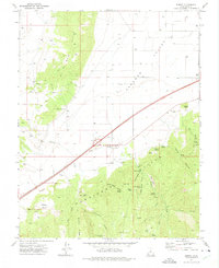
 1971 Parowan1975 Print · USGSParowan and the surrounding valley are captured in the early seventies as the community balanced its agricultural roots with forest recreation. Trace local landmarks from the City Airport to the high camps at Vermillion Castle Campground and Yankee Meadows Reservoir.2 unique versions available
 - 1980 Map of Panguitch, 1981 Print
 1980 Panguitch1981 Print · USGSThe high plateau country of Southern Utah is captured here in the early eighties, centered on the Sevier River and the gateway town of Panguitch. Researchers can trace the boundaries of Bryce Canyon National Park and find local landmarks like Ruby's Inn, Panguitch Lake, and Hatch.2 unique versions available
 - 2002 Map of Parowan, 2005 Print
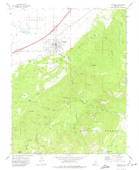
 2002 Parowan2005 Print · USGSParowan sits at the foot of the Hurricane Cliffs during a period of steady growth in the high desert of Iron County. Researchers can trace the town's expansion toward the City Airport and locate landmarks like the Cem and Parowan High Sch.
 - 2023 Map of Parowan, 2023 Print
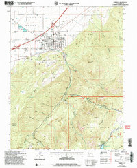
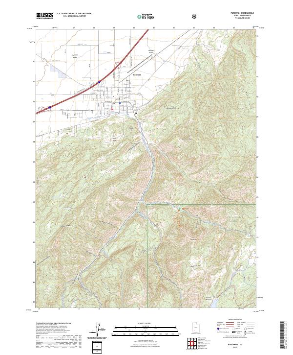 2023 Parowan2023 Print · USGSParowan and the surrounding Iron County high country are documented in this recent survey, capturing the town where the desert valley meets the cliffs. Genealogists and local historians can trace the town grid to the Parowan City Cem or follow backcountry routes toward Yankee Meadows and Noahs Ark.
 - 2023 Map of Summit, 2023 Print
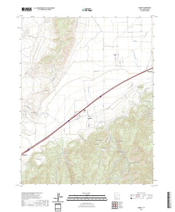 2023 Summit2023 Print · USGSIron County at the edge of the Hurricane Cliffs shows a landscape of high-altitude ridges and valley settlements. Researchers can trace the layout of Summit, locate the Summit City Cem, and follow the path of Old US Hwy 91.
End of results
Showing maps 1-10 of 10
Top cities near Parowan
- Cedar City historical maps
- Enoch historical maps
- Paragonah historical maps
- Summit historical maps
- Brian Head historical maps
Frequently asked questions
- What are the different types of historical maps available for Parowan?
- What is the oldest map of Parowan?
- Where can I purchase historical maps of Parowan for my home or office?
- Where can I download high-res historical maps of Parowan?
- Are there historical topographic maps available for Parowan?
- Is there historical aerial imagery available for Parowan?
- Where are historical maps of Parowan sourced from?