Old Maps of Lynndyl, Utah for Academic Research
Study the evolution of Lynndyl with 14 high-resolution historic maps. Whether you're teaching, researching, or modeling changes in land use, these maps provide essential visual documentation of urban, environmental, and geographic change.
- Analyze long-term change: Track patterns in development, transportation, and natural features.
- Ideal for environmental or urban studies: Support academic projects with primary historical map data.
- Use in the classroom or lab: Educators and researchers rely on these maps to bring historical context to life.
These maps are a powerful tool for teaching, research, and visualizing how Lynndyl has changed over the decades.
Lynndyl, UT maps
(14)- 1885 Map of Sevier Desert
 1885 Sevier Desert1885 Print · USGSMining districts and desert outposts across central Utah come to life in the mid-1880s as the railroad pushes through the canyon. Researchers can trace early industrial footprints at Silver City, locate the riverside settlement of Deseret, and follow the original Central Pacific Railroad line.5 unique versions available
 - 1951 Map of Oak City, 1953 Print
 1951 Oak City1953 Print · USGSMillard County's high desert and mountain frontier are captured here in the early fifties, showing the precarious balance of irrigation and transport. Researchers can find the old Utah Central Railroad grade, the Oak City cemetery, and the Oak Creek Ranger Sta at the forest edge.3 unique versions available
 - 1953 Map of Delta, 1969 Print
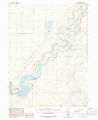
 1953 Delta1969 Print · USGSWest-central Utah in the early fifties shows a landscape of vast desert playas and rising mountain ranges. Genealogists and historians can trace rail sidings like Champlin Siding, local industry at the Tungsten Mill, and historic outposts such as Fort Deseret.3 unique versions available
 - 1958 Map of Delta
 1958 Delta1958 Print · USGSThe West Desert of Utah comes into sharp focus during the late 1950s, showing the intersection of military ranges, irrigation projects, and historical transit. You can trace the proximity of the Topaz Camp to Delta, or locate the Pony Express Monument and the ruins of Fort Deseret.
 - 1962 Map of Delta
 1962 Delta1962 Print · USGSWest Central Utah in the early sixties reveals a landscape of desert agriculture and military testing grounds. Researchers can trace the Union Pacific line through Delta or locate historic sites like the Pony Express Monument and Silver City.
 - 1962 Map of Lynndyl, 1963 Print
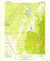
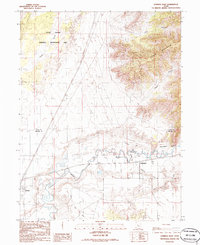
 1962 Lynndyl1963 Print · USGSThe high desert of Juab and Millard Counties comes into focus during the early sixties, centered on the railroad hub of Lynndyl. Local historians can trace the Union Pacific line, the remote Arrowhead Mine, and the irrigation network of the Utah Central Canal.2 unique versions available
 - 1979 Map of Lynndyl
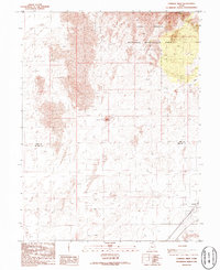
 1979 Lynndyl1979 Print · USGSThe Tintic mining district and the West Desert come alive in this late 1970s survey of central Utah. Genealogists and historians can trace the rail-and-mine economy through settlements like Eureka, Silver City, and the Union Pacific siding at Soma.2 unique versions available
 - 1985 Map of Strong
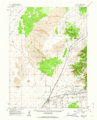
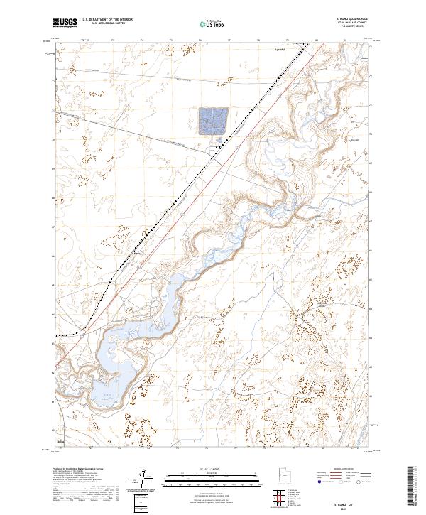
 1985 Strong1985 Print · USGSMillard County water management and desert geography are on display in the mid-1980s. Trace the path of the Sevier River and Central Utah Canal, and locate local landmarks like Strong and the DMAD Reservoir.
 - 1986 Map of Lynndyl East
 1986 Lynndyl East1986 Print · USGSJuab and Millard counties are captured in the mid-eighties as a landscape of desert dunes and irrigated river valleys. Researchers can trace the Union Pacific rail corridor through Lynndyl and Leamington or follow the path of the Central Utah Canal.
 - 1986 Map of Lynndyl West
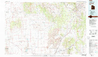
 1986 Lynndyl West1986 Print · USGSThe high desert of western Utah is captured here in the mid-1980s, highlighting the transition from rugged dunes to the rail-side settlement of Lynndyl. Trace the Union Pacific tracks and the vast borders of the Little Sahara National Recreation Area.
 - 1989 Map of Delta
 1989 Delta1989 Print · USGSThe Millard County desert in the late eighties reveals a complex irrigation system supporting agricultural life around Delta. Researchers can trace the layout of the Union Pacific Railroad, the historic site of Topaz Camp, and the volcanic features of Pahvant Butte.2 unique versions available
 - 2023 Map of Lynndyl East, 2023 Print
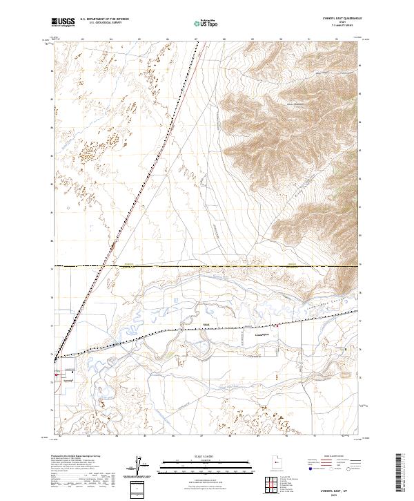 2023 Lynndyl East2023 Print · USGSThe Sevier River valley in Juab and Millard counties appears here in its modern rural character. Trace early irrigation systems like Macks Ditch and McIntyre Canal alongside the small settlements of Leamington and Lynndyl.
 - 2023 Map of Strong, 2023 Print
 2023 Strong2023 Print · USGSMillard County's high-desert landscape is captured in this recent survey, focusing on the essential water systems of the Sevier River valley. Researchers can trace the infrastructure of the DMAD Reservoir and the Central Utah Canal alongside the small settlements of Strong and Lynndyl.
 - 2023 Map of Lynndyl West, 2023 Print
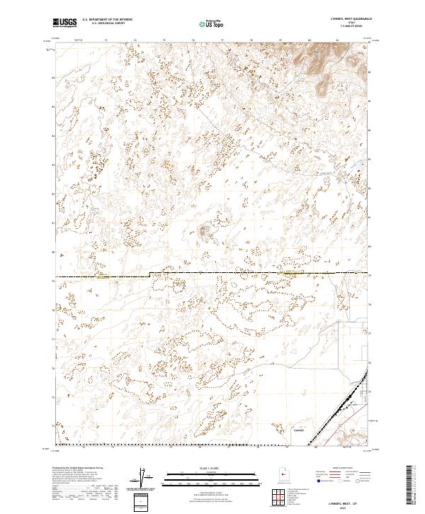 2023 Lynndyl West2023 Print · USGSThe arid landscape along the Juab and Millard county line is captured in this modern survey. Genealogists and local researchers can trace the street plan of Lynndyl along Railroad Ave and the surrounding terrain of the Sand Hills.
End of results
Showing maps 1-14 of 14
Top cities near Lynndyl
Frequently asked questions
- What are the different types of historical maps available for Lynndyl?
- What is the oldest map of Lynndyl?
- Where can I purchase historical maps of Lynndyl for my home or office?
- Where can I download high-res historical maps of Lynndyl?
- Are there historical topographic maps available for Lynndyl?
- Is there historical aerial imagery available for Lynndyl?
- Where are historical maps of Lynndyl sourced from?