Old Maps of Hooper, Utah for Hiking & Exploration
Hike through history with 25 historic maps of Hooper. Explore old trails, ghost towns, and forgotten backroads — perfect for outdoor adventurers and local explorers.
- Rediscover forgotten places: Map out old mining camps, roads, and footpaths that no longer exist on modern maps.
- Layer with modern tools: Combine with LiDAR or satellite views to plan hikes through historical terrain.
- Made for exploration: Popular among hikers, overlanders, and local history lovers.
Use these maps to find adventure and explore the hidden past of Hooper.
Hooper, UT maps
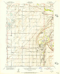
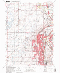
(25)- 1954 Map of Brigham City, 1968 Print
 1954 Brigham City1968 Print · USGSNorthern Utah and the edges of the Great Salt Lake are captured here during the mid-fifties, showing the region's transition from pioneer rail hubs to modern military ranges. Researchers can find old sidings like Lemay Siding, the Golden Spike Monument, and settlements like Washakie.4 unique versions available
 - 1955 Map of Roy, 1956 Print
 1955 Roy1956 Print · USGSSettlements along the Weber River valley were rapidly evolving in the mid-fifties as military and rail hubs expanded. Genealogists and historians can trace the foundations of Roy and Clinton, locating family-named landmarks like the Clinton Cemetery and Lakeview School.4 unique versions available
 - 1955 Map of Ogden Bay, 1956 Print
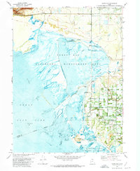
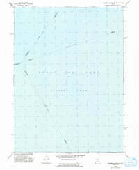
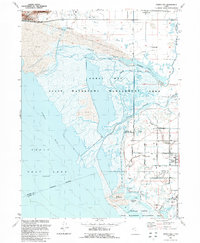
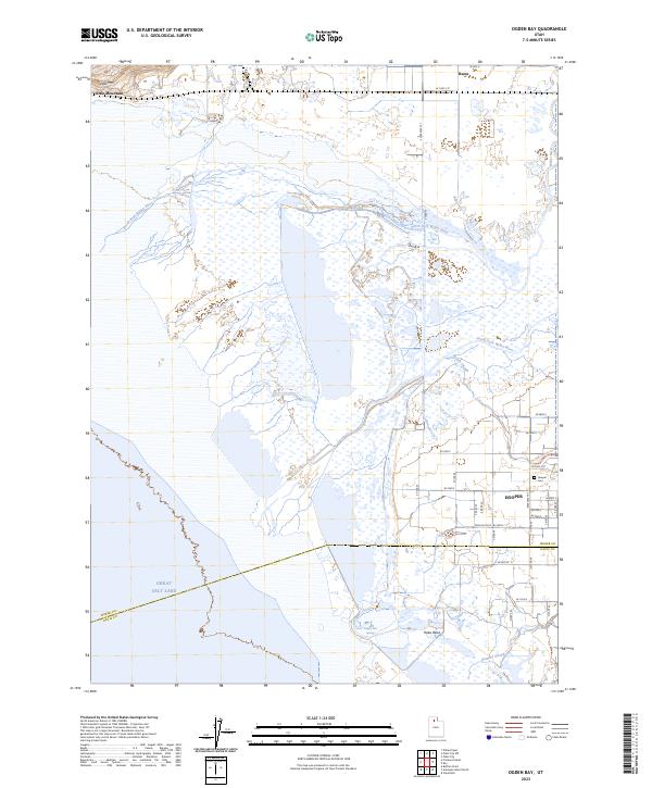
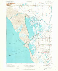 1955 Ogden Bay1956 Print · USGSThe eastern shores of the Great Salt Lake are captured here in the mid-fifties as water management transformed the Weber River delta. Genealogists and local historians can trace the irrigation networks around Hooper and find sites like Hooper Hot Springs and Hales Bend (Site).
 - 1955 Map of Fremont Island, 1956 Print
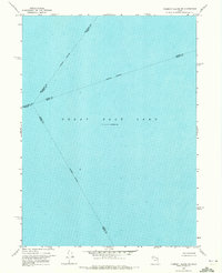
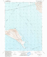
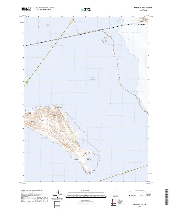
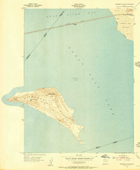 1955 Fremont Island1956 Print · USGSFremont Island sits isolated in the Great Salt Lake during the mid-fifties, bisected by the long rail causeway of the Southern Pacific. Genealogists and historians can trace the remote Graves and Ruins on the island's southern tip or locate the rail station at Bagley.
 - 1958 Map of Brigham City
 1958 Brigham City1958 Print · USGSNorthern Utah in the late fifties shows a landscape of extremes, from the salt flats to the bustling Bear River Valley. Trace historical routes like the Old Immigrant Trail and locate local landmarks such as the Brigham Sugar Mill and Booth Valley School.
 - 1962 Map of Brigham City
 1962 Brigham City1962 Print · USGSNorthern Utah in the early sixties reveals a landscape of vast salt flats and growing towns along the Wasatch Front. Researchers can trace the Southern Pacific line past the Golden Spike Monument or locate landmarks like Indian Cave and Donner-Reed Pass.
 - 1968 Map of Promontory Point, 1970 Print
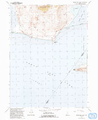
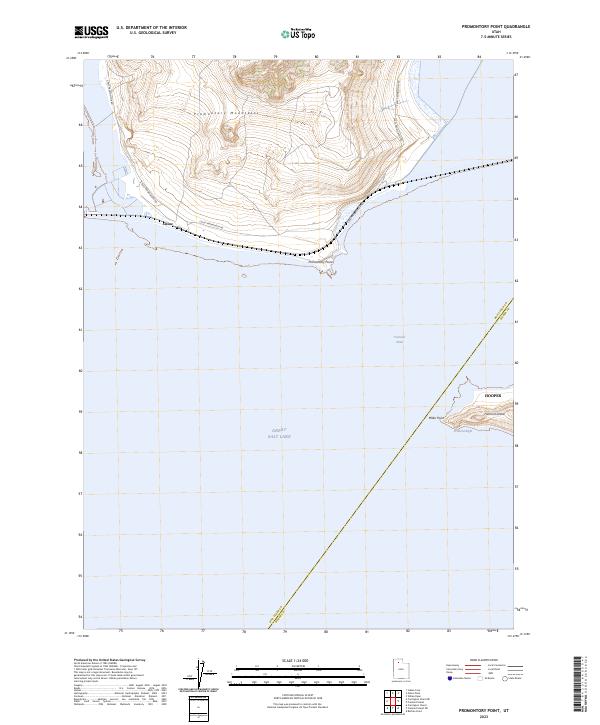
 1968 Promontory Point1970 Print · USGSThe Southern Pacific railroad skirts the tip of the Great Salt Lake in the late 1960s, marking a vital industrial corridor through Box Elder County. Researchers can trace the Lucin Cutoff and find remote outposts like Saline and the specialized Elevated Flume.2 unique versions available
 - 1968 Map of Fremont Island SW, 1972 Print
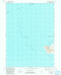
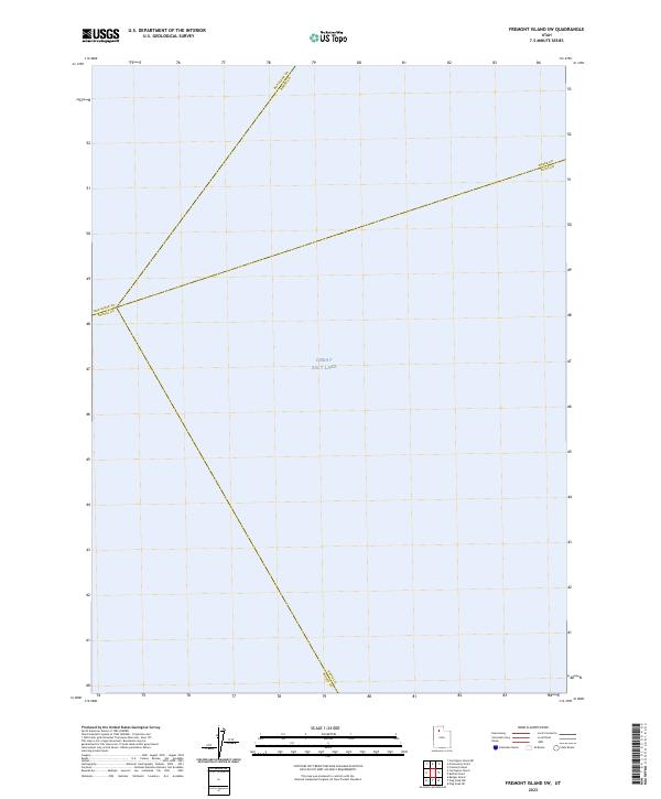
 1968 Fremont Island SW1972 Print · USGSThe open waters of the Great Salt Lake are captured in the late sixties at a documented elevation of 4,193 feet. Researchers can trace the intersection of four counties along the Weber-Davis and Tooele-Davis indefinite boundaries.
 - 1972 Map of Buffalo Point, 1973 Print
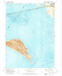
 1972 Buffalo Point1973 Print · USGSAntelope Island stands isolated in the Great Salt Lake during the early seventies, just as its northwestern shores were being organized for public use. Trace the natural features of the new Great Salt Lake State Park, including Buffalo Point and the remote Egg Island bird habitat.
 - 1972 Map of Fremont Island, 1974 Print
 1972 Fremont Island1974 Print · USGSThe eastern reaches of the Great Salt Lake are captured here in the early seventies as industrial salt works and military training grounds bordered the water. Researchers can locate the Lucin Cutoff rail line and isolated island features like Graves and Ruins.
 - 1972 Map of Ogden Bay, 1974 Print
 1972 Ogden Bay1974 Print · USGSThe eastern shore of the Great Salt Lake comes into focus in the early seventies, showing a landscape defined by water management and river deltas. Trace the historic Southern Pacific line past Hooper Hot Springs or locate the Hales Bend site.
 - 1987 Map of Promontory Point
 1987 Promontory Point1987 Print · USGSThe Wasatch Front meets the great salt desert in the late eighties, showing the rapid growth of towns from Brigham City to Layton. Follow the Southern Pacific (Lucin Cutoff) across the water and explore the remote terrain of Antelope Island and Promontory Point.
 - 1990 Map of Roy
 1990 Roy1990 Print · USGSThe corridor between Ogden and Clinton is shown here in the 1990s, defined by its massive military installations and expanding suburban grid. Researchers can trace local landmarks like Clinton Cem, the Ogden Municipal Airport, and the former Old Railroad Grade.2 unique versions available
 - 1991 Map of Fremont Island
 1991 Fremont Island1991 Print · USGSThe Great Salt Lake in the early nineties features the prominent Fremont Island and its surrounding bays. Local history enthusiasts can trace the Lucin Cutoff rail line or locate the Ruins Graves and David E Miller Hill.
 - 1991 Map of Fremont Island SW
 1991 Fremont Island SW1991 Print · USGSThe waters of Gilbert Bay are the primary focus of this late-century survey of the Great Salt Lake. Researchers can trace the convergence of several underwater county lines, including the Weber Co Davis Co and Davis Co Tooele Co boundaries.
 - 1991 Map of Promontory Point
 1991 Promontory Point1991 Print · USGSThe northern reaches of the Great Salt Lake are captured in the early 1990s at the terminus of the Promontory Mountains. Trace the industrial footprint of the Lucin Cutoff and find early sites like the settlement at Saline or Fremont Island.
 - 1991 Map of Ogden Bay
 1991 Ogden Bay1991 Print · USGSThe Weber River delta in the early nineties shows a fascinating mix of managed wetlands and rural Utah settlements. Trace the agricultural layout of Hooper and West Warren, or locate historic sites like Hales Bend and the local Cem.
 - 1991 Map of Buffalo Point
 1991 Buffalo Point1991 Print · USGSAntelope Island and the surrounding waters of the Great Salt Lake are captured here during the early nineties. Researchers can trace the shoreline and island landmarks including Buffalo Spring, the heights of Buffalo Point, and Egg Island.
 - 1999 Map of Roy, 2001 Print
 1999 Roy2001 Print · USGSWeber County's growing suburban and military landscape is captured here during the late 1990s as cities like Roy and Clinton expand. Researchers can trace family history at Stoker Memorial Cemetery or locate landmarks like Hill Air Force Base and the Aerospace Museum.
 - 2023 Map of Buffalo Point, 2023 Print
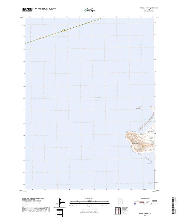 2023 Buffalo Point2023 Print · USGSAntelope Island sits amidst the waters of the Great Salt Lake in this recent survey. Hikers and cartography enthusiasts can trace the Buffalo Point Trl up to Buffalo Point or locate the remote Egg Island and Buffalo Spring.
 - 2023 Map of Fremont Island SW, 2023 Print
 2023 Fremont Island SW2023 Print · USGSThe open waters of the Great Salt Lake take center stage in this 2023 survey. You can trace the precise convergence of four county lines, including the boundary between Box Elder and Tooele and Weber and Davis counties.
 - 2023 Map of Promontory Point, 2023 Print
 2023 Promontory Point2023 Print · USGSThe northern reaches of the Great Salt Lake are captured here in the early twenty-first century, showing the rugged interface of land and water. Researchers can trace the shoreline of Fremont Island and locate the remote settlement of Saline near Promontory Point.
 - 2023 Map of Fremont Island, 2023 Print
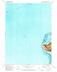
 2023 Fremont Island2023 Print · USGSFremont Island and the surrounding waters of the Great Salt Lake are shown here in the early twenty-first century. Researchers can trace landforms like Circle Valley, Beacon Hill, and the shoreline of Kit Carson Bay.
 - 2023 Map of Ogden Bay, 2023 Print
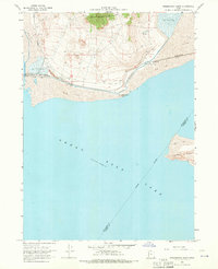
 2023 Ogden Bay2023 Print · USGSThe eastern shore of the Great Salt Lake comes into focus in this contemporary survey of the Weber River delta. Researchers can trace the boundaries of Hooper, locate the Hooper Cem, and explore the marshes near Hooper Hot Springs.
 - 2023 Map of Roy, 2023 Print
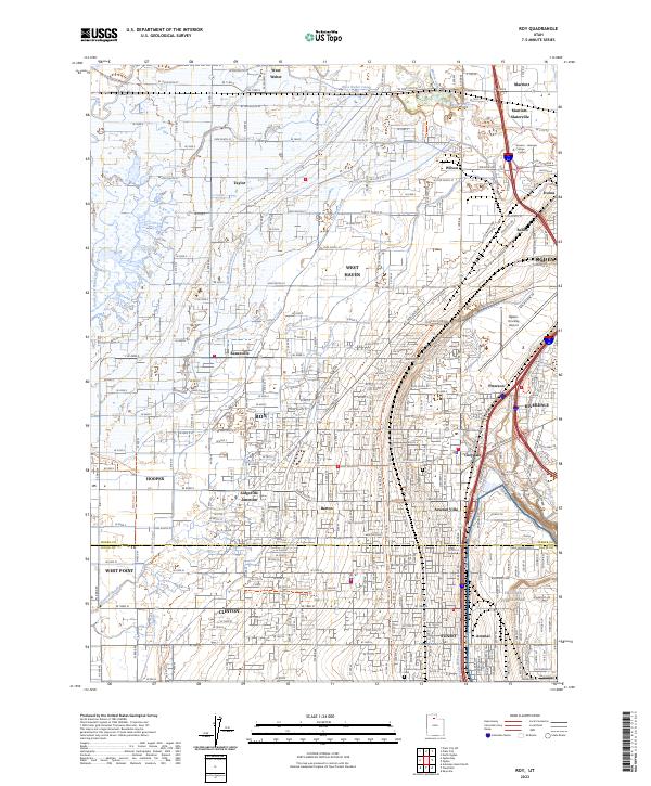 2023 Roy2023 Print · USGSThe northern Wasatch Front is shown in detail during its recent period of suburban expansion and military importance. Researchers can trace family sites near Roy City Cemetery or follow the path of the Union Pacific RR through ROY and SUNSET.
End of results
Showing maps 1-25 of 25
Top cities near Hooper
- Roy historical maps
- Syracuse historical maps
- Clinton historical maps
- West Point historical maps
- West Haven historical maps
- Marriott-Slaterville historical maps
Top neighborhoods of Hooper
Frequently asked questions
- What are the different types of historical maps available for Hooper?
- What is the oldest map of Hooper?
- Where can I purchase historical maps of Hooper for my home or office?
- Where can I download high-res historical maps of Hooper?
- Are there historical topographic maps available for Hooper?
- Is there historical aerial imagery available for Hooper?
- Where are historical maps of Hooper sourced from?