Old Maps of Wilson Creek, Washington for Hiking & Exploration
Hike through history with 17 historic maps of Wilson Creek. Explore old trails, ghost towns, and forgotten backroads — perfect for outdoor adventurers and local explorers.
- Rediscover forgotten places: Map out old mining camps, roads, and footpaths that no longer exist on modern maps.
- Layer with modern tools: Combine with LiDAR or satellite views to plan hikes through historical terrain.
- Made for exploration: Popular among hikers, overlanders, and local history lovers.
Use these maps to find adventure and explore the hidden past of Wilson Creek.
Wilson Creek, WA maps
(17)- 1953 Map of Ritzville, 1966 Print
 1953 Ritzville1966 Print · USGSEastern Washington was undergoing a massive agricultural and industrial transformation in the mid-fifties as irrigation from the Grand Coulee Dam reached the plateau. Researchers can trace the mid-century rail network of the Great Northern and locate vital local sites like Larson Air Force Base and Odessa.3 unique versions available
 - 1956 Map of Wilson Creek NW, 1957 Print
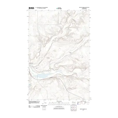
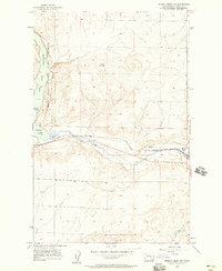 1956 Wilson Creek NW1957 Print · USGSEastern Washington at the mid-century shows a landscape shaped by water and rail as the Great Northern railroad tracks pass the settlement of Wilson Creek. You can trace early infrastructure and family landmarks like the Long Lake Dam and Bohnet Road.2 unique versions available
 - 1956 Map of Wilson Creek, 1958 Print
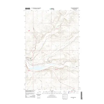
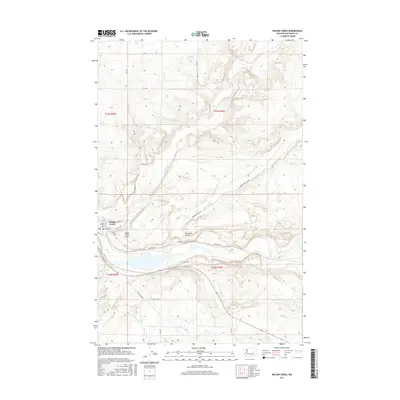
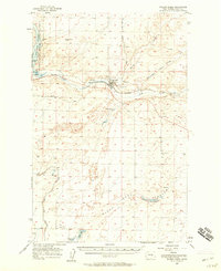 1956 Wilson Creek1958 Print · USGSThe rail and water infrastructure of Grant County is meticulously detailed during the mid-fifties, centered on the hub of Wilson Creek. Researchers can trace the path of the Great Northern railroad alongside the Brook Lake State Game Reserve and the Long Lake Dam.2 unique versions available
 - 1959 Map of Ritzville
 1959 Ritzville1959 Print · USGSEastern Washington in the late fifties reveals a landscape transformed by massive irrigation projects and postwar growth. Genealogists and historians can trace rail-line communities from Ritzville to Davenport and locate landmarks like Larson Air Force Base and Telford Station.
 - 1965 Map of Ritzville
 1965 Ritzville1965 Print · USGSCentral Washington during the mid-sixties shows a landscape shaped by massive irrigation projects and the Cold War. Genealogists and historians can trace rail-town life and military presence through Ephrata Air Base, the Telford Station, and local schools.
 - 1982 Map of Moses Lake, 1983 Print
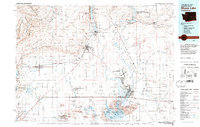 1982 Moses Lake1983 Print · USGSThe Columbia Basin during the early eighties shows a landscape transformed by large-scale irrigation and military aviation. Researchers can trace the development of Larson Air Force Base or locate vanished rail stops along the Burlington Northern near Ephrata and Quincy.2 unique versions available
 - 1986 Map of Wilson Creek
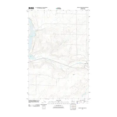
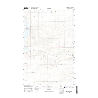
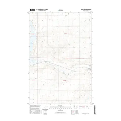
 1986 Wilson Creek1986 Print · USGSThe town of Wilson Creek and the surrounding coulees are documented here in the mid-1980s, showcasing the region's complex water and transit network. Researchers can trace the path of Crab Creek, locate the local Landing Strip, and identify the numerous Gravel Pits and Alkali Flats that define the valley floor.
 - 2011 Map of Wilson Creek NW, 2011 Print
 2011 Wilson Creek NW2011 Print · USGSCovers Wilson Creek, including Grant County, United States, and other nearby areas
 - 2011 Map of Wilson Creek, 2011 Print
 2011 Wilson Creek2011 Print · USGSCovers Wilson Creek, including Marlin, Grant County, and other nearby areas
 - 2014 Map of Wilson Creek NW, 2014 Print
 2014 Wilson Creek NW2014 Print · USGSCovers Wilson Creek, including Grant County, United States, and other nearby areas
 - 2014 Map of Wilson Creek, 2014 Print
 2014 Wilson Creek2014 Print · USGSCovers Wilson Creek, including Marlin, Grant County, and other nearby areas
 - 2017 Map of Wilson Creek, 2017 Print
 2017 Wilson Creek2017 Print · USGSCovers Wilson Creek, including Marlin, Grant County, and other nearby areas
 - 2017 Map of Wilson Creek NW, 2017 Print
 2017 Wilson Creek NW2017 Print · USGSCovers Wilson Creek, including Grant County, United States, and other nearby areas
 - 2020 Map of Wilson Creek, 2020 Print
 2020 Wilson Creek2020 Print · USGSCovers Wilson Creek, including Marlin, Grant County, and other nearby areas
 - 2020 Map of Wilson Creek NW, 2020 Print
 2020 Wilson Creek NW2020 Print · USGSCovers Wilson Creek, including Grant County, United States, and other nearby areas
 - 2023 Map of Wilson Creek, 2023 Print
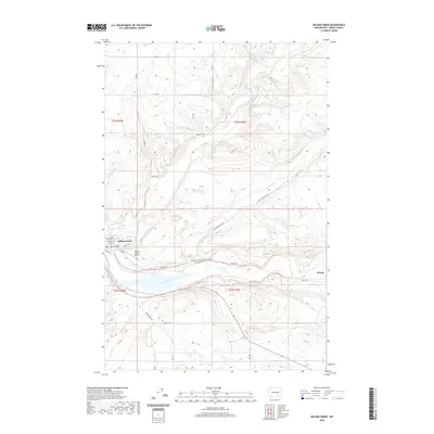
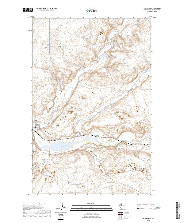 2023 Wilson Creek2023 Print · USGSThe town of Wilson Creek serves as a hub for this Eastern Washington landscape during the early twenty-first century. Researchers can trace the layout of the local street grid near Wilson Creek Airport or follow the waters of Crab Creek and Soda Lake.
 - 2023 Map of Wilson Creek NW, 2023 Print
 2023 Wilson Creek NW2023 Print · USGSThe arid coulee country of Grant County is captured here in its modern form, centered on the settlement of Wilson Creek. Genealogists and local historians can trace family locations near Wilson Creek Cem or along the winding course of Crab Creek.
End of results
Showing maps 1-17 of 17
Top cities near Wilson Creek
Frequently asked questions
- What are the different types of historical maps available for Wilson Creek?
- What is the oldest map of Wilson Creek?
- Where can I purchase historical maps of Wilson Creek for my home or office?
- Where can I download high-res historical maps of Wilson Creek?
- Are there historical topographic maps available for Wilson Creek?
- Is there historical aerial imagery available for Wilson Creek?
- Where are historical maps of Wilson Creek sourced from?